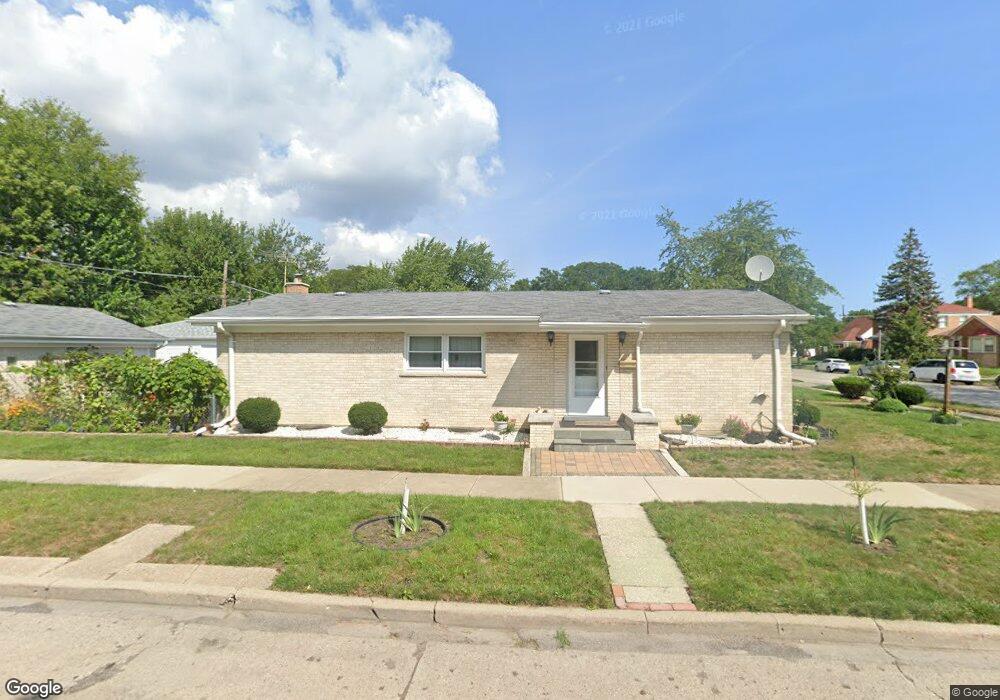
5200 Conrad St Skokie, IL 60077
Southwest Skokie NeighborhoodEstimated Value: $419,000 - $474,000
3
Beds
3
Baths
1,200
Sq Ft
$367/Sq Ft
Est. Value
About This Home
This home is located at 5200 Conrad St, Skokie, IL 60077 and is currently estimated at $440,857, approximately $367 per square foot. 5200 Conrad St is a home located in Cook County with nearby schools including Madison Elementary School, Thomas Edison Elementary School, and Lincoln Junior High School.
Ownership History
Date
Name
Owned For
Owner Type
Purchase Details
Closed on
Feb 25, 1999
Sold by
Lazar Ted Q
Bought by
Yesaeil Albert S and Yesaeil Panna S
Current Estimated Value
Home Financials for this Owner
Home Financials are based on the most recent Mortgage that was taken out on this home.
Original Mortgage
$141,600
Outstanding Balance
$34,504
Interest Rate
6.83%
Estimated Equity
$406,353
Purchase Details
Closed on
Sep 9, 1997
Sold by
Friedman Ruth
Bought by
Lazar Ted A
Home Financials for this Owner
Home Financials are based on the most recent Mortgage that was taken out on this home.
Original Mortgage
$144,000
Interest Rate
6.12%
Create a Home Valuation Report for This Property
The Home Valuation Report is an in-depth analysis detailing your home's value as well as a comparison with similar homes in the area
Home Values in the Area
Average Home Value in this Area
Purchase History
| Date | Buyer | Sale Price | Title Company |
|---|---|---|---|
| Yesaeil Albert S | $177,000 | Ticor Title | |
| Lazar Ted A | $106,666 | -- |
Source: Public Records
Mortgage History
| Date | Status | Borrower | Loan Amount |
|---|---|---|---|
| Open | Yesaeil Albert S | $141,600 | |
| Previous Owner | Lazar Ted A | $144,000 |
Source: Public Records
Tax History Compared to Growth
Tax History
| Year | Tax Paid | Tax Assessment Tax Assessment Total Assessment is a certain percentage of the fair market value that is determined by local assessors to be the total taxable value of land and additions on the property. | Land | Improvement |
|---|---|---|---|---|
| 2024 | $1,517 | $32,965 | $6,709 | $26,256 |
| 2023 | $4,534 | $35,000 | $6,709 | $28,291 |
| 2022 | $4,534 | $35,000 | $6,709 | $28,291 |
| 2021 | $1,769 | $26,465 | $4,128 | $22,337 |
| 2020 | $7,509 | $26,465 | $4,128 | $22,337 |
| 2019 | $7,575 | $29,737 | $4,128 | $25,609 |
| 2018 | $1,856 | $21,741 | $3,741 | $18,000 |
| 2017 | $1,832 | $21,741 | $3,741 | $18,000 |
| 2016 | $2,549 | $24,201 | $3,741 | $20,460 |
| 2015 | $2,822 | $22,735 | $3,225 | $19,510 |
| 2014 | $2,701 | $22,735 | $3,225 | $19,510 |
| 2013 | $2,802 | $22,735 | $3,225 | $19,510 |
Source: Public Records
Map
Nearby Homes
- 8605 Laramie Ave
- 5109 Greenleaf St
- 5309 Crain St
- 5126 Elm St
- 8461 Gross Point Rd
- 8464 Gross Point Rd
- 8534 Terminal Ave
- 8655 Harms Rd
- 8541 Lotus Ave Unit 914
- 5247 Suffield Ct
- 4901 Carol Unit F St
- 5352 Greenwood St
- 5128 Suffield Ct
- 5500 Lincoln Ave Unit 407W
- 5500 Lincoln Ave Unit 116E
- 5500 Lincoln Ave Unit 109W
- 8836 Bronx Ave
- 5510 Lincoln Ave Unit B301
- 5510 Lincoln Ave Unit B101
- 5506 Lincoln Ave Unit A117
- 8640 Laramie Ave
- 8644 Laramie Ave
- 8644 Laramie Ave
- 5201 Conrad St
- 5201 Conrad St
- 8650 Laramie Ave
- 8618 Laramie Ave
- 8653 Gross Point Rd
- 5215 Conrad St
- 8649 Gross Point Rd
- 8659 Gross Point Rd
- 8659 Gross Point Rd
- 8635 Laramie Ave
- 8641 Laramie Ave
- 8663 Gross Point Rd
- 5219 Conrad St
- 5155 Conrad St
- 5155 Conrad St
- 8641 Gross Point Rd
- 8645 Laramie Ave