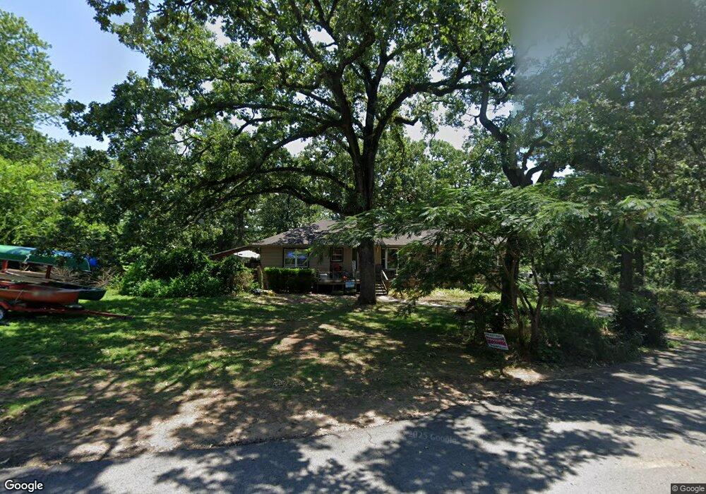
5200 Highland Dr Fort Smith, AR 72903
Estimated Value: $231,000 - $263,350
3
Beds
3
Baths
1,897
Sq Ft
$128/Sq Ft
Est. Value
About This Home
This home is located at 5200 Highland Dr, Fort Smith, AR 72903 and is currently estimated at $242,838, approximately $128 per square foot. 5200 Highland Dr is a home located in Sebastian County with nearby schools including Euper Lane Elementary School, L.A. Chaffin Junior High School, and Northside High School.
Ownership History
Date
Name
Owned For
Owner Type
Purchase Details
Closed on
Jan 15, 2020
Sold by
Roberts Caron S and Caron S Roberts Bypass Trust
Bought by
Davis Preston and Ramos Shirley
Current Estimated Value
Home Financials for this Owner
Home Financials are based on the most recent Mortgage that was taken out on this home.
Original Mortgage
$144,004
Outstanding Balance
$126,686
Interest Rate
3.6%
Mortgage Type
VA
Estimated Equity
$116,152
Purchase Details
Closed on
May 14, 2019
Sold by
Smets Family Trust
Bought by
Caron S Roberts Bypass Trust
Purchase Details
Closed on
Aug 24, 2010
Sold by
Smets Charles J and Smets Patience W
Bought by
Smets Charles J and Smets Family Trust
Create a Home Valuation Report for This Property
The Home Valuation Report is an in-depth analysis detailing your home's value as well as a comparison with similar homes in the area
Home Values in the Area
Average Home Value in this Area
Purchase History
| Date | Buyer | Sale Price | Title Company |
|---|---|---|---|
| Davis Preston | $139,000 | Western Arkansas Title Svcs | |
| Caron S Roberts Bypass Trust | -- | None Available | |
| Smets Charles J | -- | None Available |
Source: Public Records
Mortgage History
| Date | Status | Borrower | Loan Amount |
|---|---|---|---|
| Open | Davis Preston | $144,004 |
Source: Public Records
Tax History
| Year | Tax Paid | Tax Assessment Tax Assessment Total Assessment is a certain percentage of the fair market value that is determined by local assessors to be the total taxable value of land and additions on the property. | Land | Improvement |
|---|---|---|---|---|
| 2025 | $2,002 | $49,975 | $7,000 | $42,975 |
| 2024 | $1,725 | $32,850 | $6,000 | $26,850 |
| 2023 | $1,482 | $32,850 | $6,000 | $26,850 |
| 2022 | $1,532 | $32,850 | $6,000 | $26,850 |
| 2021 | $1,532 | $32,850 | $6,000 | $26,850 |
| 2020 | $1,532 | $32,850 | $6,000 | $26,850 |
| 2019 | $961 | $30,590 | $6,000 | $24,590 |
| 2018 | $986 | $30,590 | $6,000 | $24,590 |
| 2017 | $858 | $30,590 | $6,000 | $24,590 |
| 2016 | $1,208 | $30,590 | $6,000 | $24,590 |
| 2015 | $1,208 | $30,590 | $6,000 | $24,590 |
| 2014 | $858 | $23,010 | $6,000 | $17,010 |
Source: Public Records
Map
Nearby Homes
- 5325 Free Ferry Rd
- 5421 Free Ferry Rd
- 5420 Free Ferry Rd
- 5306 Labelle Ct
- 4620 Free Ferry Rd
- 4615 Free Ferry Rd
- 5600 Elmwood Place
- 1112 Autumn Oaks Ln
- 5701 Free Ferry Rd Unit 34
- 5701 Free Ferry Rd Unit 29
- 5701 Free Ferry Rd Unit 12
- 4415 Park Ave
- 4321 Free Ferry Ln
- 8 Free Ferry Heights
- 4215 Park Ave
- 6104 Park Ave
- 6001 Bolton Rd
- 6212 Free Ferry Rd
- 139 N 41st St
- 1145 N 57th Place
- 5210 Highland Dr
- 5201 Highland Dr
- 5121 Highland Dr
- 301 N 53rd St
- 5220 Highland Dr
- 204 N 51st St
- 5115 Free Ferry Rd
- 305 N 53rd St
- 5304 Highland Dr
- 300 N 53rd St
- 5305 Free Ferry Rd
- 5200 Park Ave
- 5112 Park Ave
- 304 N 53rd St
- 5318 Highland Dr
- 212 N 51st St
- 148 N 51st St
- 5100 Park Ave
- 222 N 51st St
- 5220 Park Ave
Your Personal Tour Guide
Ask me questions while you tour the home.