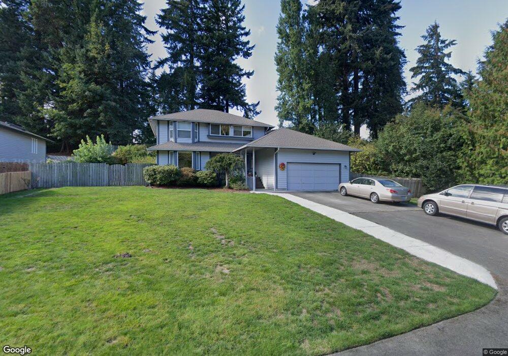
5200 Rich Cove Ln E Port Orchard, WA 98366
Estimated Value: $553,982 - $668,000
3
Beds
3
Baths
2,078
Sq Ft
$297/Sq Ft
Est. Value
About This Home
This home is located at 5200 Rich Cove Ln E, Port Orchard, WA 98366 and is currently estimated at $616,996, approximately $296 per square foot. 5200 Rich Cove Ln E is a home located in Kitsap County with nearby schools including Manchester Elementary School, John Sedgwick Middle School, and South Kitsap High School.
Ownership History
Date
Name
Owned For
Owner Type
Purchase Details
Closed on
Aug 8, 2000
Sold by
Bennett Bruce and Bennett Phyllis C
Bought by
Montgomery Michael G and Irene Montgomery J
Current Estimated Value
Home Financials for this Owner
Home Financials are based on the most recent Mortgage that was taken out on this home.
Original Mortgage
$160,276
Outstanding Balance
$57,991
Interest Rate
8.19%
Mortgage Type
FHA
Estimated Equity
$559,005
Create a Home Valuation Report for This Property
The Home Valuation Report is an in-depth analysis detailing your home's value as well as a comparison with similar homes in the area
Home Values in the Area
Average Home Value in this Area
Purchase History
| Date | Buyer | Sale Price | Title Company |
|---|---|---|---|
| Montgomery Michael G | $162,000 | Land Title Company |
Source: Public Records
Mortgage History
| Date | Status | Borrower | Loan Amount |
|---|---|---|---|
| Open | Montgomery Michael G | $160,276 |
Source: Public Records
Tax History Compared to Growth
Tax History
| Year | Tax Paid | Tax Assessment Tax Assessment Total Assessment is a certain percentage of the fair market value that is determined by local assessors to be the total taxable value of land and additions on the property. | Land | Improvement |
|---|---|---|---|---|
| 2026 | $4,247 | $488,850 | $81,460 | $407,390 |
| 2025 | $4,247 | $488,850 | $81,460 | $407,390 |
| 2024 | $4,118 | $488,850 | $81,460 | $407,390 |
| 2023 | $4,089 | $488,850 | $81,460 | $407,390 |
| 2022 | $3,912 | $391,200 | $65,290 | $325,910 |
| 2021 | $3,738 | $353,780 | $62,180 | $291,600 |
| 2020 | $3,712 | $341,370 | $55,500 | $285,870 |
| 2019 | $3,187 | $322,060 | $52,340 | $269,720 |
| 2018 | $3,334 | $252,500 | $47,380 | $205,120 |
| 2017 | $2,756 | $252,500 | $47,380 | $205,120 |
| 2016 | $2,861 | $240,550 | $45,120 | $195,430 |
| 2015 | $2,620 | $222,780 | $45,120 | $177,660 |
| 2014 | -- | $211,840 | $43,600 | $168,240 |
| 2013 | -- | $211,840 | $43,600 | $168,240 |
Source: Public Records
Map
Nearby Homes
- 5172 Rich View Dr E
- 0 Point White Dr NE
- 3356 Point White Dr NE
- 6560 NE Latyson Ln
- 0 Nevada Ave & Michigan St Unit NWM2365944
- 22 Lots Ave
- 7016 E Nightingale St
- 7020 E Nightingale St
- 3643 Beach Dr E
- 7058 E Nightingale St
- 6997 E Bullseye St
- 7081 E Bullseye St
- 6417 E Michigan St
- 3193 Woods Rd E
- 3538 Beach Dr E
- 3737 NE Bahia Vista Dr
- 7041 E Washington St
- 6705 NE Dapple Ct
- 7260 E Last Refuge Way
- 3620 NE Bahia Vista Dr
- 5190 Rich Cove Ln E
- 5269 Rich View Dr E
- 5292 Rich Cove Ln E
- 5253 Rich View Dr E
- 5219 Rich View Dr E
- 5268 Rich View Dr E
- 5290 Rich View Dr E
- 5291 Beach Dr E
- 5244 Rich View Dr E
- 5201 Rich Cove Ln E
- 5195 Rich View Dr E
- 5218 Rich View Dr E
- 5282 Rich View Dr E
- 5324 Rich Cove Ln E
- 5194 Rich View Dr E
- 5325 Rich Cove Ln E
- 5160 Rich View Dr E
- 5481 Rich Cove Ln E
- 5083 Beach Dr E
- 5464 E Lighthouse Dr