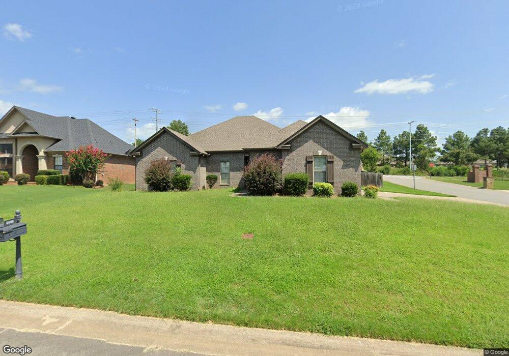
5200 Tennyson Dr Conway, AR 72034
Estimated Value: $284,392 - $316,000
Studio
--
Bath
1,792
Sq Ft
$170/Sq Ft
Est. Value
About This Home
This home is located at 5200 Tennyson Dr, Conway, AR 72034 and is currently estimated at $304,598, approximately $169 per square foot. 5200 Tennyson Dr is a home with nearby schools including Woodrow Cummins Elementary School, Ruth Doyle Intermediate School, and Conway Junior High School.
Ownership History
Date
Name
Owned For
Owner Type
Purchase Details
Closed on
Jan 1, 2015
Bought by
Lovelady & Lovelady Leasing Llc
Current Estimated Value
Purchase Details
Closed on
Aug 5, 2005
Bought by
Smith-White
Home Financials for this Owner
Home Financials are based on the most recent Mortgage that was taken out on this home.
Original Mortgage
$160,000
Interest Rate
5.65%
Mortgage Type
Construction
Purchase Details
Closed on
Oct 26, 2004
Bought by
Smith Busn
Create a Home Valuation Report for This Property
The Home Valuation Report is an in-depth analysis detailing your home's value as well as a comparison with similar homes in the area
Home Values in the Area
Average Home Value in this Area
Purchase History
| Date | Buyer | Sale Price | Title Company |
|---|---|---|---|
| Lovelady & Lovelady Leasing Llc | -- | -- | |
| Smith-White | -- | -- | |
| Smith White Inc | -- | None Available | |
| Smith-White | -- | -- | |
| Smith Busn | $70,000 | -- |
Source: Public Records
Mortgage History
| Date | Status | Borrower | Loan Amount |
|---|---|---|---|
| Previous Owner | Smith-White | $160,000 |
Source: Public Records
Tax History
| Year | Tax Paid | Tax Assessment Tax Assessment Total Assessment is a certain percentage of the fair market value that is determined by local assessors to be the total taxable value of land and additions on the property. | Land | Improvement |
|---|---|---|---|---|
| 2025 | $2,730 | $53,950 | $7,400 | $46,550 |
| 2024 | $2,605 | $53,950 | $7,400 | $46,550 |
| 2023 | $2,368 | $46,800 | $7,400 | $39,400 |
| 2022 | $2,368 | $46,800 | $7,400 | $39,400 |
| 2021 | $2,264 | $46,800 | $7,400 | $39,400 |
| 2020 | $2,058 | $40,680 | $7,400 | $33,280 |
| 2019 | $2,058 | $40,680 | $7,400 | $33,280 |
| 2018 | $2,058 | $40,680 | $7,400 | $33,280 |
| 2017 | $2,058 | $40,680 | $7,400 | $33,280 |
| 2016 | $2,058 | $40,680 | $7,400 | $33,280 |
| 2015 | $1,935 | $38,250 | $7,400 | $30,850 |
| 2014 | $1,935 | $38,250 | $7,400 | $30,850 |
Source: Public Records
Map
Nearby Homes
- 5215 Bay Town
- 5090 Oakhurst Way
- 5340 Plantation Cove
- 6 Eve Ln
- 1015 Champions Dr
- 1645 Nantucket Dr
- 1650 Dolphin Dr
- 1670 Dolphin Dr
- 1520 Southwinds Dr
- 1515 Southwinds Dr
- 4655 Palm Springs Cir
- 1635 Southwinds Dr
- 955 Woodard Dr
- 760 Bristol Ln
- 4505 Sawgrass Cove
- 4520 Oregon Trail
- 4420 Raleigh Dr
- 4335 Gazebo Dr
- 4325 Gazebo Dr
- 4830 Edgewood Park
- 5210 Tennyson Dr
- 5220 Tennyson Dr
- 1460 Byron Dr
- 5215 Tennyson Dr
- 1450 Byron Dr
- 5205 Tennyson Dr
- 1440 Byron Dr
- 5230 Tennyson Dr
- 5225 Tennyson Dr
- 1430 Byron Dr
- 0 Byron Dr Unit 16021436
- 0 Byron Dr Unit 16023091
- 0 Byron Dr Unit 17030430
- 0 Byron Dr Unit 20037721
- 5235 Tennyson Dr
- 0 Tennyson Dr Unit 20034990
- 5240 Tennyson Dr
- 5200 Shakespeare Dr
- 1420 Byron Dr
- 5245 Tennyson Dr