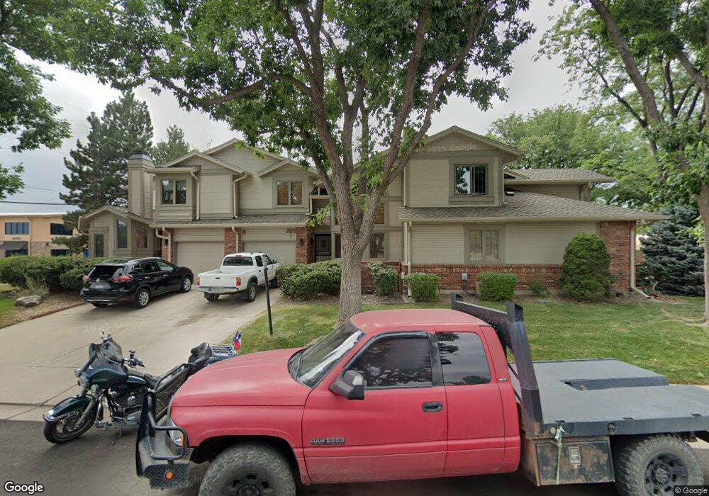
5203 Union Ct Unit 1 Arvada, CO 80002
Rainbow Ridge NeighborhoodEstimated Value: $429,916 - $509,000
3
Beds
3
Baths
1,619
Sq Ft
$283/Sq Ft
Est. Value
About This Home
This home is located at 5203 Union Ct Unit 1, Arvada, CO 80002 and is currently estimated at $458,979, approximately $283 per square foot. 5203 Union Ct Unit 1 is a home located in Jefferson County with nearby schools including Vanderhoof Elementary School, Drake Junior High School, and Arvada West High School.
Ownership History
Date
Name
Owned For
Owner Type
Purchase Details
Closed on
Jul 22, 2022
Sold by
Graham Greeley Mary
Bought by
Ross Mark
Current Estimated Value
Purchase Details
Closed on
Aug 29, 2001
Sold by
Macgowan J Mark and Macgowan Donna J
Bought by
Greeley Mary Graham
Home Financials for this Owner
Home Financials are based on the most recent Mortgage that was taken out on this home.
Original Mortgage
$115,000
Interest Rate
6.98%
Create a Home Valuation Report for This Property
The Home Valuation Report is an in-depth analysis detailing your home's value as well as a comparison with similar homes in the area
Home Values in the Area
Average Home Value in this Area
Purchase History
| Date | Buyer | Sale Price | Title Company |
|---|---|---|---|
| Ross Mark | $435,000 | New Title Company Name | |
| Greeley Mary Graham | $153,500 | Land Title Guarantee Company |
Source: Public Records
Mortgage History
| Date | Status | Borrower | Loan Amount |
|---|---|---|---|
| Previous Owner | Greeley Mary Graham | $115,000 |
Source: Public Records
Tax History Compared to Growth
Tax History
| Year | Tax Paid | Tax Assessment Tax Assessment Total Assessment is a certain percentage of the fair market value that is determined by local assessors to be the total taxable value of land and additions on the property. | Land | Improvement |
|---|---|---|---|---|
| 2024 | $1,949 | $21,059 | $6,030 | $15,029 |
| 2023 | $1,949 | $21,059 | $6,030 | $15,029 |
| 2022 | $1,396 | $21,857 | $4,170 | $17,687 |
| 2021 | $1,414 | $22,486 | $4,290 | $18,196 |
| 2020 | $1,386 | $22,165 | $4,290 | $17,875 |
| 2019 | $1,365 | $22,165 | $4,290 | $17,875 |
| 2018 | $1,063 | $18,531 | $3,600 | $14,931 |
| 2017 | $969 | $18,531 | $3,600 | $14,931 |
| 2016 | $800 | $16,700 | $2,706 | $13,994 |
| 2015 | $612 | $16,700 | $2,706 | $13,994 |
| 2014 | $612 | $12,545 | $2,229 | $10,316 |
Source: Public Records
Map
Nearby Homes
- 5154 Taft Ct
- 5173 Vivian St
- 12355 W 51st Ave
- 5160 Ward Rd
- 12081 W 54th Ave
- 5240 Routt Ct Unit B
- 5555 Ward Rd
- 5182 Rob Way
- 5293 Quail Way
- 11205 W 53rd Ln
- 11201 W 53rd Dr
- 5383 Quail St
- 11958 W 57th Place
- 4784 Swadley St
- 11944 W 57th Dr
- 11924 W 57th Dr
- 5779 Taft St
- 11237 W 55th Ln
- 5334 Owens St
- 5795 Xenon Way
- 5203 Union Ct Unit 6
- 5203 Union Ct Unit 5
- 5203 Union Ct Unit 4
- 5203 Union Ct Unit 3
- 5203 Union Ct Unit 2
- 5203 Union Ct
- 12095 W 52nd Ave
- 5223 Union Ct Unit 6
- 5223 Union Ct Unit 5
- 5223 Union Ct Unit 4
- 5223 Union Ct Unit 3
- 5223 Union Ct Unit 2
- 5223 Union Ct Unit 1
- 5202 Union Ct Unit 4
- 5202 Union Ct Unit 3
- 5202 Union Ct Unit 2
- 5202 Union Ct Unit 1
- 5222 Union Ct Unit 4
- 5222 Union Ct Unit 3
- 5222 Union Ct Unit 2