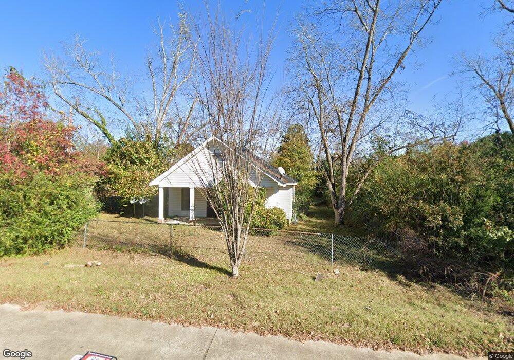
5204 Bloomfield Rd Macon, GA 31206
Estimated Value: $83,953 - $114,000
3
Beds
1
Bath
1,376
Sq Ft
$70/Sq Ft
Est. Value
About This Home
This home is located at 5204 Bloomfield Rd, Macon, GA 31206 and is currently estimated at $95,988, approximately $69 per square foot. 5204 Bloomfield Rd is a home located in Bibb County with nearby schools including Veterans Elementary School, Southwest High School, and Gilead Christian Academy.
Ownership History
Date
Name
Owned For
Owner Type
Purchase Details
Closed on
Feb 27, 2012
Sold by
Stonecrest Income & Opportunity Fund I L
Bought by
Us Home Ownership Llc
Current Estimated Value
Purchase Details
Closed on
Nov 22, 2011
Sold by
Branch Banking & Trust Company
Bought by
Stonecrest Income & Opportunity Fund I L
Purchase Details
Closed on
Jul 5, 2011
Sold by
Byrd Ronnie and Byrd Nancy M
Bought by
Branch Banking And Trust Company
Purchase Details
Closed on
Oct 19, 2010
Sold by
Byrd Leah C
Bought by
Byrd Ronnie M
Purchase Details
Closed on
Jan 18, 2008
Sold by
Byrd Ronnie M
Bought by
Byrd Leah C
Purchase Details
Closed on
Jun 16, 1997
Sold by
Byrd Ronnie
Bought by
Byrd Nancy
Purchase Details
Closed on
Jun 9, 1997
Bought by
Byrd Ronnie M
Create a Home Valuation Report for This Property
The Home Valuation Report is an in-depth analysis detailing your home's value as well as a comparison with similar homes in the area
Purchase History
| Date | Buyer | Sale Price | Title Company |
|---|---|---|---|
| Us Home Ownership Llc | $6,000 | Dba Cosmopolitan Title | |
| Stonecrest Income & Opportunity Fund I L | -- | None Available | |
| Branch Banking And Trust Company | $4,000 | None Available | |
| Byrd Ronnie M | -- | None Available | |
| Byrd Leah C | -- | None Available | |
| Byrd Nancy | -- | -- | |
| Byrd Ronnie M | $35,000 | -- |
Source: Public Records
Tax History
| Year | Tax Paid | Tax Assessment Tax Assessment Total Assessment is a certain percentage of the fair market value that is determined by local assessors to be the total taxable value of land and additions on the property. | Land | Improvement |
|---|---|---|---|---|
| 2025 | $523 | $21,295 | $3,300 | $17,995 |
| 2024 | $541 | $21,295 | $3,300 | $17,995 |
| 2023 | $541 | $21,295 | $3,300 | $17,995 |
| 2022 | $752 | $21,721 | $7,757 | $13,964 |
| 2021 | $825 | $21,721 | $7,757 | $13,964 |
| 2020 | $843 | $21,721 | $7,757 | $13,964 |
| 2019 | $850 | $21,721 | $7,757 | $13,964 |
| 2018 | $1,482 | $21,721 | $7,757 | $13,964 |
| 2017 | $814 | $21,721 | $7,757 | $13,964 |
| 2016 | $752 | $21,722 | $7,757 | $13,964 |
| 2015 | $1,064 | $21,722 | $7,757 | $13,964 |
| 2014 | $408 | $21,722 | $7,757 | $13,964 |
Source: Public Records
Map
Nearby Homes
- 3913 Blair Ct
- 3842 Wynnwood Dr
- 5285 Greenwood Terrace
- 2545 Greenwood Terrace
- 140 Spencer Hill Ct
- 5060 Pinefield Dr
- 3797 Brownley Dr
- 3471 Bloomfield Dr
- 3266 Bloomfield Dr
- 4940 Pinefield Dr
- 2412 Shea Dr
- 2443 Lambert Dr
- 2970 Emerson Cir
- 4742 Bloomfield Rd
- 2918 Emerson Cir
- 2769 Nancy Dr
- 3120 Bloomfield Dr
- 2521 Rocky Creek Rd
- 2768 Nancy Dr
- 4500 Chambers Rd
- 5224 Bloomfield Rd
- 3860 Pine Forest Rd
- 3860 Pine Forest Rd Unit 2
- 3905 Blair Ct
- 3848 Pine Forest Rd
- 5213 Bloomfield Rd
- 5191 Bloomfield Rd
- 5244 Bloomfield Rd
- 3904 Blair Ct
- 3921 Blair Ct
- 3912 Blair Ct
- 3834 Pine Forest Rd
- 5173 Bloomfield Rd
- 5252 Bloomfield Rd
- 3919 Nisbet Rd
- 3920 Blair Ct
- 3929 Blair Ct
- 3927 Nisbet Rd
- 3831 Pine Forest Rd
- 5167 Bloomfield Rd
Your Personal Tour Guide
Ask me questions while you tour the home.