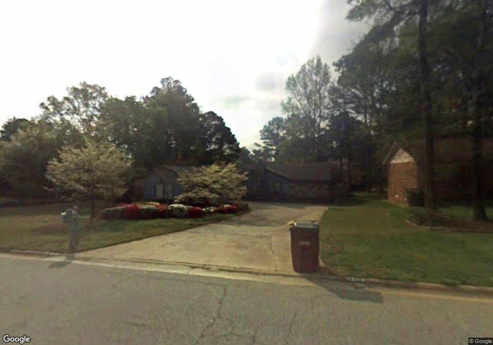
5206 Ashford Ct SW Lilburn, GA 30047
Estimated Value: $329,208 - $411,000
3
Beds
2
Baths
1,770
Sq Ft
$205/Sq Ft
Est. Value
About This Home
This home is located at 5206 Ashford Ct SW, Lilburn, GA 30047 and is currently estimated at $362,052, approximately $204 per square foot. 5206 Ashford Ct SW is a home located in Gwinnett County with nearby schools including Camp Creek Elementary School, Trickum Middle School, and Parkview High School.
Ownership History
Date
Name
Owned For
Owner Type
Purchase Details
Closed on
Apr 23, 2024
Sold by
Hester Patricia C
Bought by
Brantley Lynda
Current Estimated Value
Purchase Details
Closed on
Aug 16, 2022
Sold by
Hester Patricia Coombs
Bought by
Hester Patricia C and Brantley Lynda D
Purchase Details
Closed on
Oct 22, 2019
Sold by
Hester James W Jr Estate
Bought by
Hester Patricia Coombs
Purchase Details
Closed on
Mar 1, 1995
Sold by
Ali Monica Mccarthy
Bought by
Hester James W
Create a Home Valuation Report for This Property
The Home Valuation Report is an in-depth analysis detailing your home's value as well as a comparison with similar homes in the area
Home Values in the Area
Average Home Value in this Area
Purchase History
| Date | Buyer | Sale Price | Title Company |
|---|---|---|---|
| Brantley Lynda | -- | -- | |
| Hester Patricia C | $267,500 | -- | |
| Hester Patricia Coombs | -- | -- | |
| Hester James W | $102,000 | -- |
Source: Public Records
Tax History Compared to Growth
Tax History
| Year | Tax Paid | Tax Assessment Tax Assessment Total Assessment is a certain percentage of the fair market value that is determined by local assessors to be the total taxable value of land and additions on the property. | Land | Improvement |
|---|---|---|---|---|
| 2025 | $2,090 | $130,320 | $22,200 | $108,120 |
| 2024 | $2,091 | $130,760 | $22,200 | $108,560 |
| 2023 | $2,091 | $125,040 | $26,000 | $99,040 |
| 2022 | $1,392 | $107,000 | $26,000 | $81,000 |
| 2021 | $1,379 | $80,680 | $16,800 | $63,880 |
| 2020 | $3,315 | $80,680 | $16,800 | $63,880 |
| 2019 | $837 | $77,440 | $16,800 | $60,640 |
| 2018 | $819 | $60,560 | $12,800 | $47,760 |
| 2016 | $860 | $56,240 | $12,800 | $43,440 |
| 2015 | $873 | $55,440 | $11,200 | $44,240 |
| 2014 | $879 | $55,440 | $11,200 | $44,240 |
Source: Public Records
Map
Nearby Homes
- 5104 Onawa Ct SW
- 5033 Charlemagne Way SW
- 5041 Bainbridge Ct SW Unit 3
- 881 Rockbridge Rd SW
- 746 Oxford Ct SW
- 5000 Bainbridge Ct SW
- 717 Oxford Ct SW
- 1054 Morgan Garner Dr SW
- 574 Horseshoe Cir SW
- 5002 Abbey Ln SW
- 851 Rockbridge Rd SW
- 954 Camp Creek Dr SW
- 551 Briggs Cir SW
- 1075 Westchester Dr SW
- 771 Mountainbrooke Cir SW
- 5221 La Paloma Dr SW Unit 1
- 4872 Arrowhead Trail West SW Unit 1
- 5216 Ashford Ct SW
- 5196 Ashford Ct SW
- 0 Ashford Ct SW Unit 8556073
- 0 Ashford Ct SW Unit 8404107
- 0 Ashford Ct SW Unit 8016618
- 0 Ashford Ct SW Unit 9077195
- 0 Ashford Ct SW Unit 7233296
- 5197 Manitu Ct SW
- 5226 Ashford Ct SW
- 5207 Manitu Ct SW
- 5186 Ashford Ct SW
- 5187 Manitu Ct SW
- 5205 Ashford Ct SW
- 5195 Ashford Ct SW
- 5215 Ashford Ct SW
- 5217 Manitu Ct SW
- 5177 Manitu Ct SW
- 5236 Ashford Ct SW
- 0 Manitu Ct SW
- 5185 Ashford Ct SW