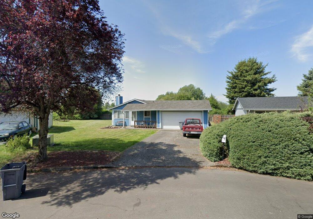
5206 NE 139th Loop Vancouver, WA 98682
Burnt Bridge Creek NeighborhoodEstimated Value: $397,000 - $447,000
3
Beds
1
Bath
1,008
Sq Ft
$416/Sq Ft
Est. Value
About This Home
This home is located at 5206 NE 139th Loop, Vancouver, WA 98682 and is currently estimated at $419,334, approximately $416 per square foot. 5206 NE 139th Loop is a home located in Clark County with nearby schools including Burnt Bridge Creek Elementary School, Frontier Middle School, and Union High School.
Ownership History
Date
Name
Owned For
Owner Type
Purchase Details
Closed on
Aug 16, 2000
Sold by
Hershey John J
Bought by
Anderson Jesse R
Current Estimated Value
Home Financials for this Owner
Home Financials are based on the most recent Mortgage that was taken out on this home.
Original Mortgage
$96,300
Outstanding Balance
$34,769
Interest Rate
8.16%
Estimated Equity
$384,565
Create a Home Valuation Report for This Property
The Home Valuation Report is an in-depth analysis detailing your home's value as well as a comparison with similar homes in the area
Home Values in the Area
Average Home Value in this Area
Purchase History
| Date | Buyer | Sale Price | Title Company |
|---|---|---|---|
| Anderson Jesse R | $107,000 | First American Title Ins Co |
Source: Public Records
Mortgage History
| Date | Status | Borrower | Loan Amount |
|---|---|---|---|
| Open | Anderson Jesse R | $96,300 |
Source: Public Records
Tax History Compared to Growth
Tax History
| Year | Tax Paid | Tax Assessment Tax Assessment Total Assessment is a certain percentage of the fair market value that is determined by local assessors to be the total taxable value of land and additions on the property. | Land | Improvement |
|---|---|---|---|---|
| 2025 | $3,530 | $365,916 | $196,500 | $169,416 |
| 2024 | $3,524 | $355,607 | $196,500 | $159,107 |
| 2023 | $3,441 | $368,228 | $196,500 | $171,728 |
| 2022 | $3,103 | $355,293 | $196,500 | $158,793 |
| 2021 | $2,916 | $303,905 | $168,000 | $135,905 |
| 2020 | $2,690 | $269,874 | $150,000 | $119,874 |
| 2019 | $2,361 | $251,417 | $130,275 | $121,142 |
| 2018 | $2,434 | $237,646 | $0 | $0 |
| 2017 | $2,173 | $196,885 | $0 | $0 |
| 2016 | $1,998 | $181,992 | $0 | $0 |
| 2015 | $1,929 | $160,192 | $0 | $0 |
| 2014 | -- | $147,851 | $0 | $0 |
| 2013 | -- | $130,101 | $0 | $0 |
Source: Public Records
Map
Nearby Homes
- 14208 NE 51st St
- 4615 NE 136th Ave
- 4913 NE 130th Ave
- 4517 NE 142nd Ave
- 4900 NE 130th Ave
- 4301 NE 137th Ave
- 4315 NE 135th Ave
- 13216 NE 59th St Unit 25
- 13216 NE 59th St Unit 34
- 13216 NE 59th St Unit 24
- 5613 N East 129th Place
- 12881 NE 56th St
- 12724 NE 52nd Cir
- 4718 NE 129th Ave
- 5721 NE 129th Place
- 14801 NE 51st St
- 6200 NE 138th Ave
- 4014 NE 141st Ave
- 4309 NE 130th Ave
- 12613 NE 49th Way
- 5204 NE 139th Loop
- 5208 NE 139th Loop
- 5202 NE 139th Loop
- 5210 NE 139th Loop
- 5201 NE 139th Loop
- 5122 NE 139th Loop
- 5209 NE 139th Loop
- 5216 NE 139th Ave
- 5300 NE 139th Ave
- 5121 NE 139th Loop
- 5124 NE 139th Ave
- 5113 NE 139th Loop
- 5120 NE 139th Loop
- 5120 NE 139th Ave
- 5310 NE 139th Ave
- 5113 NE 137th Ave
- 13902 NE 52nd St
- 13903 NE 53rd St
- 5118 NE 139th Loop
- 5121 NE 139th Ave