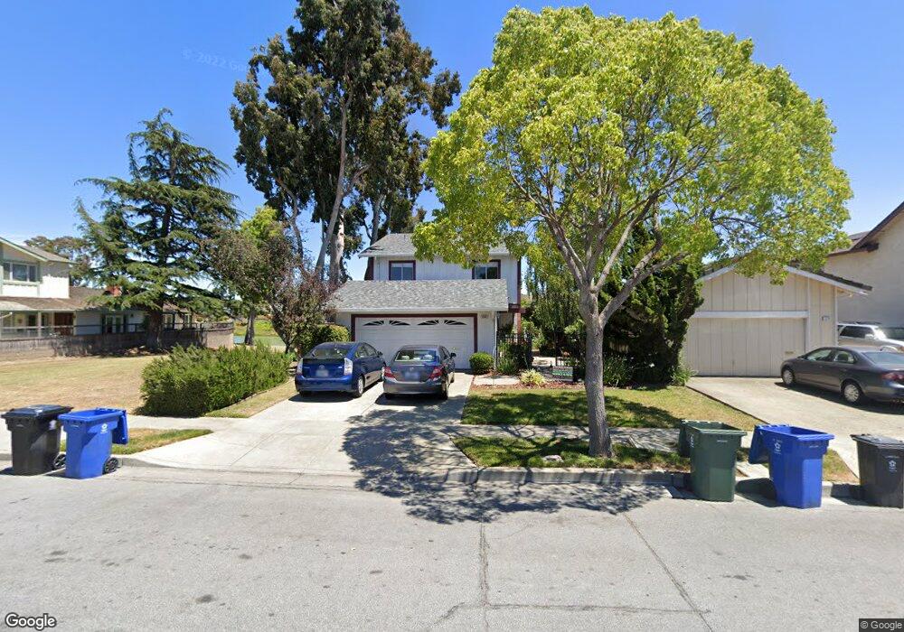
5206 Ramsgate Dr Newark, CA 94560
Newark AreaEstimated Value: $1,612,650 - $1,762,000
About This Home
This home is located at 5206 Ramsgate Dr, Newark, CA 94560 and is currently estimated at $1,686,663, approximately $874 per square foot. 5206 Ramsgate Dr is a home located in Alameda County with nearby schools including John F. Kennedy Elementary School, Newark Junior High School, and Newark Memorial High School.
Ownership History
We collect this data history from publicly available records. To have your information removed, we recommend requesting removal directly through your county’s website.
Purchase Details
Purchase Details
Home Values in the Area
Average Home Value in this Area
Purchase History
We collect this data history from publicly available records. To have your information removed, we recommend requesting removal directly through your county’s website.
| Date | Buyer | Sale Price | Title Company |
|---|---|---|---|
| -- | Placer Title Company | ||
| $298,000 | Fidelity National Title Ins |
Mortgage History
We collect this data history from publicly available records. To have your information removed, we recommend requesting removal directly through your county’s website.
| Date | Status | Borrower | Loan Amount |
|---|---|---|---|
| Open | $235,500 | ||
| Closed | $100,000 | ||
| Previous Owner | $277,500 | ||
| Previous Owner | $265,000 |
Tax History
We collect this data history from publicly available records. To have your information removed, we recommend requesting removal directly through your county’s website.
| Year | Tax Paid | Tax Assessment Tax Assessment Total Assessment is a certain percentage of the fair market value that is determined by local assessors to be the total taxable value of land and additions on the property. | Land | Improvement |
|---|---|---|---|---|
| 2025 | $6,415 | $488,024 | $148,507 | $346,517 |
| 2024 | $6,299 | $478,318 | $145,595 | $339,723 |
| 2023 | $6,121 | $475,804 | $142,741 | $333,063 |
| 2022 | $6,030 | $459,477 | $139,943 | $326,534 |
| 2021 | $5,881 | $450,331 | $137,199 | $320,132 |
| 2020 | $5,775 | $452,643 | $135,793 | $316,850 |
| 2019 | $5,693 | $443,768 | $133,130 | $310,638 |
| 2018 | $5,606 | $435,070 | $130,521 | $304,549 |
| 2017 | $5,463 | $426,541 | $127,962 | $298,579 |
| 2016 | $5,401 | $418,180 | $125,454 | $292,726 |
| 2015 | $5,382 | $411,901 | $123,570 | $288,331 |
| 2014 | $5,234 | $403,834 | $121,150 | $282,684 |
Map
- 35345 Cheviot Ct
- 35611 Sheridan Ct
- 35791 Scarborough Dr
- 35415 Blackburn Dr
- 4815 Windermere Dr
- 36088 Salisbury Dr
- 5613 Abington Ct
- 35512 Cabral Dr
- 36202 Worthing Dr
- 4635 Capitan Dr
- 36234 Worthing Dr
- 36288 Tudor Place
- 36276 Cedar Blvd
- 34736 Beret Terrace Unit 78
- 36122 Magellan Dr
- 36262 San Pedro Dr
- 4773 Ridgewood Dr
- 34607 Pueblo Terrace
- 5246 Tacoma Common Unit 51
- 4444 Gibraltar Dr
- 35384 Cheviot Ct
- 35372 Cheviot Ct
- 35391 Newcastle Ct
- 35369 Newcastle Ct
- 35356 Cheviot Ct
- 35385 Cheviot Ct
- 5176 Ramsgate Dr
- 5184 Ramsgate Dr
- 5168 Ramsgate Dr
- 35363 Cheviot Ct
- 35353 Newcastle Ct
- 5160 Ramsgate Dr
- 5152 Ramsgate Dr
- 35351 Cheviot Ct
- 35342 Cheviot Ct
- 5214 Ramsgate Dr
- 35347 Newcastle Ct
- 35380 Rutland Ct
- 5133 Ramsgate Dr
- 5222 Ramsgate Dr
Ask me questions while you tour the home.