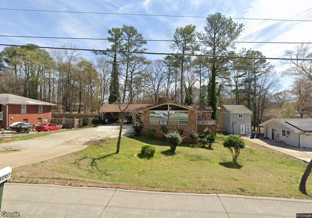
5207 Austell Rd Unit 1 Austell, GA 30106
Estimated Value: $295,459 - $339,000
3
Beds
2
Baths
1,575
Sq Ft
$198/Sq Ft
Est. Value
About This Home
This home is located at 5207 Austell Rd Unit 1, Austell, GA 30106 and is currently estimated at $311,365, approximately $197 per square foot. 5207 Austell Rd Unit 1 is a home located in Cobb County with nearby schools including Austell Elementary School, Garrett Middle School, and South Cobb High School.
Ownership History
Date
Name
Owned For
Owner Type
Purchase Details
Closed on
Mar 11, 2025
Sold by
Hannon Carl B
Bought by
Hannon Carl B and Hannon Martha B
Current Estimated Value
Purchase Details
Closed on
Oct 23, 2002
Sold by
Hannon Martha B
Bought by
Hannon Carl B
Purchase Details
Closed on
Mar 23, 1999
Sold by
Hardwick Jane M
Bought by
Hannon Martha B
Home Financials for this Owner
Home Financials are based on the most recent Mortgage that was taken out on this home.
Original Mortgage
$88,800
Interest Rate
6.74%
Mortgage Type
New Conventional
Create a Home Valuation Report for This Property
The Home Valuation Report is an in-depth analysis detailing your home's value as well as a comparison with similar homes in the area
Home Values in the Area
Average Home Value in this Area
Purchase History
| Date | Buyer | Sale Price | Title Company |
|---|---|---|---|
| Hannon Carl B | -- | None Listed On Document | |
| Hannon Carl B | -- | None Listed On Document | |
| Hannon Carl B | -- | -- | |
| Hannon Martha B | $111,000 | -- |
Source: Public Records
Mortgage History
| Date | Status | Borrower | Loan Amount |
|---|---|---|---|
| Previous Owner | Hannon Martha B | $88,800 |
Source: Public Records
Tax History
| Year | Tax Paid | Tax Assessment Tax Assessment Total Assessment is a certain percentage of the fair market value that is determined by local assessors to be the total taxable value of land and additions on the property. | Land | Improvement |
|---|---|---|---|---|
| 2025 | $3,559 | $118,136 | $26,000 | $92,136 |
| 2024 | $3,337 | $110,676 | $24,000 | $86,676 |
| 2023 | $3,606 | $119,616 | $18,000 | $101,616 |
| 2022 | $1,963 | $64,672 | $10,000 | $54,672 |
| 2021 | $1,963 | $64,672 | $10,000 | $54,672 |
| 2020 | $1,613 | $53,156 | $10,000 | $43,156 |
| 2019 | $1,450 | $63,684 | $10,000 | $53,684 |
| 2018 | $958 | $41,216 | $7,200 | $34,016 |
| 2017 | $777 | $35,940 | $6,000 | $29,940 |
| 2016 | $681 | $32,568 | $5,600 | $26,968 |
| 2015 | $558 | $27,784 | $8,000 | $19,784 |
| 2014 | $563 | $27,784 | $0 | $0 |
Source: Public Records
Map
Nearby Homes
- 1 Perkerson Mill Rd SW
- 1943 Arnold Dr
- 5164 Medford Ln
- 1959 Oakbluff Dr
- 2136 Perkerson Mill Rd SW
- 1803 Gherry Dr
- 2232 Warren Dr
- 4975 Brawner Lake Dr
- 0 Clay Rd
- 1700 Fulmont Cir
- 5472 June Dr SW
- 5474 June Dr SW
- 5025 Bishops Row SW
- 5069 Flint Hill Rd Unit AB
- 2125 Clay Rd SW
- 1886 Mobley St
- 1841 Mobley St
- 0 Lakeview Ct Unit 10711020
- 0 Harris St Unit 7719748
- 5151 Lakeview Ct
- 5219 Austell Rd
- 2044 Arnold Dr
- 2036 Arnold Dr
- 5229 Austell Rd
- 2028 Arnold Dr Unit 1
- 2054 Arnold Dr
- 2076 Brannon Dr
- 2035 Lelia St Unit 1
- 2049 Arnold Dr
- 2016 Arnold Dr
- 2105 Perkerson Mill Rd
- 2017 Arnold Dr
- 2019 Leila St
- 5261 Austell Rd
- 2106 Perkerson Mill Rd
- 2053 Brannon Dr
- 2043 Brannon Dr
- 2005 Arnold Dr
- 5150 Austell Rd
Your Personal Tour Guide
Ask me questions while you tour the home.