Estimated Value: $145,637 - $211,000
2
Beds
2
Baths
1,231
Sq Ft
$137/Sq Ft
Est. Value
About This Home
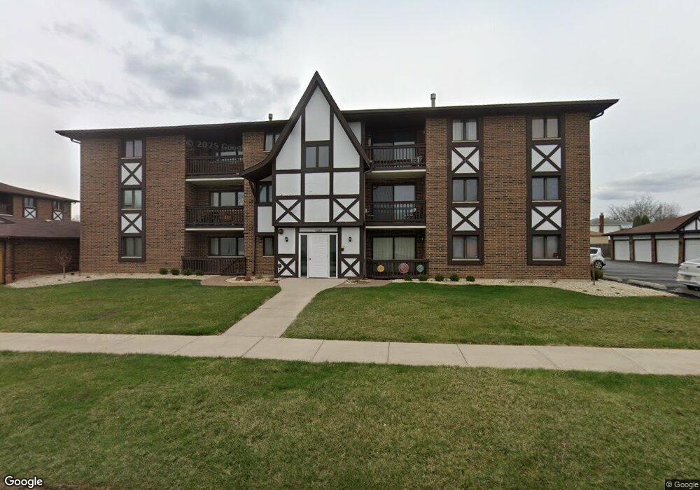
This home is located at 5208 W 122nd St Unit 52081D, Alsip, IL 60803 and is currently estimated at $168,909, approximately $137 per square foot. 5208 W 122nd St Unit 52081D is a home located in Cook County with nearby schools including Lane Elementary School, Prairie Jr High School, and A B Shepard High School.
Ownership History
Date
Name
Owned For
Owner Type
Purchase Details
Closed on
Dec 1, 2020
Sold by
Gaynor Bridget and Mcmullen James
Bought by
Mcmullen Mollie
Current Estimated Value
Purchase Details
Closed on
Oct 30, 2000
Sold by
Kendall Ramon P and Kendall Barbara
Bought by
Mcmullen Ronald J and Mcmullen Josephine M
Home Financials for this Owner
Home Financials are based on the most recent Mortgage that was taken out on this home.
Original Mortgage
$84,000
Outstanding Balance
$30,930
Interest Rate
7.87%
Estimated Equity
$137,979
Purchase Details
Closed on
Feb 7, 1994
Sold by
Cole Taylor Bank
Bought by
Kendall Ramon P and Kendall Barbara
Home Financials for this Owner
Home Financials are based on the most recent Mortgage that was taken out on this home.
Original Mortgage
$76,300
Interest Rate
7.32%
Create a Home Valuation Report for This Property
The Home Valuation Report is an in-depth analysis detailing your home's value as well as a comparison with similar homes in the area
Home Values in the Area
Average Home Value in this Area
Purchase History
| Date | Buyer | Sale Price | Title Company |
|---|---|---|---|
| Mcmullen Mollie | -- | Chicago Title | |
| Mcmullen Ronald J | $94,000 | -- | |
| Kendall Ramon P | $63,666 | Intercounty Title |
Source: Public Records
Mortgage History
| Date | Status | Borrower | Loan Amount |
|---|---|---|---|
| Open | Mcmullen Ronald J | $84,000 | |
| Previous Owner | Kendall Ramon P | $76,300 |
Source: Public Records
Tax History Compared to Growth
Tax History
| Year | Tax Paid | Tax Assessment Tax Assessment Total Assessment is a certain percentage of the fair market value that is determined by local assessors to be the total taxable value of land and additions on the property. | Land | Improvement |
|---|---|---|---|---|
| 2024 | $3,693 | $11,147 | $3,362 | $7,785 |
| 2023 | $3,359 | $11,147 | $3,362 | $7,785 |
| 2022 | $3,359 | $8,366 | $3,122 | $5,244 |
| 2021 | $905 | $8,364 | $3,121 | $5,243 |
| 2020 | $1,050 | $8,364 | $3,121 | $5,243 |
| 2019 | $667 | $7,876 | $2,881 | $4,995 |
| 2018 | $2,193 | $11,999 | $2,881 | $9,118 |
| 2017 | $4,557 | $11,999 | $2,881 | $9,118 |
| 2016 | $2,173 | $9,885 | $2,401 | $7,484 |
| 2015 | $2,072 | $9,885 | $2,401 | $7,484 |
| 2014 | $2,035 | $9,885 | $2,401 | $7,484 |
| 2013 | $1,733 | $9,555 | $2,401 | $7,154 |
Source: Public Records
Map
Nearby Homes
- 5008 W 122nd St Unit 2B
- 11841 S Leamington Ave
- 11756 S Leamington Ave
- 4833 W 123rd Place
- 5544 W Cal Sag Rd
- 12147 S Cicero Ave
- 11906 S Cicero Ave
- 12211 S Spencer St
- 4808 W 118th St
- 4804 W 118th St
- 12620 S Alpine Dr Unit 6
- 12620 S Alpine Dr Unit 4
- 12620 S Alpine Dr Unit 8
- 12613 S Parkside Ave
- 11608 S Leamington Ave
- 12649 S Parkside Ave
- 11601 S Lawler Ave
- 12655 S Parkside Ave
- 12801 W Playfield Dr
- 12715 S Laporte Ave
- 5208 W 122nd St Unit 2D
- 5208 W 122nd St Unit 52081A
- 5208 W 122nd St Unit G13
- 5208 W 122nd St Unit G15
- 5208 W 122nd St Unit 52082A
- 5208 W 122nd St Unit 52083C
- 5208 W 122nd St Unit G16
- 5208 W 122nd St Unit G12
- 5208 W 122nd St Unit 52081B
- 5208 W 122nd St Unit 52083A
- 5208 W 122nd St Unit G11
- 5208 W 122nd St Unit G14
- 5208 W 122nd St Unit 52083D
- 5208 W 122nd St Unit 52082D
- 5208 W 122nd St Unit 52082B
- 5208 W 122nd St Unit 52081C
- 5208 W 122nd St Unit 52082C
- 5208 W 122nd St Unit 1B
- 5208 W 122nd St Unit 3A
- 5208 W 122nd St Unit 1A