Estimated Value: $147,062 - $187,000
2
Beds
2
Baths
1,277
Sq Ft
$128/Sq Ft
Est. Value
About This Home
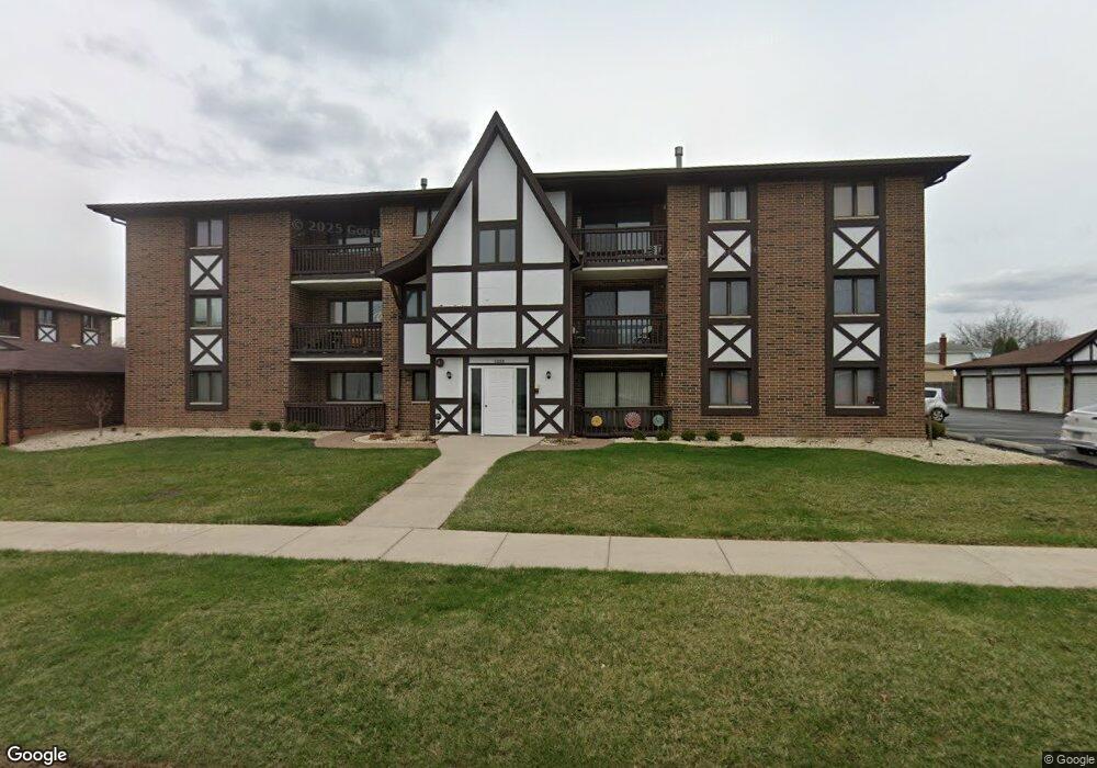
This home is located at 5208 W 122nd St Unit 52083D, Alsip, IL 60803 and is currently estimated at $164,016, approximately $128 per square foot. 5208 W 122nd St Unit 52083D is a home located in Cook County with nearby schools including Lane Elementary School, Prairie Jr High School, and A B Shepard High School.
Ownership History
Date
Name
Owned For
Owner Type
Purchase Details
Closed on
Sep 20, 2022
Sold by
Delvecchio Barbara C
Bought by
Chicago Title Land Trust
Current Estimated Value
Purchase Details
Closed on
Nov 5, 1993
Sold by
Cole Taylor Bank
Bought by
Delvecchio Barbara C
Home Financials for this Owner
Home Financials are based on the most recent Mortgage that was taken out on this home.
Original Mortgage
$50,000
Interest Rate
6.92%
Create a Home Valuation Report for This Property
The Home Valuation Report is an in-depth analysis detailing your home's value as well as a comparison with similar homes in the area
Home Values in the Area
Average Home Value in this Area
Purchase History
| Date | Buyer | Sale Price | Title Company |
|---|---|---|---|
| Chicago Title Land Trust | -- | Chicago Title | |
| Delvecchio Barbara C | $68,666 | -- |
Source: Public Records
Mortgage History
| Date | Status | Borrower | Loan Amount |
|---|---|---|---|
| Previous Owner | Delvecchio Barbara C | $50,000 |
Source: Public Records
Tax History Compared to Growth
Tax History
| Year | Tax Paid | Tax Assessment Tax Assessment Total Assessment is a certain percentage of the fair market value that is determined by local assessors to be the total taxable value of land and additions on the property. | Land | Improvement |
|---|---|---|---|---|
| 2024 | $414 | $11,565 | $3,488 | $8,077 |
| 2023 | $518 | $11,565 | $3,488 | $8,077 |
| 2022 | $518 | $8,680 | $3,239 | $5,441 |
| 2021 | $479 | $8,678 | $3,238 | $5,440 |
| 2020 | $441 | $8,678 | $3,238 | $5,440 |
| 2019 | $506 | $8,172 | $2,989 | $5,183 |
| 2018 | $488 | $9,959 | $2,989 | $6,970 |
| 2017 | $483 | $9,959 | $2,989 | $6,970 |
| 2016 | $1,351 | $10,256 | $2,491 | $7,765 |
| 2015 | $1,408 | $10,256 | $2,491 | $7,765 |
| 2014 | $1,331 | $10,256 | $2,491 | $7,765 |
| 2013 | $1,260 | $9,913 | $2,491 | $7,422 |
Source: Public Records
Map
Nearby Homes
- 5008 W 122nd St Unit 2B
- 11841 S Leamington Ave
- 11756 S Leamington Ave
- 4833 W 123rd Place
- 5544 W Cal Sag Rd
- 12147 S Cicero Ave
- 11906 S Cicero Ave
- 12211 S Spencer St
- 4808 W 118th St
- 4804 W 118th St
- 12620 S Alpine Dr Unit 6
- 12620 S Alpine Dr Unit 4
- 12620 S Alpine Dr Unit 8
- 12613 S Parkside Ave
- 11608 S Leamington Ave
- 12649 S Parkside Ave
- 11601 S Lawler Ave
- 12655 S Parkside Ave
- 12801 W Playfield Dr
- 12715 S Laporte Ave
- 5208 W 122nd St Unit 2D
- 5208 W 122nd St Unit 52081A
- 5208 W 122nd St Unit G13
- 5208 W 122nd St Unit G15
- 5208 W 122nd St Unit 52082A
- 5208 W 122nd St Unit 52083C
- 5208 W 122nd St Unit G16
- 5208 W 122nd St Unit G12
- 5208 W 122nd St Unit 52081B
- 5208 W 122nd St Unit 52083A
- 5208 W 122nd St Unit 52081D
- 5208 W 122nd St Unit G11
- 5208 W 122nd St Unit G14
- 5208 W 122nd St Unit 52082D
- 5208 W 122nd St Unit 52082B
- 5208 W 122nd St Unit 52081C
- 5208 W 122nd St Unit 52082C
- 5208 W 122nd St Unit 1B
- 5208 W 122nd St Unit 3A
- 5208 W 122nd St Unit 1A