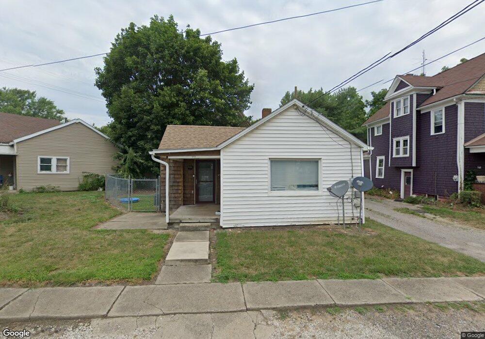
521 1st St Alliance, OH 44601
Estimated Value: $39,000 - $84,000
2
Beds
1
Bath
818
Sq Ft
$80/Sq Ft
Est. Value
About This Home
This home is located at 521 1st St, Alliance, OH 44601 and is currently estimated at $65,286, approximately $79 per square foot. 521 1st St is a home located in Stark County with nearby schools including Alliance Early Learning School, Alliance Intermediate School at Northside, and Alliance Middle School.
Ownership History
Date
Name
Owned For
Owner Type
Purchase Details
Closed on
Jul 29, 2011
Sold by
Fannie Mae
Bought by
Stickler Paul D
Current Estimated Value
Purchase Details
Closed on
Jun 6, 2011
Sold by
Rockhill James L
Bought by
Federal National Mortgage Association
Purchase Details
Closed on
Nov 21, 2000
Sold by
Liebhart Tommie Sue
Bought by
Rockhill James L
Home Financials for this Owner
Home Financials are based on the most recent Mortgage that was taken out on this home.
Original Mortgage
$27,200
Interest Rate
13.45%
Mortgage Type
Purchase Money Mortgage
Purchase Details
Closed on
Aug 23, 1999
Sold by
Reid Deborah A
Bought by
Liebhart Tommie Sue
Purchase Details
Closed on
Jun 21, 1993
Create a Home Valuation Report for This Property
The Home Valuation Report is an in-depth analysis detailing your home's value as well as a comparison with similar homes in the area
Home Values in the Area
Average Home Value in this Area
Purchase History
| Date | Buyer | Sale Price | Title Company |
|---|---|---|---|
| Stickler Paul D | $7,900 | None Available | |
| Federal National Mortgage Association | $16,000 | None Available | |
| Rockhill James L | $34,000 | -- | |
| Liebhart Tommie Sue | $10,600 | -- | |
| -- | -- | -- |
Source: Public Records
Mortgage History
| Date | Status | Borrower | Loan Amount |
|---|---|---|---|
| Previous Owner | Rockhill James L | $27,200 |
Source: Public Records
Tax History
| Year | Tax Paid | Tax Assessment Tax Assessment Total Assessment is a certain percentage of the fair market value that is determined by local assessors to be the total taxable value of land and additions on the property. | Land | Improvement |
|---|---|---|---|---|
| 2025 | -- | $10,500 | $2,660 | $7,840 |
| 2024 | -- | $10,500 | $2,660 | $7,840 |
| 2023 | $345 | $8,370 | $1,330 | $7,040 |
| 2022 | $347 | $8,370 | $1,330 | $7,040 |
| 2021 | $348 | $8,370 | $1,330 | $7,040 |
| 2020 | $246 | $5,530 | $980 | $4,550 |
| 2019 | $243 | $5,530 | $980 | $4,550 |
Source: Public Records
Map
Nearby Homes
- 710 N Freedom Ave
- 505 N Union Ave
- 849 Walnut Ave
- 62 E Market St
- 361 E Main St
- 171 1/2 W Main St
- 717 Garfield Ave
- 163 W Market St
- 264 W Market St
- 847 E Patterson St
- 33 S Lincoln Ave
- 427 S Union Ave
- V/L S Freedom Ave
- 118 S Mckinley Ave
- 343 W Columbia St
- 1015 Reed St
- 11344 Walnut Ave NE
- 1025 Reed St
- 442 S Liberty Ave
- 228 W Oxford St
- 503 N Park Ave
- 517 N Park Ave
- 508 1st St
- 553 Hester Ave
- 716 N Freedom Ave
- 704 N Freedom Ave
- 537 1st St
- 549 Hester Ave
- 506 N Park Ave
- 658 N Freedom Ave
- 520 N Park Ave
- 541 Hester Ave
- 512 N Park Ave
- 531 Hester Ave
- 646 N Freedom Ave
- 646 N Freedom Ave Unit 646 N. Freedom
- 648 N Freedom Ave Unit 648
- 634 N Freedom Ave
- 40 E Washington St
- 536 N Park Ave
Your Personal Tour Guide
Ask me questions while you tour the home.