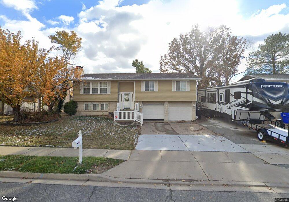
521 Applewood Dr Centerville, UT 84014
Estimated Value: $490,000 - $572,000
3
Beds
2
Baths
1,332
Sq Ft
$397/Sq Ft
Est. Value
About This Home
This home is located at 521 Applewood Dr, Centerville, UT 84014 and is currently estimated at $529,055, approximately $397 per square foot. 521 Applewood Dr is a home located in Davis County with nearby schools including Stewart Elementary School, Centerville Jr High, and Viewmont High School.
Ownership History
Date
Name
Owned For
Owner Type
Purchase Details
Closed on
Mar 13, 2019
Sold by
Crane Stephen J and Crane Teresa A
Bought by
Hansen John and Hansen Erin
Current Estimated Value
Home Financials for this Owner
Home Financials are based on the most recent Mortgage that was taken out on this home.
Original Mortgage
$284,900
Outstanding Balance
$253,527
Interest Rate
5.12%
Mortgage Type
FHA
Estimated Equity
$275,528
Purchase Details
Closed on
Apr 17, 1997
Sold by
Peterson Willis O and Peterson Beverly A
Bought by
Crane Stephen J and Crane Teresa A
Purchase Details
Closed on
Jan 26, 1996
Sold by
Peterson Willis O and Peterson Beverly A
Bought by
Peterson Willis O and Peterson Beverly A
Home Financials for this Owner
Home Financials are based on the most recent Mortgage that was taken out on this home.
Original Mortgage
$73,500
Interest Rate
7.14%
Create a Home Valuation Report for This Property
The Home Valuation Report is an in-depth analysis detailing your home's value as well as a comparison with similar homes in the area
Purchase History
| Date | Buyer | Sale Price | Title Company |
|---|---|---|---|
| Hansen John | -- | Novation Title Ins | |
| Crane Stephen J | -- | Associated Title Company | |
| Peterson Willis O | -- | Blacks Title Inc | |
| Peterson Willis O | -- | Blacks Title Inc |
Source: Public Records
Mortgage History
| Date | Status | Borrower | Loan Amount |
|---|---|---|---|
| Open | Hansen John | $284,900 | |
| Previous Owner | Peterson Willis O | $73,500 |
Source: Public Records
Tax History
| Year | Tax Paid | Tax Assessment Tax Assessment Total Assessment is a certain percentage of the fair market value that is determined by local assessors to be the total taxable value of land and additions on the property. | Land | Improvement |
|---|---|---|---|---|
| 2025 | $2,679 | $256,300 | $160,148 | $96,152 |
| 2024 | $2,646 | $257,400 | $143,190 | $114,210 |
| 2023 | $2,526 | $444,000 | $235,868 | $208,132 |
| 2022 | $2,659 | $257,400 | $118,898 | $138,502 |
| 2021 | $2,374 | $358,000 | $180,289 | $177,711 |
| 2020 | $2,003 | $302,000 | $176,716 | $125,284 |
| 2019 | $2,017 | $297,000 | $179,271 | $117,729 |
| 2018 | $1,863 | $271,000 | $166,466 | $104,534 |
| 2016 | $1,468 | $118,635 | $52,715 | $65,920 |
| 2015 | $1,432 | $109,175 | $52,715 | $56,460 |
| 2014 | $1,459 | $113,818 | $52,715 | $61,103 |
| 2013 | -- | $108,801 | $42,323 | $66,478 |
Source: Public Records
Map
Nearby Homes
- 507 W 620 N
- 493 W 620 N Unit 122
- 638 N 800 W
- 303 W 650 N Unit I
- 751 Pheasantbrook Dr
- 763 Pheasantbrook Dr
- 292 W 680 N
- 781 Pheasantbrook Dr
- 281 W 650 N Unit B
- 282 W 605 N Unit I
- 833 N Lakeside Ln
- 271 Brookfield Ln
- 775 Pheasantbrook Cir
- 147 W 925 N
- 1021 N 740 W
- 438 W 1050 N
- 67 W Pheasantbrook Dr
- 66 Brookside Ln
- 147 N 360 W Unit 21
- 22 Creekside Ln
- 543 Applewood Dr
- 524 W 620 N
- 518 W 620 N Unit 160
- 532 W 620 N
- 532 W 620 N Unit 162
- 512 W 620 N Unit 159
- 512 W 620 N Unit 158
- 548 W 620 N
- 500 W 620 N Unit 161
- 534 Applewood Dr
- 551 Applewood Dr
- 491 Applewood Dr
- 512 Applewood Dr
- 550 W 620 N Unit 164
- 488 W 620 N Unit 157
- 548 Applewood Dr
- 560 W 620 N Unit 165
- 494 Applewood Dr
- 555 N 400 W Unit 12
- 555 N 400 W Unit 8
Your Personal Tour Guide
Ask me questions while you tour the home.