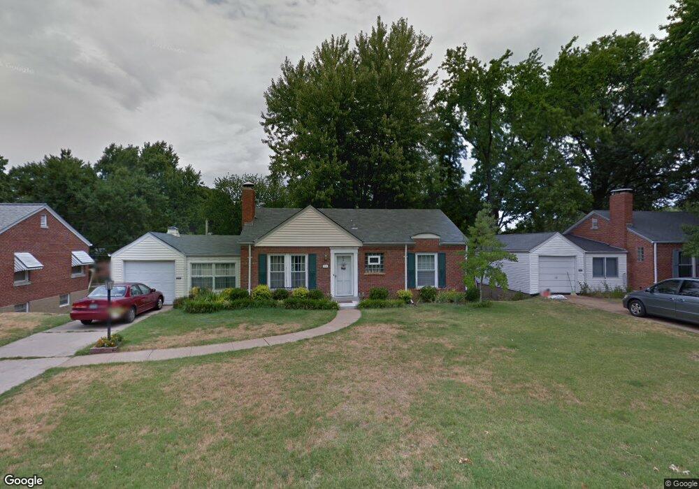
521 Ashbury Ct Saint Louis, MO 63119
Estimated Value: $325,864 - $382,000
2
Beds
1
Bath
1,248
Sq Ft
$285/Sq Ft
Est. Value
About This Home
This home is located at 521 Ashbury Ct, Saint Louis, MO 63119 and is currently estimated at $355,716, approximately $285 per square foot. 521 Ashbury Ct is a home located in St. Louis County with nearby schools including Edgar Road Elementary School, Hixson Middle School, and Webster Groves High School.
Ownership History
Date
Name
Owned For
Owner Type
Purchase Details
Closed on
Oct 19, 2006
Sold by
Casanover Amy K and Casanover Scott
Bought by
Ryan Kathryn F
Current Estimated Value
Home Financials for this Owner
Home Financials are based on the most recent Mortgage that was taken out on this home.
Original Mortgage
$105,000
Outstanding Balance
$62,656
Interest Rate
6.46%
Mortgage Type
Purchase Money Mortgage
Estimated Equity
$293,060
Purchase Details
Closed on
Nov 10, 2003
Sold by
Brown Trey and Brown Colleen
Bought by
Rubie Amy K
Home Financials for this Owner
Home Financials are based on the most recent Mortgage that was taken out on this home.
Original Mortgage
$156,000
Interest Rate
4.5%
Mortgage Type
Purchase Money Mortgage
Create a Home Valuation Report for This Property
The Home Valuation Report is an in-depth analysis detailing your home's value as well as a comparison with similar homes in the area
Home Values in the Area
Average Home Value in this Area
Purchase History
| Date | Buyer | Sale Price | Title Company |
|---|---|---|---|
| Ryan Kathryn F | $209,750 | None Available | |
| Rubie Amy K | $195,000 | -- |
Source: Public Records
Mortgage History
| Date | Status | Borrower | Loan Amount |
|---|---|---|---|
| Open | Ryan Kathryn F | $105,000 | |
| Previous Owner | Rubie Amy K | $156,000 |
Source: Public Records
Tax History Compared to Growth
Tax History
| Year | Tax Paid | Tax Assessment Tax Assessment Total Assessment is a certain percentage of the fair market value that is determined by local assessors to be the total taxable value of land and additions on the property. | Land | Improvement |
|---|---|---|---|---|
| 2025 | $3,331 | $51,210 | $33,650 | $17,560 |
| 2024 | $3,331 | $47,690 | $23,560 | $24,130 |
| 2023 | $3,331 | $47,690 | $23,560 | $24,130 |
| 2022 | $2,867 | $38,210 | $23,560 | $14,650 |
| 2021 | $2,857 | $38,210 | $23,560 | $14,650 |
| 2020 | $2,919 | $36,370 | $23,560 | $12,810 |
| 2019 | $2,902 | $36,370 | $23,560 | $12,810 |
| 2018 | $3,038 | $33,840 | $16,820 | $17,020 |
| 2017 | $3,018 | $33,840 | $16,820 | $17,020 |
| 2016 | $2,905 | $31,200 | $12,750 | $18,450 |
| 2015 | $2,908 | $31,200 | $12,750 | $18,450 |
| 2014 | $2,781 | $29,020 | $8,780 | $20,240 |
Source: Public Records
Map
Nearby Homes
- 907 Edgar Rd
- 430 Cannonbury Dr
- 1405 Culverhill Dr
- 312 Oak Tree Dr
- 725 Brookridge Dr
- 308 Oak Tree Dr
- 739 Hurstgreen Rd
- 8261 Watson Rd
- 7452 Rockwood Dr
- 1330 Drayton Ave
- 107 Saint George Place
- 7625 General Meade Ln
- 8215 General Sheridan Ln
- 7936 Radnor Dr
- 7243 General Sherman Ln
- 7101 Fernbrook Dr
- 431 Landscape Ct
- 435 S Old Orchard Ave
- 30 Webster Oaks Dr
- 12 Webster Acres
- 515 Ashbury Ct
- 527 Ashbury Ct
- 520 Willoughby Place
- 526 Willoughby Place
- 514 Willoughby Place
- 1119 Culverhill Dr
- 509 Ashbury Ct
- 520 Ashbury Ct
- 514 Ashbury Ct
- 526 Ashbury Ct
- 1109 Culverhill Dr
- 508 Willoughby Place
- 503 Ashbury Ct
- 508 Ashbury Ct
- 1131 Culverhill Dr
- 502 Willoughby Place
- 502 Ashbury Ct
- 521 Hampshire Ct
- 1116 Culverhill Dr
- 515 Hampshire Ct