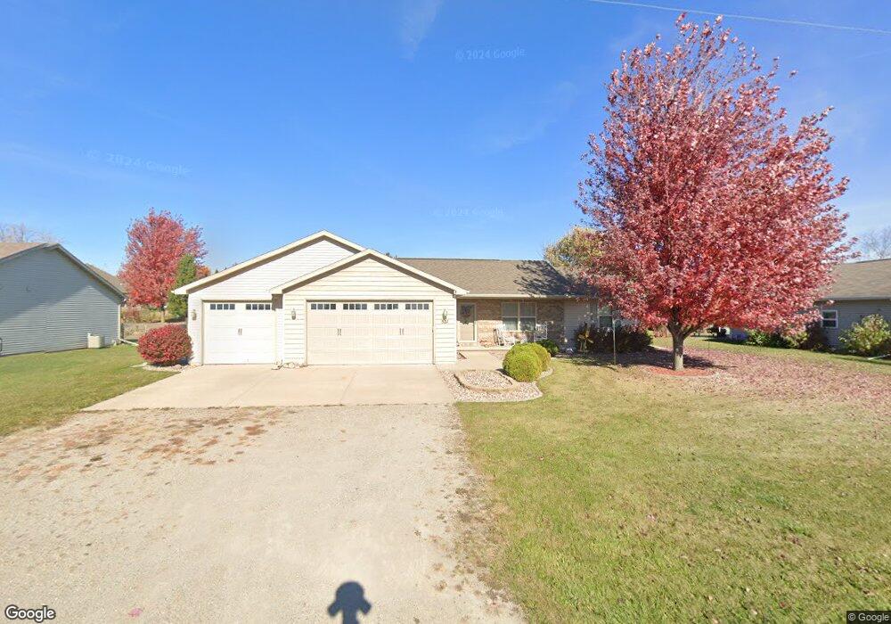
521 Block Rd Combined Locks, WI 54113
Estimated Value: $338,600 - $394,000
3
Beds
2
Baths
1,442
Sq Ft
$259/Sq Ft
Est. Value
About This Home
This home is located at 521 Block Rd, Combined Locks, WI 54113 and is currently estimated at $373,400, approximately $258 per square foot. 521 Block Rd is a home located in Outagamie County with nearby schools including River View School, Kaukauna High School, and Flex Academy.
Ownership History
Date
Name
Owned For
Owner Type
Purchase Details
Closed on
Jun 22, 2022
Sold by
Nash William T
Bought by
Le Noble Cheryl Anne
Current Estimated Value
Home Financials for this Owner
Home Financials are based on the most recent Mortgage that was taken out on this home.
Original Mortgage
$78,800
Outstanding Balance
$73,886
Interest Rate
3.75%
Mortgage Type
New Conventional
Estimated Equity
$299,514
Purchase Details
Closed on
Jul 22, 2011
Sold by
Decker Homes Inc
Bought by
Nash William T and Nash Cheryl A
Create a Home Valuation Report for This Property
The Home Valuation Report is an in-depth analysis detailing your home's value as well as a comparison with similar homes in the area
Home Values in the Area
Average Home Value in this Area
Purchase History
| Date | Buyer | Sale Price | Title Company |
|---|---|---|---|
| Le Noble Cheryl Anne | -- | New Title Company Name | |
| Nash William T | $149,900 | -- |
Source: Public Records
Mortgage History
| Date | Status | Borrower | Loan Amount |
|---|---|---|---|
| Open | Le Noble Cheryl Anne | $78,800 |
Source: Public Records
Tax History
| Year | Tax Paid | Tax Assessment Tax Assessment Total Assessment is a certain percentage of the fair market value that is determined by local assessors to be the total taxable value of land and additions on the property. | Land | Improvement |
|---|---|---|---|---|
| 2023 | $3,335 | $205,300 | $36,900 | $168,400 |
| 2022 | $3,215 | $205,300 | $36,900 | $168,400 |
| 2021 | $3,200 | $205,300 | $36,900 | $168,400 |
| 2020 | $3,238 | $167,700 | $33,800 | $133,900 |
| 2019 | $3,178 | $167,700 | $33,800 | $133,900 |
| 2018 | $3,147 | $167,700 | $33,800 | $133,900 |
| 2017 | $3,158 | $167,700 | $33,800 | $133,900 |
| 2016 | $2,968 | $149,900 | $26,000 | $123,900 |
| 2015 | $3,049 | $149,900 | $26,000 | $123,900 |
| 2014 | $2,987 | $149,900 | $26,000 | $123,900 |
| 2013 | $3,127 | $149,900 | $26,000 | $123,900 |
Source: Public Records
Map
Nearby Homes
- 592 Cornrow Ln
- W2247 Block Rd
- W2286 Valleywood Ln
- 708 Saunders Rd Unit 1
- W5372 Gable Dr
- N349 Fieldside Ln
- N371 Fieldside Ln
- 223 Sunny Meadows Dr
- 435 Roger St
- W2512 Buchanan Rd
- N9555 Chadbury Ln
- 400 Frances St
- N9535 State Park Rd
- W5445 Colin St
- 708 Westfield St
- 101 Sunny Meadows Dr
- 2723 Main Ave
- 107 Lamine Ln
- W5479 Hidden Trail Ln
- 1712 Thelen Ave
Your Personal Tour Guide
Ask me questions while you tour the home.