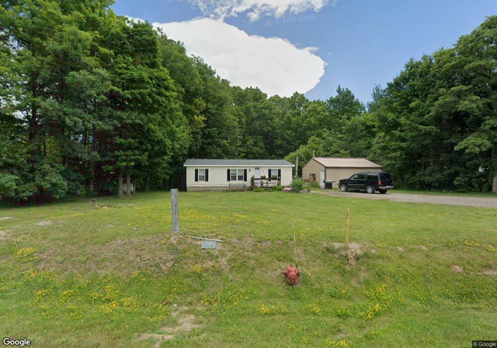
521 Blue Star Hwy South Haven, MI 49090
Estimated Value: $164,000 - $2,162,000
3
Beds
2
Baths
1,040
Sq Ft
$1,118/Sq Ft
Est. Value
About This Home
This home is located at 521 Blue Star Hwy, South Haven, MI 49090 and is currently estimated at $1,163,000, approximately $1,118 per square foot. 521 Blue Star Hwy is a home located in Allegan County with nearby schools including South Haven High School.
Ownership History
Date
Name
Owned For
Owner Type
Purchase Details
Closed on
Nov 8, 2011
Sold by
Depauw Rick and Depauw Kelley
Bought by
Hamlin Harold J and Hamlin Martha E
Current Estimated Value
Purchase Details
Closed on
Apr 1, 2011
Sold by
Secretary Of Housing & Urban Development
Bought by
Depauw Rick
Purchase Details
Closed on
Jun 7, 2010
Sold by
Citimortgage Inc
Bought by
The Secretary Of Housing & Urban Develop
Purchase Details
Closed on
Jun 4, 2009
Sold by
Grigg Elry J
Bought by
Citimortgage Inc
Purchase Details
Closed on
Jul 3, 2002
Sold by
Singer Valerie and Singer Valerie A
Bought by
Grigg Elry J and Grigg Elry Jacob
Home Financials for this Owner
Home Financials are based on the most recent Mortgage that was taken out on this home.
Original Mortgage
$82,348
Interest Rate
6.79%
Mortgage Type
FHA
Purchase Details
Closed on
Jul 10, 1998
Sold by
Keith David
Bought by
Singer Valerie
Purchase Details
Closed on
Jun 27, 1996
Bought by
Keith David
Create a Home Valuation Report for This Property
The Home Valuation Report is an in-depth analysis detailing your home's value as well as a comparison with similar homes in the area
Home Values in the Area
Average Home Value in this Area
Purchase History
| Date | Buyer | Sale Price | Title Company |
|---|---|---|---|
| Hamlin Harold J | $452,000 | Chicago Title Of Michigan | |
| Depauw Rick | $20,480 | None Available | |
| The Secretary Of Housing & Urban Develop | -- | None Available | |
| Citimortgage Inc | $82,933 | None Available | |
| Grigg Elry J | -- | Chicago Title | |
| Singer Valerie | -- | -- | |
| Keith David | -- | -- |
Source: Public Records
Mortgage History
| Date | Status | Borrower | Loan Amount |
|---|---|---|---|
| Previous Owner | Grigg Elry J | $82,348 |
Source: Public Records
Tax History Compared to Growth
Tax History
| Year | Tax Paid | Tax Assessment Tax Assessment Total Assessment is a certain percentage of the fair market value that is determined by local assessors to be the total taxable value of land and additions on the property. | Land | Improvement |
|---|---|---|---|---|
| 2025 | $374 | $23,200 | $23,200 | $0 |
| 2024 | -- | $13,200 | $13,200 | $0 |
| 2023 | -- | $13,200 | $13,200 | $0 |
| 2022 | $0 | $12,000 | $12,000 | $0 |
| 2021 | $224 | $12,000 | $12,000 | $0 |
| 2020 | $224 | $12,000 | $12,000 | $0 |
| 2019 | $298 | $12,000 | $12,000 | $0 |
| 2018 | $0 | $7,000 | $7,000 | $0 |
| 2017 | $0 | $7,000 | $7,000 | $0 |
| 2016 | $0 | $7,000 | $7,000 | $0 |
| 2015 | -- | $7,000 | $7,000 | $0 |
| 2014 | -- | $5,700 | $5,700 | $0 |
| 2013 | -- | $5,800 | $5,800 | $0 |
Source: Public Records
Map
Nearby Homes
- 7241 A St
- VL Highfield Beach Dr Unit 43
- VL Highfield Beach Dr Unit Lot 6
- 7230 Maple St
- 500 Blue Star Hwy Unit 21 Acres
- V/L Miami Ave
- V/L Miami Ave Unit Lots 21-24
- 000 Miami Ave
- 475 Lakeshore Dr
- 7255 Miami Ave
- 7146 Lakeview Ave
- 637 Lantern Watch Dr Unit 35
- 665 Lantern Watch Dr Unit 28
- 7251 Beverly Dr
- 688 Waters Edge Unit 15
- 688 Waters Edge
- 684 Waters Edge Unit 14
- 7263 Beverly Dr
- 02 Hawks Nest Dr
- 00 Hawks Nest Dr
- 524 Little Sable Dr
- 524 Little Sable Dr Unit 1
- 524 Little Sable Dr Unit 4
- 7205 Point Betsie
- 7225 Longfellow Dr
- 7218 B St
- 540 Blue Star Hwy
- 541 Blue Star Hwy
- 7221 B St
- 7223 A St
- 7227 Longfellow Dr
- 7227 Longfellow St
- 519 Little Sable Dr
- 519 Little Sable Dr Unit 6
- 516 Little Sable Dr Unit 2
- 5 Little Sable Dr
- 4 Little Sable Dr
- 3 Little Sable Dr
- Unit 4 Little Sable Dr
- 516 Little Sable Dr