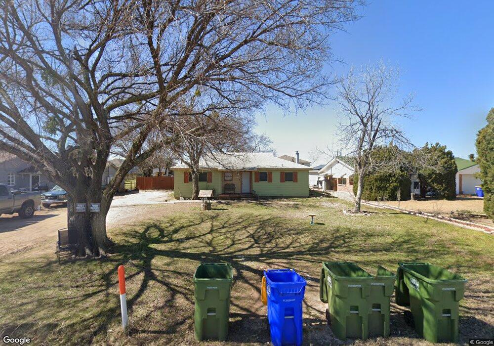
521 Bomber Rd Fort Worth, TX 76108
Estimated Value: $266,853 - $446,000
3
Beds
1
Bath
1,902
Sq Ft
$167/Sq Ft
Est. Value
About This Home
This home is located at 521 Bomber Rd, Fort Worth, TX 76108 and is currently estimated at $317,213, approximately $166 per square foot. 521 Bomber Rd is a home located in Tarrant County with nearby schools including North Elementary School, Brewer Middle School, and Tannahill Intermediate School.
Ownership History
Date
Name
Owned For
Owner Type
Purchase Details
Closed on
Dec 21, 2005
Sold by
Pettit Julie
Bought by
Day Ronald
Current Estimated Value
Purchase Details
Closed on
Dec 16, 2005
Sold by
Hud
Bought by
Pettit Julie
Purchase Details
Closed on
Sep 7, 2005
Sold by
Washington Mutual Bank
Bought by
Hud
Purchase Details
Closed on
May 1, 2001
Sold by
Ziemski Thomas and Ziemski Elisha K
Bought by
Washington Mutual Bank Fa
Purchase Details
Closed on
Apr 20, 2001
Sold by
Ziemski Thomas
Bought by
Liberty Trust
Purchase Details
Closed on
Jan 7, 1999
Sold by
Herrell Glynis W and Herrell Samuel W
Bought by
Ziemski Thomas
Home Financials for this Owner
Home Financials are based on the most recent Mortgage that was taken out on this home.
Original Mortgage
$45,399
Interest Rate
6.68%
Mortgage Type
FHA
Create a Home Valuation Report for This Property
The Home Valuation Report is an in-depth analysis detailing your home's value as well as a comparison with similar homes in the area
Home Values in the Area
Average Home Value in this Area
Purchase History
| Date | Buyer | Sale Price | Title Company |
|---|---|---|---|
| Day Ronald | -- | None Available | |
| Pettit Julie | -- | First American Title | |
| Hud | -- | -- | |
| Washington Mutual Bank Fa | $56,940 | -- | |
| Liberty Trust | -- | -- | |
| Ziemski Thomas | -- | Rattikin Title Co |
Source: Public Records
Mortgage History
| Date | Status | Borrower | Loan Amount |
|---|---|---|---|
| Previous Owner | Ziemski Thomas | $45,399 |
Source: Public Records
Tax History Compared to Growth
Tax History
| Year | Tax Paid | Tax Assessment Tax Assessment Total Assessment is a certain percentage of the fair market value that is determined by local assessors to be the total taxable value of land and additions on the property. | Land | Improvement |
|---|---|---|---|---|
| 2025 | $2,904 | $196,075 | $54,849 | $141,226 |
| 2024 | $2,904 | $196,075 | $54,849 | $141,226 |
| 2023 | $4,121 | $199,462 | $54,849 | $144,613 |
| 2022 | $4,267 | $158,398 | $25,000 | $133,398 |
| 2021 | $3,940 | $143,248 | $25,000 | $118,248 |
| 2020 | $3,778 | $136,350 | $25,000 | $111,350 |
| 2019 | $4,356 | $151,427 | $25,000 | $126,427 |
| 2018 | $3,646 | $126,754 | $11,000 | $115,754 |
| 2017 | $4,368 | $149,453 | $11,000 | $138,453 |
| 2016 | $2,046 | $70,000 | $11,000 | $59,000 |
| 2015 | $2,079 | $72,400 | $11,000 | $61,400 |
| 2014 | $2,079 | $72,400 | $11,000 | $61,400 |
Source: Public Records
Map
Nearby Homes
- 8401 Clifford St
- 633 Lariat Ln
- 311 Russell St
- 8113 Foxfire Ln
- 8321 Raymond Ave
- 8133 Foxfire Ln
- 304 Lockwood St
- 200 Waynell St
- 203 East Place
- 8113 Raymond Ave
- 813 Hackamore St
- 308 Hallvale Dr
- 8814 Rockway St
- 627 Hallvale Dr
- 7945 White Settlement Rd
- 857 Mccully St
- 8814 Clifford St
- 8402 Melrose St W
- 105 Lockwood St
- 9752 New Bern Dr
- 525 Bomber Rd
- 517 Bomber Rd
- 513 Bomber Rd
- 520 Ingram St
- 520 Ingram St Unit A
- 520 Ingram St Unit D
- 520 Ingram St Unit C
- 520 Ingram St Unit A
- 516 Ingram St
- 516 Ingram St Unit C
- 516 Ingram St Unit A
- 524 Ingram St Unit D
- 524 Ingram St Unit C
- 524 Ingram St Unit B
- 524 Ingram St Unit A
- 507 Bomber Rd
- 512 Ingram St
- 512 Ingram St Unit D
- 512 Ingram St Unit C
- 512 Ingram St Unit A