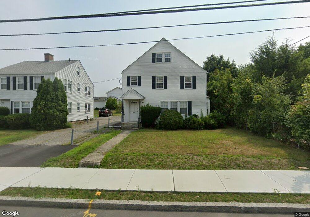
521 Burncoat St Worcester, MA 01606
Burncoat NeighborhoodEstimated Value: $429,000 - $632,000
2
Beds
2
Baths
1,606
Sq Ft
$311/Sq Ft
Est. Value
About This Home
This home is located at 521 Burncoat St, Worcester, MA 01606 and is currently estimated at $499,129, approximately $310 per square foot. 521 Burncoat St is a home located in Worcester County with nearby schools including Belmont Street Community School, Jacob Hiatt Magnet School, and Chandler Magnet.
Ownership History
Date
Name
Owned For
Owner Type
Purchase Details
Closed on
Apr 9, 2008
Sold by
George Carolyn Z and Moynihan Melinda S
Bought by
George Carolyn Z
Current Estimated Value
Purchase Details
Closed on
Sep 11, 1996
Sold by
Candico Realty Corp
Bought by
George Carolyn Z and Moynihan Melinda S
Create a Home Valuation Report for This Property
The Home Valuation Report is an in-depth analysis detailing your home's value as well as a comparison with similar homes in the area
Home Values in the Area
Average Home Value in this Area
Purchase History
| Date | Buyer | Sale Price | Title Company |
|---|---|---|---|
| George Carolyn Z | -- | -- | |
| George Carolyn Z | $180,000 | -- |
Source: Public Records
Tax History Compared to Growth
Tax History
| Year | Tax Paid | Tax Assessment Tax Assessment Total Assessment is a certain percentage of the fair market value that is determined by local assessors to be the total taxable value of land and additions on the property. | Land | Improvement |
|---|---|---|---|---|
| 2025 | $4,469 | $338,800 | $102,900 | $235,900 |
| 2024 | $4,533 | $329,700 | $102,900 | $226,800 |
| 2023 | $4,229 | $294,900 | $89,500 | $205,400 |
| 2022 | $4,041 | $265,700 | $71,600 | $194,100 |
| 2021 | $3,516 | $216,000 | $57,300 | $158,700 |
| 2020 | $3,327 | $195,700 | $57,300 | $138,400 |
| 2019 | $3,411 | $189,500 | $51,500 | $138,000 |
| 2018 | $3,357 | $177,500 | $51,500 | $126,000 |
| 2017 | $3,198 | $166,400 | $51,500 | $114,900 |
| 2016 | $3,112 | $151,000 | $38,600 | $112,400 |
| 2015 | $3,031 | $151,000 | $38,600 | $112,400 |
| 2014 | $2,951 | $151,000 | $38,600 | $112,400 |
Source: Public Records
Map
Nearby Homes
- 3 Malden St
- 89 E Mountain St
- 602 Burncoat St
- 80 Prudential Rd
- 49 Prudential Rd
- 12 Dixfield Rd
- 12 Prudential Rd
- 29 E Mountain
- 9 Idalla Ave
- 15 Inwood Rd
- 68 Housatonic St
- 126 Brooks St
- 31 Danielles Way
- 22 Danielles Way
- 26 Danielles Way
- 1097 W Boylston St
- 43 Fales St
- 1110 W Boylston St Unit A
- 59 Santoro Rd
- 95 Saint Nicholas Ave