Estimated Value: $285,000 - $390,000
3
Beds
2
Baths
1,900
Sq Ft
$171/Sq Ft
Est. Value
About This Home
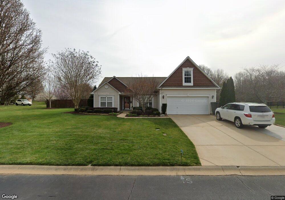
This home is located at 521 Carey Dr, Greer, SC 29651 and is currently estimated at $325,746, approximately $171 per square foot. 521 Carey Dr is a home located in Spartanburg County with nearby schools including Reidville Elementary School, Berry Shoals Intermediate School, and Byrnes Freshman Academy.
Ownership History
Date
Name
Owned For
Owner Type
Purchase Details
Closed on
Mar 28, 2013
Sold by
Huffman Chad and Huffman Larry E
Bought by
Rumsey William P
Current Estimated Value
Home Financials for this Owner
Home Financials are based on the most recent Mortgage that was taken out on this home.
Original Mortgage
$156,330
Interest Rate
4.31%
Mortgage Type
FHA
Purchase Details
Closed on
May 9, 2003
Sold by
Woodmark Homes Llc
Bought by
Huffman Chad and Huffman Larry E
Create a Home Valuation Report for This Property
The Home Valuation Report is an in-depth analysis detailing your home's value as well as a comparison with similar homes in the area
Home Values in the Area
Average Home Value in this Area
Purchase History
| Date | Buyer | Sale Price | Title Company |
|---|---|---|---|
| Rumsey William P | $162,000 | -- | |
| Huffman Chad | $135,818 | -- |
Source: Public Records
Mortgage History
| Date | Status | Borrower | Loan Amount |
|---|---|---|---|
| Previous Owner | Rumsey William P | $156,330 |
Source: Public Records
Tax History Compared to Growth
Tax History
| Year | Tax Paid | Tax Assessment Tax Assessment Total Assessment is a certain percentage of the fair market value that is determined by local assessors to be the total taxable value of land and additions on the property. | Land | Improvement |
|---|---|---|---|---|
| 2025 | $1,334 | $8,427 | $1,217 | $7,210 |
| 2024 | $1,334 | $8,427 | $1,217 | $7,210 |
| 2023 | $1,334 | $8,427 | $1,217 | $7,210 |
| 2022 | $1,206 | $7,328 | $900 | $6,428 |
| 2021 | $1,206 | $7,328 | $900 | $6,428 |
| 2020 | $1,184 | $7,328 | $900 | $6,428 |
| 2019 | $1,181 | $7,328 | $900 | $6,428 |
| 2018 | $1,128 | $7,328 | $900 | $6,428 |
| 2017 | $984 | $6,440 | $900 | $5,540 |
| 2016 | $950 | $6,440 | $900 | $5,540 |
| 2015 | $923 | $6,440 | $900 | $5,540 |
| 2014 | $3,467 | $9,660 | $1,350 | $8,310 |
Source: Public Records
Map
Nearby Homes
- 117 Dark Wood Ct
- 1142 Bulrush Dr
- 1018 Reverend Robert Reid St
- 816 Powder Branch Dr
- 804 Powder Branch Dr
- 816 Powder Branch Dr Unit PB 40 Chestnut B
- 804 Powder Branch Dr Unit PB 45 Chestnut B
- 808 Powder Branch Dr
- 802 Powder Branch Dr
- 808 Powder Branch Dr Unit PB 43 Chestnut BEL
- 802 Powder Branch Dr Unit PB 46 Magnolia A
- 812 Powder Branch Dr
- 812 Powder Branch Dr Unit PB 42 Magnolia BER
- 824 Powder Branch Dr Unit PB 37 Magnolia BER
- 828 Powder Branch Dr Unit PB 35 Chestnut B
- 814 Powder Branch Dr Unit PB 41 Magnolia A
- 828 Powder Branch Dr
- 824 Powder Branch Dr
- 814 Powder Branch Dr
- 830 Powder Branch Dr