Estimated Value: $79,000 - $168,000
2
Beds
1
Bath
900
Sq Ft
$134/Sq Ft
Est. Value
About This Home
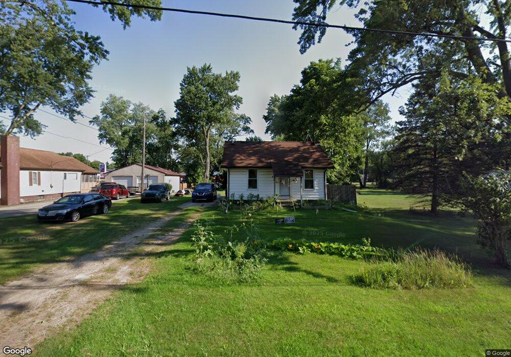
This home is located at 521 Clark St, Niles, MI 49120 and is currently estimated at $120,226, approximately $133 per square foot. 521 Clark St is a home located in Berrien County with nearby schools including James Ellis School, Howard-Ellis Elementary School, and Ring Lardner Middle School.
Ownership History
Date
Name
Owned For
Owner Type
Purchase Details
Closed on
Jun 6, 2019
Sold by
Carrier Gregory A
Bought by
Wightman Lynsi and Vermilyer James
Current Estimated Value
Purchase Details
Closed on
Apr 12, 2019
Sold by
Carrier Gregory A and Carner Wendy M
Bought by
Wightman Lynsi and Vermilyer James
Purchase Details
Closed on
Aug 6, 2015
Sold by
Berrien County
Bought by
Carrier Gregory A and Carrier Wendy M
Purchase Details
Closed on
Oct 23, 1998
Purchase Details
Closed on
Nov 10, 1997
Purchase Details
Closed on
Jun 3, 1996
Purchase Details
Closed on
Feb 7, 1985
Purchase Details
Closed on
Jun 20, 1978
Create a Home Valuation Report for This Property
The Home Valuation Report is an in-depth analysis detailing your home's value as well as a comparison with similar homes in the area
Home Values in the Area
Average Home Value in this Area
Purchase History
We collect this data history from publicly available records. To have your information removed, we recommend requesting removal directly through your county’s website.
| Date | Buyer | Sale Price | Title Company |
|---|---|---|---|
| Wightman Lynsi | $23,200 | None Listed On Document | |
| Wightman Lynsi | $23,200 | None Available | |
| Carrier Gregory A | $7,000 | Attorney | |
| -- | $55,500 | -- | |
| -- | $40,000 | -- | |
| -- | $40,000 | -- | |
| -- | $13,500 | -- | |
| -- | $16,500 | -- |
Source: Public Records
Tax History
| Year | Tax Paid | Tax Assessment Tax Assessment Total Assessment is a certain percentage of the fair market value that is determined by local assessors to be the total taxable value of land and additions on the property. | Land | Improvement |
|---|---|---|---|---|
| 2025 | $1,375 | $43,100 | $0 | $0 |
| 2024 | $330 | $43,700 | $0 | $0 |
| 2023 | $314 | $34,900 | $0 | $0 |
| 2022 | $299 | $30,300 | $0 | $0 |
| 2021 | $776 | $28,800 | $7,500 | $21,300 |
| 2020 | $969 | $26,500 | $0 | $0 |
| 2019 | $1,140 | $25,000 | $7,500 | $17,500 |
| 2018 | $1,138 | $25,000 | $0 | $0 |
| 2017 | $1,133 | $24,600 | $0 | $0 |
| 2016 | $646 | $24,700 | $0 | $0 |
| 2015 | $644 | $23,600 | $0 | $0 |
| 2014 | $241 | $22,400 | $0 | $0 |
Source: Public Records
Map
Nearby Homes
- 2002 N Old Us 31 Unit 7
- 2028 N Old Us 31 Unit 11
- 2002 N Old Us 31 Unit 12S
- VL N 5th St
- 434 Bruce Ave
- 31863 Heritage Place
- 1919 Industrial Dr
- 440 Pucker St
- 1630 Forest Trail
- 816 Burns St
- 2802 Primrose Ct
- 1603 N 5th St
- 1015 Lake St
- 1441 Clarendon Ave
- 1356 Sheridan Ave
- 1020 N 8th St
- 652 N 7th St
- V/L Pucker St
- 1022 Howard St
- 1123 N 9th St
- 517 Clark St
- 30 Clark St
- 537 Clark St
- 543 Clark St
- 526 Monroe St
- 520 Clark St
- 549 Clark St
- 538 Clark St
- 536 Monroe St
- 518 Clark St
- 544 Clark St
- 555 Clark St
- 0 Monroe St Unit 69002810056
- 0 Monroe St Unit 69002810061
- 0 Monroe St Unit 2223477
- 0 Monroe St Unit 2810056
- 0 Monroe St Unit 2810061
- 546 Clark St
- 544 Monroe St
- 2310 N 5th St
Your Personal Tour Guide
Ask me questions while you tour the home.