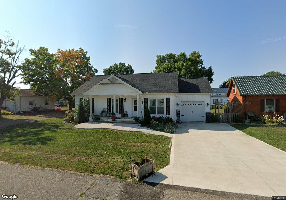
521 E Cliff St Baltimore, OH 43105
Estimated Value: $255,000 - $365,000
2
Beds
2
Baths
1,320
Sq Ft
$232/Sq Ft
Est. Value
About This Home
This home is located at 521 E Cliff St, Baltimore, OH 43105 and is currently estimated at $305,893, approximately $231 per square foot. 521 E Cliff St is a home with nearby schools including Liberty Union Elementary School, Liberty Union Middle School, and Liberty Union High School.
Ownership History
Date
Name
Owned For
Owner Type
Purchase Details
Closed on
Feb 26, 2019
Sold by
Woods Roger D and Woods Bernice J
Bought by
Marcum Darla K
Current Estimated Value
Purchase Details
Closed on
May 14, 2007
Sold by
Reincheld Rick J
Bought by
Woods Roger D and Woods Bernice J
Purchase Details
Closed on
Nov 13, 1992
Sold by
Reincheld Chester F
Bought by
Reincheld Rick J
Create a Home Valuation Report for This Property
The Home Valuation Report is an in-depth analysis detailing your home's value as well as a comparison with similar homes in the area
Home Values in the Area
Average Home Value in this Area
Purchase History
| Date | Buyer | Sale Price | Title Company |
|---|---|---|---|
| Marcum Darla K | $38,000 | First Ohio Title Insurance | |
| Woods Roger D | $30,500 | Attorney | |
| Reincheld Rick J | -- | -- |
Source: Public Records
Tax History
| Year | Tax Paid | Tax Assessment Tax Assessment Total Assessment is a certain percentage of the fair market value that is determined by local assessors to be the total taxable value of land and additions on the property. | Land | Improvement |
|---|---|---|---|---|
| 2025 | $7,413 | $105,910 | $17,710 | $88,200 |
| 2024 | $7,413 | $98,750 | $12,860 | $85,890 |
| 2023 | $3,790 | $98,750 | $12,860 | $85,890 |
| 2022 | $3,759 | $98,750 | $12,860 | $85,890 |
| 2021 | $3,124 | $72,670 | $11,640 | $61,030 |
| 2020 | $1,869 | $72,670 | $11,640 | $61,030 |
| 2019 | $596 | $13,340 | $11,640 | $1,700 |
| 2018 | $370 | $7,400 | $5,820 | $1,580 |
| 2017 | $372 | $7,580 | $5,820 | $1,760 |
| 2016 | $366 | $7,580 | $5,820 | $1,760 |
| 2015 | $350 | $7,580 | $5,820 | $1,760 |
| 2014 | $337 | $7,580 | $5,820 | $1,760 |
| 2013 | $337 | $7,580 | $5,820 | $1,760 |
Source: Public Records
Map
Nearby Homes
- 220 N Wagner Ave
- 113 S Park Dr
- 407 S Main St
- 201 E Dorchester Dr
- 403 S Walnut St
- 601 S Main St
- 727 W Washington St
- 570 Baltimore Somerset Rd NE Unit Lot 1
- 445 Baltimore Somerset Rd NE
- 112 N Creekview Ct
- 0 Basil Rd NW Unit 226003110
- 7836 Basil Rd NW
- 116 S High St
- 0 Cherry Ln Unit 226008720
- 201 N Liberty St
- 0 Lancaster-Newark Rd NE Unit Lot A
- 0 Lancaster-Newark Rd NE
- 0 S Company St Unit Lot 2 225029545
- 0 S Company St Unit Lot 1 225029543
- 1455 Giesy Rd NW
- 224 N Wagner Ave
- 517 E Cliff St
- 225 Hansberger Ave
- 525 E Cliff St
- 221 Hansberger Ave
- 210 N Wagner Ave
- 418 E Cliff St
- 420 E Cliff St
- 459 E Cliff St
- 416 E Cliff St
- 219 N Wagner Ave
- 208 N Wagner Ave
- 208 N Wagner Ave
- 215 N Wagner Ave
- 226 Hansberger Ave
- 211 Hansberger Ave
- 211 Hansberger Ave
- 211 N Wagner Ave
- 224 Hansberger Ave
- 207 N Wagner Ave
Your Personal Tour Guide
Ask me questions while you tour the home.