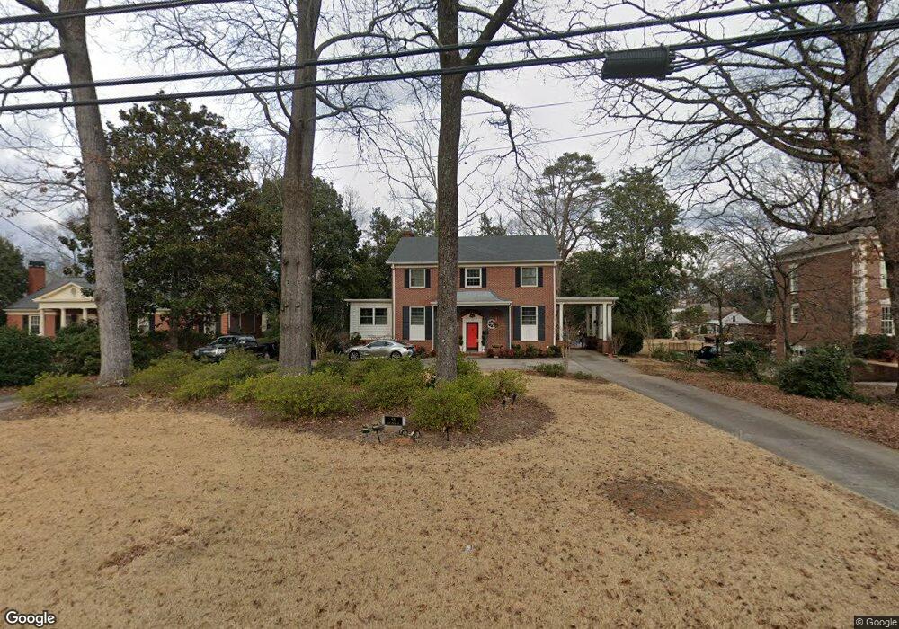
521 E College St Griffin, GA 30224
Spalding County NeighborhoodEstimated Value: $356,140 - $391,000
3
Beds
2
Baths
2,580
Sq Ft
$144/Sq Ft
Est. Value
About This Home
This home is located at 521 E College St, Griffin, GA 30224 and is currently estimated at $372,785, approximately $144 per square foot. 521 E College St is a home located in Spalding County with nearby schools including Futral Road Elementary School, Rehoboth Road Middle School, and Spalding High School.
Ownership History
Date
Name
Owned For
Owner Type
Purchase Details
Closed on
Feb 29, 2024
Sold by
Johnston Dixie
Bought by
Marcoux James A
Current Estimated Value
Home Financials for this Owner
Home Financials are based on the most recent Mortgage that was taken out on this home.
Original Mortgage
$264,000
Outstanding Balance
$258,573
Interest Rate
6.63%
Mortgage Type
New Conventional
Estimated Equity
$114,212
Purchase Details
Closed on
Jun 19, 1951
Bought by
Methodist Church-The First
Create a Home Valuation Report for This Property
The Home Valuation Report is an in-depth analysis detailing your home's value as well as a comparison with similar homes in the area
Home Values in the Area
Average Home Value in this Area
Purchase History
| Date | Buyer | Sale Price | Title Company |
|---|---|---|---|
| Marcoux James A | $330,000 | -- | |
| Methodist Church-The First | -- | -- |
Source: Public Records
Mortgage History
| Date | Status | Borrower | Loan Amount |
|---|---|---|---|
| Open | Marcoux James A | $264,000 | |
| Closed | Marcoux James A | $264,000 |
Source: Public Records
Tax History
| Year | Tax Paid | Tax Assessment Tax Assessment Total Assessment is a certain percentage of the fair market value that is determined by local assessors to be the total taxable value of land and additions on the property. | Land | Improvement |
|---|---|---|---|---|
| 2025 | $5,261 | $140,384 | $22,000 | $118,384 |
| 2024 | -- | $138,494 | $20,110 | $118,384 |
| 2023 | $4,887 | $138,494 | $20,110 | $118,384 |
| 2022 | $4,887 | $122,285 | $20,110 | $102,175 |
| 2021 | $4,331 | $97,903 | $20,110 | $77,793 |
| 2020 | $4,331 | $97,903 | $20,110 | $77,793 |
| 2019 | $3,794 | $85,748 | $20,110 | $65,638 |
| 2018 | $0 | $85,748 | $20,110 | $65,638 |
| 2017 | $3,794 | $85,748 | $20,110 | $65,638 |
| 2016 | $0 | $85,748 | $20,110 | $65,638 |
| 2015 | -- | $85,748 | $20,110 | $65,638 |
| 2014 | -- | $85,748 | $20,110 | $65,638 |
Source: Public Records
Map
Nearby Homes
- 644 Brook Cir
- 372 E College St
- 123 Huntsman Dr
- 411 Terrace St
- 323 E College St
- 319 E College St
- 226 Tilney Ave
- 310 Terrace St
- 729 Springer Dr
- 606 E Wall St
- 517 S 6th St
- 505 Kincaid Ave
- 159 Milner Ave
- 550 S Hill St
- 722 Maple Dr
- 711 Maple Dr
- 406 E Solomon St
- 839 Bieze St
- 123 N Brawner St
- 303 E Broadway St
- 517 E College St
- 525 E College St
- 535 E College St
- 515 E College St
- 534 Brook Cir
- 530 Brook Cir
- 536 Brook Cir
- 509 E College St Unit 2
- 509 E College St
- 528 Brook Cir
- 615 E College St
- 530 E College St
- 604 E College St
- 546 Brook Cir
- 526 Brook Cir
- 612 E College St
- 518 E College St
- 503 E College St
- 618 E College St Unit /3
- 618 E College St
Your Personal Tour Guide
Ask me questions while you tour the home.