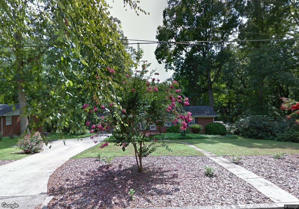
521 Ervin Rd Morganton, NC 28655
Estimated Value: $312,000 - $380,000
3
Beds
2
Baths
1,968
Sq Ft
$173/Sq Ft
Est. Value
About This Home
This home is located at 521 Ervin Rd, Morganton, NC 28655 and is currently estimated at $339,555, approximately $172 per square foot. 521 Ervin Rd is a home located in Burke County with nearby schools including Hillcrest Elementary School, Walter R. Johnson Middle School, and Freedom High School.
Ownership History
Date
Name
Owned For
Owner Type
Purchase Details
Closed on
May 5, 2023
Sold by
Mcmurray Lura Deaton and Deaton Mary A
Bought by
Lura Deaton Mcmurray Living Trust and Mary A Deaton Living Trust
Current Estimated Value
Purchase Details
Closed on
Aug 15, 2022
Sold by
James H Connelly And Melda O Connelly Tr
Bought by
Deaton Mary A and Mcmurray Lura Deaton
Purchase Details
Closed on
May 1, 2006
Sold by
Estate Of Mildred R Conley
Bought by
Connelly James Hugh and Connelly Melda
Create a Home Valuation Report for This Property
The Home Valuation Report is an in-depth analysis detailing your home's value as well as a comparison with similar homes in the area
Home Values in the Area
Average Home Value in this Area
Purchase History
| Date | Buyer | Sale Price | Title Company |
|---|---|---|---|
| Lura Deaton Mcmurray Living Trust | -- | None Listed On Document | |
| Lura Deaton Mcmurray Living Trust | -- | None Listed On Document | |
| Deaton Mary A | $265,000 | Dill G Redmond | |
| Connelly James Hugh | -- | None Available |
Source: Public Records
Tax History Compared to Growth
Tax History
| Year | Tax Paid | Tax Assessment Tax Assessment Total Assessment is a certain percentage of the fair market value that is determined by local assessors to be the total taxable value of land and additions on the property. | Land | Improvement |
|---|---|---|---|---|
| 2025 | $1,471 | $247,545 | $34,365 | $213,180 |
| 2024 | $1,479 | $247,545 | $34,365 | $213,180 |
| 2023 | $1,474 | $247,545 | $34,365 | $213,180 |
| 2022 | $1,113 | $148,365 | $29,605 | $118,760 |
| 2021 | $1,107 | $148,365 | $29,605 | $118,760 |
| 2020 | $1,103 | $148,365 | $29,605 | $118,760 |
| 2019 | $1,103 | $148,365 | $29,605 | $118,760 |
| 2018 | $1,006 | $134,319 | $29,605 | $104,714 |
| 2017 | $1,004 | $134,319 | $29,605 | $104,714 |
| 2016 | $978 | $134,319 | $29,605 | $104,714 |
| 2015 | $975 | $134,319 | $29,605 | $104,714 |
| 2014 | $974 | $134,319 | $29,605 | $104,714 |
| 2013 | $974 | $134,319 | $29,605 | $104,714 |
Source: Public Records
Map
Nearby Homes
- 112A Wesley Dr Unit B
- 105 Newland St
- 710 Bouchelle St
- 214 Howard St
- 0 N Green St
- 406 Lenoir St
- 244 N Anderson St
- 231 Davis Dr
- 218 Davis Dr
- 209 Park St
- 118 W Union St Unit A
- 212 Riverside Dr
- 0 N Carolina 126 Unit 10123934
- 115 Kinwood St
- 718 E Union St
- 203 Beacon Ave
- 115 Riverside Ct
- VL E Concord St
- 302 White St
- 609 E Concord St
- 520 Ervin Rd
- 523 Ervin Rd
- 201 Fox St
- 518 Ervin Rd Unit 26/27
- 518 Ervin Rd
- 111 Fox St
- 205 Fox St
- VL 518 Ervin Rd Unit 26 AND 27
- 111 Wesley Dr
- 501 Ervin Rd
- 61 Fox Ridge Dr Unit 61
- 207 Fox St
- 200 Fox St
- 314 Morehead Street Extension
- 202 Fox St
- 109 Wesley Dr
- 310 Morehead Street Extension
- 312 Morehead Street Extension
- 209 Fox St
- 316 Morehead Street Extension