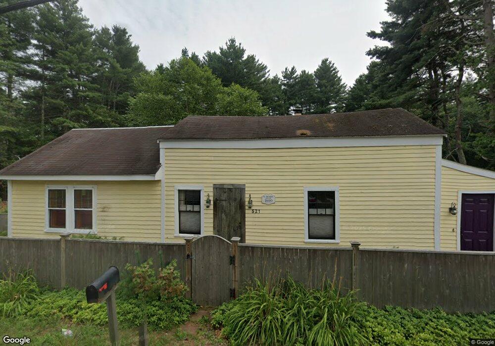
521 Hudson Rd Sudbury, MA 01776
Estimated Value: $619,000 - $766,000
2
Beds
2
Baths
1,504
Sq Ft
$440/Sq Ft
Est. Value
About This Home
This home is located at 521 Hudson Rd, Sudbury, MA 01776 and is currently estimated at $662,105, approximately $440 per square foot. 521 Hudson Rd is a home located in Middlesex County with nearby schools including Peter Noyes Elementary School, Ephraim Curtis Middle School, and Lincoln-Sudbury Regional High School.
Ownership History
Date
Name
Owned For
Owner Type
Purchase Details
Closed on
Apr 15, 1987
Sold by
Bendel Bruce A
Bought by
Taft Rt
Current Estimated Value
Create a Home Valuation Report for This Property
The Home Valuation Report is an in-depth analysis detailing your home's value as well as a comparison with similar homes in the area
Home Values in the Area
Average Home Value in this Area
Purchase History
| Date | Buyer | Sale Price | Title Company |
|---|---|---|---|
| Taft Rt | $52,000 | -- |
Source: Public Records
Mortgage History
| Date | Status | Borrower | Loan Amount |
|---|---|---|---|
| Open | Taft Rt | $286,800 | |
| Closed | Taft Rt | $25,000 | |
| Closed | Taft Rt | $154,000 |
Source: Public Records
Tax History Compared to Growth
Tax History
| Year | Tax Paid | Tax Assessment Tax Assessment Total Assessment is a certain percentage of the fair market value that is determined by local assessors to be the total taxable value of land and additions on the property. | Land | Improvement |
|---|---|---|---|---|
| 2025 | $7,677 | $524,400 | $324,200 | $200,200 |
| 2024 | $7,417 | $507,700 | $314,700 | $193,000 |
| 2023 | $7,092 | $449,700 | $302,400 | $147,300 |
| 2022 | $6,846 | $379,300 | $277,600 | $101,700 |
| 2021 | $7,199 | $382,300 | $277,600 | $104,700 |
| 2020 | $7,053 | $382,300 | $277,600 | $104,700 |
| 2019 | $6,847 | $382,300 | $277,600 | $104,700 |
| 2018 | $6,521 | $363,700 | $269,100 | $94,600 |
| 2017 | $5,537 | $353,800 | $266,300 | $87,500 |
| 2016 | $6,148 | $345,400 | $256,100 | $89,300 |
| 2015 | $6,079 | $345,400 | $258,200 | $87,200 |
| 2014 | $6,053 | $335,700 | $250,600 | $85,100 |
Source: Public Records
Map
Nearby Homes
- 47 Fairbank Rd
- 4 Elderberry Cir
- 21 Summer St
- 12 Camperdown Ln
- 54 Phillips Rd
- 14 Tanbark Rd
- 36 Old Forge Ln
- 7 Saddle Ridge Rd
- 55 Widow Rites Ln
- 45 Widow Rites Ln
- 166 Parker St Unit 4
- 24 Goodnow Rd
- 67 Old Marlboro Rd
- 788 Main St
- 786 Main St
- 10 Shoreline Dr Unit 12
- 8 Shoreline Dr Unit 11
- 14 Old County Rd Unit 21
- 34 Hallock Point Rd
- 3 Shore Line Dr Unit 15
- 3 Great Lake Dr
- 523 Hudson Rd
- 518 Hudson Rd
- 7 Great Lake Dr
- 511 Hudson Rd
- 530 Hudson Rd
- 35 Pinewood Ave
- 43 Pinewood Ave
- 534 Hudson Rd
- 510 Hudson Rd
- 0 Pinewood Ave
- 22 Laurel Cir
- 11 Great Lake Dr
- 12 Great Lake Dr
- 14 Laurel Cir
- 25 Pinewood Ave
- 45 Pinewood Ave
- 47 Pinewood Ave
- 28 Pinewood Ave
- 42 Pinewood Ave