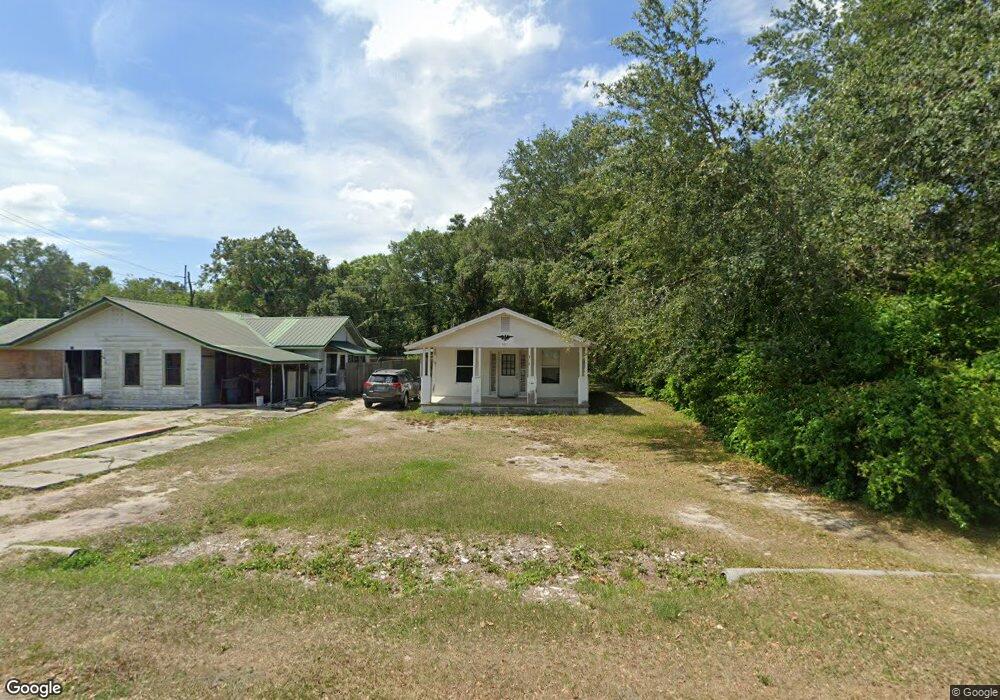
521 Kaolin St Waverly, FL 33877
Southeast Winterhaven NeighborhoodEstimated Value: $110,347 - $147,000
1
Bed
1
Bath
616
Sq Ft
$200/Sq Ft
Est. Value
About This Home
This home is located at 521 Kaolin St, Waverly, FL 33877 and is currently estimated at $123,087, approximately $199 per square foot. 521 Kaolin St is a home located in Polk County with nearby schools including Chain of Lakes Elementary School, Bartow Elementary Academy, and Mclaughlin Middle School And Fine Arts Academy.
Ownership History
Date
Name
Owned For
Owner Type
Purchase Details
Closed on
Apr 22, 2003
Sold by
Quattlebaum Deborah
Bought by
Lewis Guy Bean and Lewis Linda Diane
Current Estimated Value
Purchase Details
Closed on
Jun 24, 2002
Sold by
Stellato Mark A
Bought by
Stellato Mark A and Quattlebaum Deborah
Purchase Details
Closed on
Mar 21, 1998
Sold by
Stellato Salvatore and Stellato Jane B
Bought by
Stellato Mark A
Home Financials for this Owner
Home Financials are based on the most recent Mortgage that was taken out on this home.
Original Mortgage
$15,000
Interest Rate
6.99%
Create a Home Valuation Report for This Property
The Home Valuation Report is an in-depth analysis detailing your home's value as well as a comparison with similar homes in the area
Home Values in the Area
Average Home Value in this Area
Purchase History
| Date | Buyer | Sale Price | Title Company |
|---|---|---|---|
| Lewis Guy Bean | $35,000 | -- | |
| Stellato Mark A | -- | -- | |
| Stellato Mark A | $15,000 | -- |
Source: Public Records
Mortgage History
| Date | Status | Borrower | Loan Amount |
|---|---|---|---|
| Previous Owner | Stellato Mark A | $15,000 |
Source: Public Records
Tax History
| Year | Tax Paid | Tax Assessment Tax Assessment Total Assessment is a certain percentage of the fair market value that is determined by local assessors to be the total taxable value of land and additions on the property. | Land | Improvement |
|---|---|---|---|---|
| 2025 | $1,235 | $45,557 | -- | -- |
| 2024 | $1,027 | $41,415 | -- | -- |
| 2023 | $1,027 | $37,650 | $0 | $0 |
| 2022 | $952 | $34,227 | $0 | $0 |
| 2021 | $880 | $31,115 | $3,300 | $27,815 |
| 2020 | $827 | $28,664 | $3,139 | $25,525 |
| 2018 | $751 | $26,268 | $2,978 | $23,290 |
| 2017 | $707 | $22,628 | $0 | $0 |
| 2016 | $674 | $21,988 | $0 | $0 |
Source: Public Records
Map
Nearby Homes
- 656 W Date St W
- 128 Woodlawn Ave
- 0 Henry St
- 915 C F Kinney Rd
- 219 Sheila Ln
- 6002 Waverly Rd
- 0 C F Kinney Rd Unit A11686511
- 863 C F Kinney Rd
- 1163 Lake Dr
- 833 3rd Ave
- 348 Gordon Ave
- 660 Duggers Way
- 4879 Malibu Dr Unit 90
- 4865 Huffy Ct Unit 105
- 4778 Breezer Dr
- 669 Bell Prairie Cir
- 4700 Schwinn Dr Unit 2
- 0 Hwy 27 Unit P4916588
- ALFORD Plan at Leoma's Landing
- 1123 Amber Waves Ct
Your Personal Tour Guide
Ask me questions while you tour the home.