Estimated Value: $238,402 - $257,000
3
Beds
1
Bath
1,346
Sq Ft
$184/Sq Ft
Est. Value
About This Home
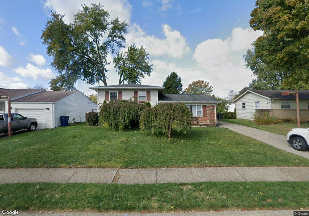
This home is located at 521 Kappler Rd, Heath, OH 43056 and is currently estimated at $247,101, approximately $183 per square foot. 521 Kappler Rd is a home located in Licking County with nearby schools including Garfield Elementary School, Stevenson Elementary School, and Heath Middle School.
Ownership History
Date
Name
Owned For
Owner Type
Purchase Details
Closed on
Nov 14, 2012
Sold by
Meread Steven and Meread Racheal
Bought by
Mereand Steven
Current Estimated Value
Home Financials for this Owner
Home Financials are based on the most recent Mortgage that was taken out on this home.
Original Mortgage
$119,352
Outstanding Balance
$82,698
Interest Rate
3.75%
Mortgage Type
FHA
Estimated Equity
$164,403
Purchase Details
Closed on
May 15, 2006
Sold by
Babbitt Ellen F
Bought by
Mereand Steven and Mereand Rachael
Home Financials for this Owner
Home Financials are based on the most recent Mortgage that was taken out on this home.
Original Mortgage
$93,800
Interest Rate
8.95%
Mortgage Type
Fannie Mae Freddie Mac
Purchase Details
Closed on
Mar 24, 2006
Sold by
Estate Of Robert Franklin Maston
Bought by
Maston Carol
Home Financials for this Owner
Home Financials are based on the most recent Mortgage that was taken out on this home.
Original Mortgage
$93,800
Interest Rate
8.95%
Mortgage Type
Fannie Mae Freddie Mac
Create a Home Valuation Report for This Property
The Home Valuation Report is an in-depth analysis detailing your home's value as well as a comparison with similar homes in the area
Home Values in the Area
Average Home Value in this Area
Purchase History
| Date | Buyer | Sale Price | Title Company |
|---|---|---|---|
| Mereand Steven | -- | None Available | |
| Mereand Steven | $117,300 | The Talon Group | |
| Maston Carol | -- | None Available |
Source: Public Records
Mortgage History
| Date | Status | Borrower | Loan Amount |
|---|---|---|---|
| Open | Mereand Steven | $119,352 | |
| Previous Owner | Mereand Steven | $93,800 |
Source: Public Records
Tax History
| Year | Tax Paid | Tax Assessment Tax Assessment Total Assessment is a certain percentage of the fair market value that is determined by local assessors to be the total taxable value of land and additions on the property. | Land | Improvement |
|---|---|---|---|---|
| 2024 | $2,564 | $59,580 | $16,770 | $42,810 |
| 2023 | $2,837 | $59,580 | $16,770 | $42,810 |
| 2022 | $2,484 | $45,820 | $8,680 | $37,140 |
| 2021 | $2,535 | $45,820 | $8,680 | $37,140 |
| 2020 | $2,551 | $45,820 | $8,680 | $37,140 |
| 2019 | $2,098 | $38,360 | $10,850 | $27,510 |
| 2018 | $2,121 | $0 | $0 | $0 |
| 2017 | $2,118 | $0 | $0 | $0 |
| 2016 | $2,082 | $0 | $0 | $0 |
| 2015 | $2,117 | $0 | $0 | $0 |
| 2014 | $2,977 | $0 | $0 | $0 |
| 2013 | $2,057 | $0 | $0 | $0 |
Source: Public Records
Map
Nearby Homes
- 514 S 30th St
- 521 Partridge Rd
- 101 Fieldpoint Rd
- 224 Walden Rd
- 243 Fieldpoint Rd
- 878 Oberlin Dr
- 915 W Main St
- 67 N 31st St
- 944 Fieldson Dr
- 25 S 24th St
- 233 Wildwood Ct Unit 233C
- 761 W Main St
- 61 N 24th St
- 132 Cambria St
- 1416 Amesbury Ln
- 1077 Woodlawn Ave
- 105 Clark Ave
- 1094 Aldine Dr
- 680 Creekview Dr
- 79 James Ave
- 515 Kappler Rd
- 527 Kappler Rd
- 522 S 30th St
- 533 Kappler Rd
- 509 Kappler Rd
- 522 Kappler Rd
- 516 Kappler Rd
- 528 Kappler Rd
- 506 S 30th St
- 539 Kappler Rd
- 503 Kappler Rd
- 534 Kappler Rd
- 510 Kappler Rd
- 500 S 30th St
- 540 Kappler Rd
- 504 Kappler Rd
- 495 Kappler Rd
- 547 Kappler Rd
- 69 Fieldpoint Rd
- 71 Fieldpoint Rd