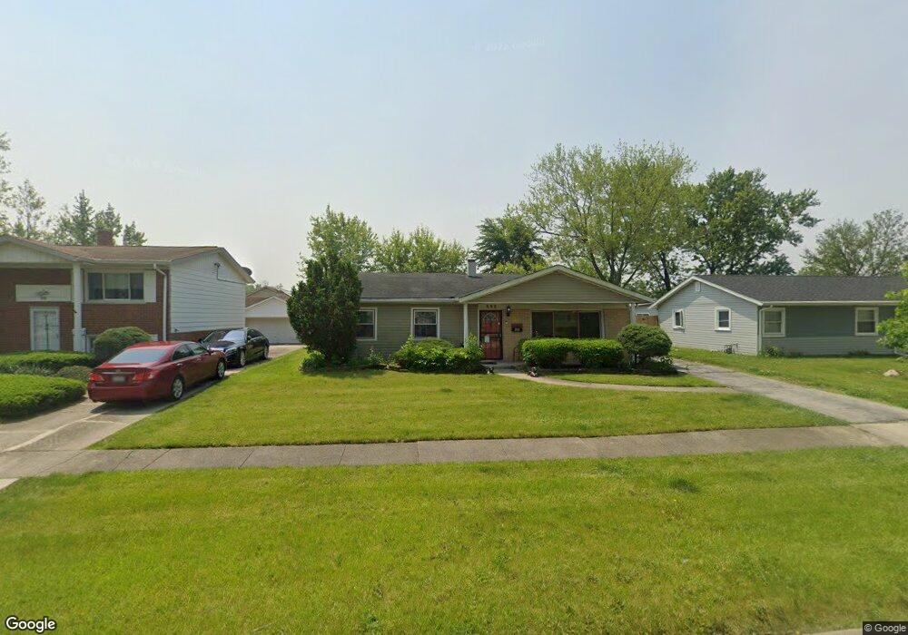
521 Landau Rd University Park, IL 60484
Estimated Value: $160,000 - $205,246
3
Beds
2
Baths
1,425
Sq Ft
$132/Sq Ft
Est. Value
About This Home
This home is located at 521 Landau Rd, University Park, IL 60484 and is currently estimated at $188,562, approximately $132 per square foot. 521 Landau Rd is a home located in Will County with nearby schools including Balmoral Elementary School, Crete-Monee Middle School, and Crete-Monee High School.
Ownership History
Date
Name
Owned For
Owner Type
Purchase Details
Closed on
Oct 6, 2009
Sold by
The Bank Of New York Mellon
Bought by
Zakhem Tony
Current Estimated Value
Purchase Details
Closed on
Apr 27, 2009
Sold by
Denault Randy and The Cit Group/Consumer Finance
Bought by
The Bank Of New York Mellon and The Bank Of New York
Purchase Details
Closed on
Feb 18, 2009
Sold by
Denault Randy
Bought by
The Cit Group/Consumer Finance Inc
Purchase Details
Closed on
Mar 30, 2007
Sold by
Nash Llewellyn and Nash Phyllis M
Bought by
Denault Randy
Home Financials for this Owner
Home Financials are based on the most recent Mortgage that was taken out on this home.
Original Mortgage
$103,200
Interest Rate
9.2%
Mortgage Type
Balloon
Create a Home Valuation Report for This Property
The Home Valuation Report is an in-depth analysis detailing your home's value as well as a comparison with similar homes in the area
Home Values in the Area
Average Home Value in this Area
Purchase History
| Date | Buyer | Sale Price | Title Company |
|---|---|---|---|
| Zakhem Tony | $20,100 | Chicago Title Insurance Co | |
| The Bank Of New York Mellon | -- | None Available | |
| The Cit Group/Consumer Finance Inc | $31,919 | None Available | |
| Denault Randy | $129,000 | First American Title Ins Co |
Source: Public Records
Mortgage History
| Date | Status | Borrower | Loan Amount |
|---|---|---|---|
| Previous Owner | Denault Randy | $103,200 |
Source: Public Records
Tax History Compared to Growth
Tax History
| Year | Tax Paid | Tax Assessment Tax Assessment Total Assessment is a certain percentage of the fair market value that is determined by local assessors to be the total taxable value of land and additions on the property. | Land | Improvement |
|---|---|---|---|---|
| 2024 | $7,160 | $57,047 | $8,402 | $48,645 |
| 2023 | $7,160 | $49,178 | $7,243 | $41,935 |
| 2022 | $6,097 | $43,260 | $6,371 | $36,889 |
| 2021 | $5,810 | $39,397 | $5,852 | $33,545 |
| 2020 | $5,848 | $38,120 | $5,662 | $32,458 |
| 2019 | $5,862 | $36,149 | $5,369 | $30,780 |
| 2018 | $5,749 | $34,745 | $5,255 | $29,490 |
| 2017 | $5,619 | $33,216 | $5,138 | $28,078 |
| 2016 | $5,334 | $31,480 | $4,941 | $26,539 |
| 2015 | $4,736 | $28,761 | $4,503 | $24,258 |
| 2014 | $4,736 | $28,364 | $4,441 | $23,923 |
| 2013 | $4,736 | $29,700 | $4,650 | $25,050 |
Source: Public Records
Map
Nearby Homes
- 543 Regent Rd
- 903 Blackhawk Dr
- 815 Blackhawk Dr
- 807 Blackhawk Dr
- 735 Union Dr
- 607 Sullivan Ln
- 537 Nathan Rd
- 610 Sandra Dr
- 608 Sullivan Ln
- 523 Circle Dr
- 724 Union Dr
- 655 Sullivan Ln
- 1039 Abbot Ln
- 662 Sullivan Ln
- 740 Mission St
- 1029 Samson Dr
- 713 Circle Dr
- 1032 Samson Dr
- 505 Barbara Ct
- 1031 Blackhawk Dr