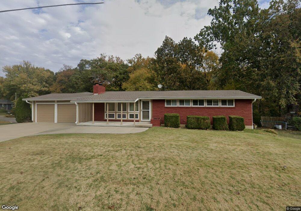
521 Locust St Liberty, MO 64068
Estimated Value: $292,000 - $339,000
3
Beds
3
Baths
1,225
Sq Ft
$259/Sq Ft
Est. Value
About This Home
This home is located at 521 Locust St, Liberty, MO 64068 and is currently estimated at $316,809, approximately $258 per square foot. 521 Locust St is a home located in Clay County with nearby schools including Lewis And Clark Elementary School, Heritage Middle School, and Liberty North High School.
Ownership History
Date
Name
Owned For
Owner Type
Purchase Details
Closed on
Sep 30, 2005
Sold by
Barratt Peter A and Barratt Kathleen D
Bought by
Brant Everett W
Current Estimated Value
Purchase Details
Closed on
Aug 20, 2003
Sold by
Sirva Relocation Llc
Bought by
Barratt Peter A and Barratt Kathleen D
Home Financials for this Owner
Home Financials are based on the most recent Mortgage that was taken out on this home.
Original Mortgage
$80,000
Interest Rate
5.12%
Mortgage Type
Purchase Money Mortgage
Purchase Details
Closed on
Feb 7, 2001
Sold by
Associates Financial Svcs Of America Inc
Bought by
Kleeman Ronald A
Home Financials for this Owner
Home Financials are based on the most recent Mortgage that was taken out on this home.
Original Mortgage
$89,000
Interest Rate
6.85%
Purchase Details
Closed on
Sep 28, 2000
Sold by
Melton Lester W
Bought by
Associates Financial Svcs Of America Inc
Create a Home Valuation Report for This Property
The Home Valuation Report is an in-depth analysis detailing your home's value as well as a comparison with similar homes in the area
Home Values in the Area
Average Home Value in this Area
Purchase History
| Date | Buyer | Sale Price | Title Company |
|---|---|---|---|
| Brant Everett W | -- | Chicago | |
| Barratt Peter A | -- | -- | |
| Kleeman Ronald A | -- | Assured Quality Title Co | |
| Associates Financial Svcs Of America Inc | -- | First American Title Ins Co |
Source: Public Records
Mortgage History
| Date | Status | Borrower | Loan Amount |
|---|---|---|---|
| Previous Owner | Barratt Peter A | $80,000 | |
| Previous Owner | Kleeman Ronald A | $89,000 |
Source: Public Records
Tax History Compared to Growth
Tax History
| Year | Tax Paid | Tax Assessment Tax Assessment Total Assessment is a certain percentage of the fair market value that is determined by local assessors to be the total taxable value of land and additions on the property. | Land | Improvement |
|---|---|---|---|---|
| 2025 | $2,943 | $43,430 | -- | -- |
| 2024 | $2,943 | $38,270 | -- | -- |
| 2023 | $2,993 | $38,270 | $0 | $0 |
| 2022 | $2,785 | $35,150 | $0 | $0 |
| 2021 | $2,763 | $35,150 | $6,840 | $28,310 |
| 2020 | $2,643 | $31,580 | $0 | $0 |
| 2019 | $2,643 | $31,578 | $6,840 | $24,738 |
| 2018 | $2,327 | $27,300 | $0 | $0 |
| 2017 | $2,305 | $27,300 | $4,560 | $22,740 |
| 2016 | $2,305 | $27,300 | $4,560 | $22,740 |
| 2015 | $2,306 | $27,300 | $4,560 | $22,740 |
| 2014 | $2,257 | $26,510 | $4,790 | $21,720 |
Source: Public Records
Map
Nearby Homes
- 523 Lancelot Dr
- 417 Locust St
- 527 Lancelot Dr
- 1484 Hemlock Dr
- 1487 Spruce Dr
- 900 Wildbriar Dr
- 1107 Wildbriar Dr
- 815 Kings Ridge
- 194 Camelot Dr
- 1575 Oakwood Ln
- 412 N Fairview Ave
- 1304 Nashua Rd
- 9623 NE 89th St
- 1207 Linden Rd
- 1548 Timber Ridge Dr
- 1025 Orchard Ave
- 1208 Linden Rd
- 15 Valley Rd
- 1541 N Withers Rd
- 1408 Telford Dr
- 515 Locust St
- 1465 Spruce Ave
- 1460 Spruce Ave
- 509 Locust St
- 1465 Hemlock Dr
- 518 Locust St
- 1466 Spruce Dr
- 1467 Spruce Ave
- 1467 Spruce Dr
- 1466 Spruce Ave
- 1464 Hemlock Dr
- 1464 Hemlock Ct
- 510 Locust St
- 1463 Spruce Ave
- 1469 Spruce Dr
- 1470 Spruce Ave
- 1461 Spruce Ave
- 1469 Spruce Ave
- 520 Lancelot Ct
- 507 Locust St