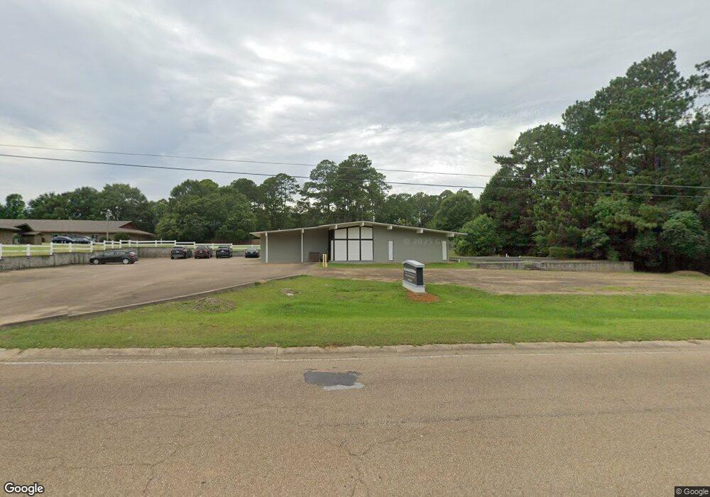
521 Marion Ave McComb, MS 39648
Estimated Value: $124,000
Studio
3
Baths
2,262
Sq Ft
$55/Sq Ft
Est. Value
About This Home
This home is located at 521 Marion Ave, McComb, MS 39648 and is currently priced at $124,000, approximately $54 per square foot. 521 Marion Ave is a home located in Pike County with nearby schools including Otken Elementary School, Higgins Middle School, and Denman Junior High School.
Ownership History
Date
Name
Owned For
Owner Type
Purchase Details
Closed on
Apr 30, 2024
Sold by
Bridging Community With Healthcare Llc
Bought by
James Scott Lindsey Roth Llc
Current Estimated Value
Purchase Details
Closed on
Apr 29, 2024
Sold by
James Scott Lindsey Roth Llc
Bought by
Weyerhaeuser Co
Purchase Details
Closed on
Nov 1, 2016
Sold by
United States Of America
Bought by
Bridging Community With Healthcare Llc
Home Financials for this Owner
Home Financials are based on the most recent Mortgage that was taken out on this home.
Original Mortgage
$82,236
Interest Rate
3.47%
Mortgage Type
Future Advance Clause Open End Mortgage
Create a Home Valuation Report for This Property
The Home Valuation Report is an in-depth analysis detailing your home's value as well as a comparison with similar homes in the area
Purchase History
We collect this data history from publicly available records. To have your information removed, we recommend requesting removal directly through your county’s website.
| Date | Buyer | Sale Price | Title Company |
|---|---|---|---|
| James Scott Lindsey Roth Llc | -- | None Listed On Document | |
| Weyerhaeuser Co | -- | None Listed On Document | |
| Bridging Community With Healthcare Llc | $100,000 | None Available |
Source: Public Records
Mortgage History
We collect this data history from publicly available records. To have your information removed, we recommend requesting removal directly through your county’s website.
| Date | Status | Borrower | Loan Amount |
|---|---|---|---|
| Previous Owner | Bridging Community With Healthcare Llc | $82,236 |
Source: Public Records
Tax History
| Year | Tax Paid | Tax Assessment Tax Assessment Total Assessment is a certain percentage of the fair market value that is determined by local assessors to be the total taxable value of land and additions on the property. | Land | Improvement |
|---|---|---|---|---|
| 2025 | $4,928 | $27,704 | $0 | $0 |
| 2024 | $3,891 | $21,790 | $0 | $0 |
| 2023 | $3,847 | $21,790 | $0 | $0 |
| 2022 | $3,793 | $21,790 | $0 | $0 |
| 2021 | $3,782 | $21,790 | $0 | $0 |
| 2020 | $3,826 | $22,040 | $0 | $0 |
| 2019 | $3,477 | $20,941 | $0 | $0 |
| 2018 | $3,376 | $20,941 | $0 | $0 |
| 2017 | $3,396 | $20,941 | $0 | $0 |
| 2016 | -- | $20,941 | $0 | $0 |
| 2015 | -- | $19,760 | $0 | $0 |
| 2014 | $3,168 | $19,760 | $0 | $0 |
| 2013 | -- | $19,760 | $0 | $0 |
Source: Public Records
Map
Nearby Homes
- 1605 Lissa Dr
- 000 Rawls & White St
- 427 Lakeview Ave
- 0 Llewellyn Ave
- 0000 Mississippi 570
- 000 Pike Point Place
- 917 North St
- 406 Aston Ave
- 402 Laurel St
- TDB Delaware Ave
- 900 N James Ave
- 111 Cedar Ridge Rd
- 128 Sinclair St
- 804 North St
- 110 Woodland Ridge Dr Unit A
- 400 Burke Ave
- 800 Jackson Ave
- 310 Burke Ave
- 201 Sinclair St
- 501A Commanche Dr
Your Personal Tour Guide
Ask me questions while you tour the home.