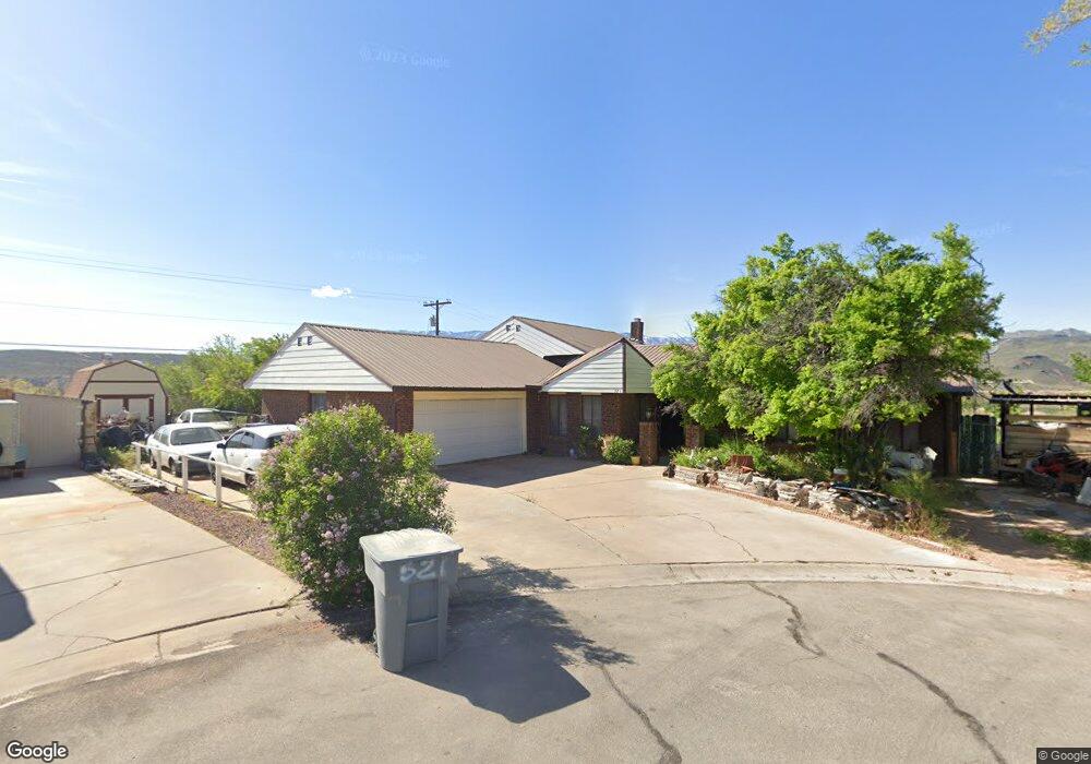
521 N 290 West Cir La Verkin, UT 84745
Estimated Value: $435,000 - $524,000
3
Beds
2
Baths
2,380
Sq Ft
$200/Sq Ft
Est. Value
About This Home
This home is located at 521 N 290 West Cir, La Verkin, UT 84745 and is currently estimated at $475,296, approximately $199 per square foot. 521 N 290 West Cir is a home located in Washington County with nearby schools including La Verkin Elementary School, Hurricane Middle School, and Hurricane High School.
Create a Home Valuation Report for This Property
The Home Valuation Report is an in-depth analysis detailing your home's value as well as a comparison with similar homes in the area
Home Values in the Area
Average Home Value in this Area
Tax History Compared to Growth
Tax History
| Year | Tax Paid | Tax Assessment Tax Assessment Total Assessment is a certain percentage of the fair market value that is determined by local assessors to be the total taxable value of land and additions on the property. | Land | Improvement |
|---|---|---|---|---|
| 2025 | $2,197 | $288,750 | $60,500 | $228,250 |
| 2023 | $2,216 | $293,755 | $57,750 | $236,005 |
| 2022 | $2,317 | $289,135 | $49,500 | $239,635 |
| 2021 | $2,002 | $367,800 | $50,000 | $317,800 |
| 2020 | $1,898 | $326,100 | $50,000 | $276,100 |
| 2019 | $1,822 | $300,000 | $50,000 | $250,000 |
| 2018 | $1,763 | $142,945 | $0 | $0 |
| 2017 | $1,624 | $131,725 | $0 | $0 |
| 2016 | $1,426 | $110,990 | $0 | $0 |
| 2015 | $494 | $106,205 | $0 | $0 |
| 2014 | $1,391 | $102,630 | $0 | $0 |
Source: Public Records
Map
Nearby Homes
- 521 N 290 Cir W
- 520 N 290 Cir W
- 505 N 290 West Cir
- 520 N 290 West Cir
- 495 W 530 N Unit 106
- 564 290 W
- 555 N 290 W
- 514 N 290 West Cir
- 304 W 500 N
- 360 W 500 N
- 514 N 290 W
- 504 N 290 Cir W
- 306 W 500 N
- 504 N 290 West Cir
- 625 N 300 W Unit 1
- 625 N 300 W Unit 12
- 635 N 300 W Unit Lot 2
- 635 N 300 W Unit 22
- 635 N 300 W Unit 23
- 635 N 300 W Unit Lot 15