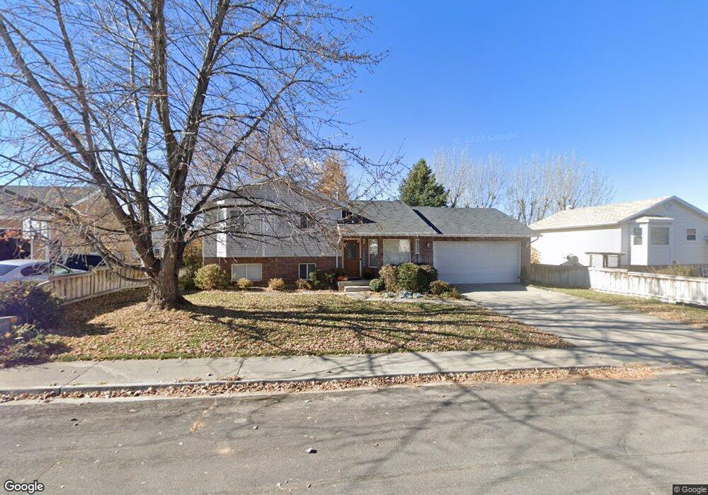
521 N 450 W Santaquin, UT 84655
Estimated Value: $449,000 - $519,000
3
Beds
2
Baths
2,200
Sq Ft
$220/Sq Ft
Est. Value
About This Home
This home is located at 521 N 450 W, Santaquin, UT 84655 and is currently estimated at $483,029, approximately $219 per square foot. 521 N 450 W is a home located in Utah County with nearby schools including Apple Valley Elementary, Payson Junior High School, and Payson High School.
Ownership History
Date
Name
Owned For
Owner Type
Purchase Details
Closed on
Jan 27, 2014
Sold by
Nielsen David and Nielsen Deborah C
Bought by
Nielsen Deborah Cheryl and Deborah Cheryl Nielsen Trust
Current Estimated Value
Home Financials for this Owner
Home Financials are based on the most recent Mortgage that was taken out on this home.
Original Mortgage
$128,000
Outstanding Balance
$67,824
Interest Rate
4.45%
Mortgage Type
New Conventional
Estimated Equity
$415,205
Purchase Details
Closed on
Sep 29, 2011
Sold by
Nielsen Deborah
Bought by
Nielsen Deborah Cheryl and Deborah Cheryl Nielsen Trust
Purchase Details
Closed on
Mar 9, 2004
Sold by
Clucas Craig A and Clucas Roxanne
Bought by
Nielsen Deborah
Home Financials for this Owner
Home Financials are based on the most recent Mortgage that was taken out on this home.
Original Mortgage
$147,900
Interest Rate
5.65%
Mortgage Type
Purchase Money Mortgage
Purchase Details
Closed on
Feb 21, 2003
Sold by
Clucas Craig A and Clucas Roxanne
Bought by
Clucas Craig A
Home Financials for this Owner
Home Financials are based on the most recent Mortgage that was taken out on this home.
Original Mortgage
$102,200
Interest Rate
4.75%
Purchase Details
Closed on
Oct 12, 2001
Sold by
Barney Roxanne and Shepherd Donna
Bought by
Shepherd Roxanne and Shepherd Vern
Home Financials for this Owner
Home Financials are based on the most recent Mortgage that was taken out on this home.
Original Mortgage
$20,000
Interest Rate
6.73%
Mortgage Type
Credit Line Revolving
Purchase Details
Closed on
Mar 19, 1999
Sold by
Barney Roxanne
Bought by
Barney Roxanne and Shepherd Vern
Home Financials for this Owner
Home Financials are based on the most recent Mortgage that was taken out on this home.
Original Mortgage
$33,100
Interest Rate
6.73%
Purchase Details
Closed on
Mar 1, 1999
Sold by
Barney Roxanne and Shepherd Donna
Bought by
Barney Roxanne
Home Financials for this Owner
Home Financials are based on the most recent Mortgage that was taken out on this home.
Original Mortgage
$33,100
Interest Rate
6.73%
Create a Home Valuation Report for This Property
The Home Valuation Report is an in-depth analysis detailing your home's value as well as a comparison with similar homes in the area
Home Values in the Area
Average Home Value in this Area
Purchase History
| Date | Buyer | Sale Price | Title Company |
|---|---|---|---|
| Nielsen Deborah Cheryl | -- | Cornerstone Title Ins A | |
| Nielsen David | -- | Cornerstone Title Ins A | |
| Nielsen Deborah Cheryl | -- | None Available | |
| Nielsen Deborah | -- | Pro Title & Escrow Inc | |
| Clucas Craig A | -- | Pro Title & Escrow Inc | |
| Shepherd Roxanne | -- | Associated Title Company | |
| Barney Roxanne | -- | Wasatch Land & Title | |
| Barney Roxanne | -- | Wasatch Land & Title |
Source: Public Records
Mortgage History
| Date | Status | Borrower | Loan Amount |
|---|---|---|---|
| Open | Nielsen David | $128,000 | |
| Closed | Nielsen Deborah | $147,900 | |
| Previous Owner | Clucas Craig A | $102,200 | |
| Previous Owner | Shepherd Roxanne | $20,000 | |
| Previous Owner | Barney Roxanne | $33,100 |
Source: Public Records
Tax History Compared to Growth
Tax History
| Year | Tax Paid | Tax Assessment Tax Assessment Total Assessment is a certain percentage of the fair market value that is determined by local assessors to be the total taxable value of land and additions on the property. | Land | Improvement |
|---|---|---|---|---|
| 2025 | $2,126 | $234,355 | $139,200 | $286,900 |
| 2024 | $2,126 | $211,750 | $0 | $0 |
| 2023 | $2,223 | $222,035 | $0 | $0 |
| 2022 | $2,194 | $226,105 | $0 | $0 |
| 2021 | $1,875 | $299,500 | $78,500 | $221,000 |
| 2020 | $1,801 | $278,800 | $68,300 | $210,500 |
| 2019 | $1,588 | $251,300 | $68,300 | $183,000 |
| 2018 | $1,450 | $218,800 | $59,700 | $159,100 |
| 2017 | $1,432 | $115,445 | $0 | $0 |
| 2016 | $1,343 | $106,095 | $0 | $0 |
| 2015 | $1,231 | $95,370 | $0 | $0 |
| 2014 | $1,121 | $86,735 | $0 | $0 |
Source: Public Records
Map
Nearby Homes
- 369 N 500 W Unit 3
- 685 Empress St Unit 79
- 689 Empress St Unit 78
- Pendleton Plan at Silver Oaks
- 263 N Polly Ln
- 263 Polly Ln Unit 8
- 259 N Polly Ln
- 259 N Polly Ln Unit 7
- 255 Polly Ln Unit 6
- 255 N Polly Ln
- 251 N Polly Ln
- 251 N Polly Ln Unit 4
- 245 N Polly Ln Unit 2
- 245 N Polly Ln
- 241 N Polly Ln Unit 1
- 162 W 690 N
- 683 W Empress St Unit 80
- 358 W 910 N
- 600 N Center St
- 43 N 300 W