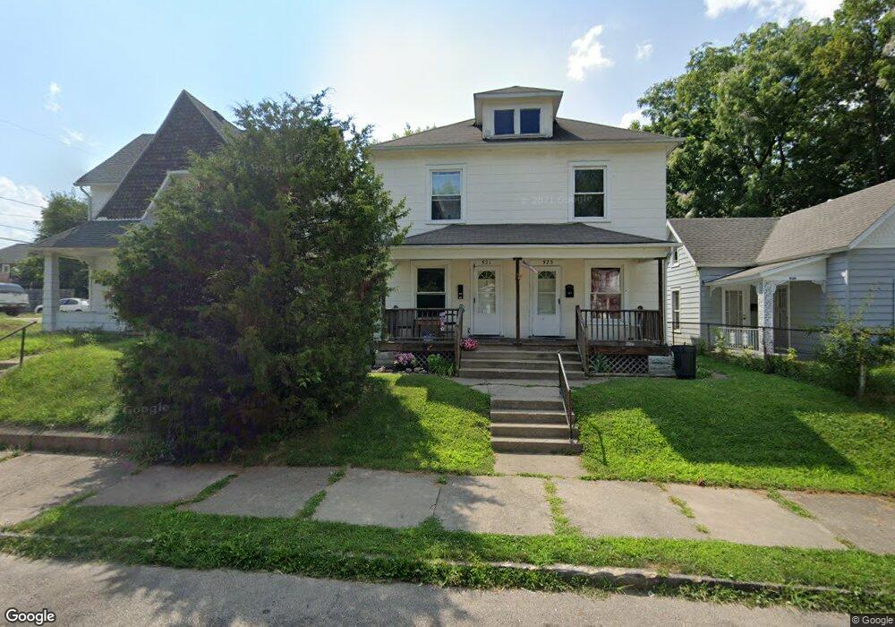
521 N Shaffer St Unit 523 Springfield, OH 45504
Estimated Value: $79,000 - $125,000
4
Beds
2
Baths
2,284
Sq Ft
$42/Sq Ft
Est. Value
About This Home
This home is located at 521 N Shaffer St Unit 523, Springfield, OH 45504 and is currently estimated at $96,667, approximately $42 per square foot. 521 N Shaffer St Unit 523 is a home located in Clark County with nearby schools including Snyder Park Elementary School, Roosevelt Middle School, and Springfield High School.
Ownership History
Date
Name
Owned For
Owner Type
Purchase Details
Closed on
Aug 13, 2013
Sold by
Wellmann Bryan D and Wellmann Terri K
Bought by
Bwell Properties Llc
Current Estimated Value
Purchase Details
Closed on
Mar 1, 2013
Sold by
Tbw Properties Ltd
Bought by
Wellmann Bryan D and Wellmann Terri K
Create a Home Valuation Report for This Property
The Home Valuation Report is an in-depth analysis detailing your home's value as well as a comparison with similar homes in the area
Home Values in the Area
Average Home Value in this Area
Purchase History
| Date | Buyer | Sale Price | Title Company |
|---|---|---|---|
| Bwell Properties Llc | -- | Team Title & Closing Serv | |
| Wellmann Bryan D | -- | None Available |
Source: Public Records
Tax History
| Year | Tax Paid | Tax Assessment Tax Assessment Total Assessment is a certain percentage of the fair market value that is determined by local assessors to be the total taxable value of land and additions on the property. | Land | Improvement |
|---|---|---|---|---|
| 2025 | $841 | $22,100 | $4,390 | $17,710 |
| 2024 | $820 | $16,600 | $3,790 | $12,810 |
| 2023 | $820 | $16,600 | $3,790 | $12,810 |
| 2022 | $840 | $16,600 | $3,790 | $12,810 |
| 2021 | $754 | $13,720 | $3,130 | $10,590 |
| 2020 | $756 | $13,720 | $3,130 | $10,590 |
| 2019 | $758 | $13,720 | $3,130 | $10,590 |
| 2018 | $859 | $14,930 | $3,690 | $11,240 |
| 2017 | $858 | $14,928 | $3,686 | $11,242 |
| 2016 | $859 | $14,928 | $3,686 | $11,242 |
| 2015 | $927 | $15,789 | $3,686 | $12,103 |
| 2014 | $923 | $15,789 | $3,686 | $12,103 |
| 2013 | $913 | $15,789 | $3,686 | $12,103 |
Source: Public Records
Map
Nearby Homes
- 424 N Shaffer St
- 424-424 1/2 N Shaffer St
- 430 N Jackson St
- 511 N Light St
- 705 Grant St Unit 705
- 705-705 1/2 Grant St Unit 705
- 423 N Jackson St Unit 425
- 239 N Shaffer St
- 222 N Race St Unit 224
- 366 N Isabella St
- 101`103 N Western
- 727 W High St
- 1015 Hillcrest Ave
- 1205 W High St
- 1420 Parker Ct
- 120 E Ward St
- 1225 W High St
- 1524 W North St Unit 1526
- 820 W 1st St
- 1417 W Main St
- 517 N Shaffer St
- 525 N Shaffer St
- 802 Grant St
- 806 Grant St
- 524 N Shaffer St
- 518 N Shaffer St
- 810 Grant St Unit 812
- 530 N Shaffer St
- 740 Grant St
- 814 Grant St Unit 816
- 736 Grant St
- 820 Grant St
- 732 Grant St
- 738 Rubsam St
- 822 Grant St Unit 824
- 822 Grant St Unit 2
- 730 Rubsam St
- 518 N Jackson St
- 728 Grant St Unit 730
- 721 Rubsam St
Your Personal Tour Guide
Ask me questions while you tour the home.