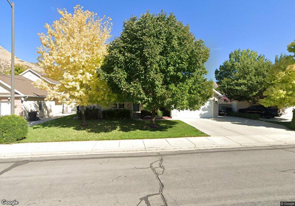
521 S 1650 E Springville, UT 84663
East Hobble Creek NeighborhoodEstimated Value: $585,000 - $718,000
3
Beds
4
Baths
1,610
Sq Ft
$394/Sq Ft
Est. Value
About This Home
This home is located at 521 S 1650 E, Springville, UT 84663 and is currently estimated at $634,878, approximately $394 per square foot. 521 S 1650 E is a home located in Utah County with nearby schools including Brookside School, Springville High School, and Springville Junior High School.
Ownership History
Date
Name
Owned For
Owner Type
Purchase Details
Closed on
Apr 1, 2009
Sold by
Rigtrup Newell H and Rigtrup Coleen L
Bought by
Rigtrup Newell Hans and Rigtrup Coleen Lula Crandall
Current Estimated Value
Purchase Details
Closed on
Jul 2, 2003
Sold by
Klauck Michael W and Klauck Kraig A
Bought by
Rigtrup Newell H and Rigtrup Coleen L
Home Financials for this Owner
Home Financials are based on the most recent Mortgage that was taken out on this home.
Original Mortgage
$265,773
Outstanding Balance
$112,993
Interest Rate
5.26%
Mortgage Type
Purchase Money Mortgage
Estimated Equity
$521,885
Create a Home Valuation Report for This Property
The Home Valuation Report is an in-depth analysis detailing your home's value as well as a comparison with similar homes in the area
Home Values in the Area
Average Home Value in this Area
Purchase History
| Date | Buyer | Sale Price | Title Company |
|---|---|---|---|
| Rigtrup Newell Hans | -- | None Available | |
| Rigtrup Newell H | -- | Provo Land Title Company |
Source: Public Records
Mortgage History
| Date | Status | Borrower | Loan Amount |
|---|---|---|---|
| Open | Rigtrup Newell H | $265,773 |
Source: Public Records
Tax History
| Year | Tax Paid | Tax Assessment Tax Assessment Total Assessment is a certain percentage of the fair market value that is determined by local assessors to be the total taxable value of land and additions on the property. | Land | Improvement |
|---|---|---|---|---|
| 2025 | $3,062 | $320,430 | -- | -- |
| 2024 | $3,062 | $313,720 | $0 | $0 |
| 2023 | $3,042 | $311,960 | $0 | $0 |
| 2022 | $3,410 | $343,420 | $0 | $0 |
| 2021 | $3,064 | $480,300 | $154,200 | $326,100 |
| 2020 | $2,910 | $442,300 | $134,100 | $308,200 |
| 2019 | $2,552 | $394,900 | $126,900 | $268,000 |
| 2018 | $2,601 | $384,000 | $116,000 | $268,000 |
| 2017 | $2,321 | $181,995 | $0 | $0 |
| 2016 | $2,124 | $163,295 | $0 | $0 |
| 2015 | $2,030 | $159,500 | $0 | $0 |
| 2014 | $2,016 | $157,410 | $0 | $0 |
Source: Public Records
Map
Nearby Homes
- 557 S 1470 E
- 66 E 750 S Unit 23
- 1361 E 400 S
- 59 E 775 S Unit 21
- 52 E 775 S Unit 19
- 1800 Spring Oaks Dr
- 1518 E Pheasant Run Dr
- 1783 E Spring Oaks Dr N Unit 12 & 1
- 2554 E 350 S Unit 4
- 1839 River Bottom Rd
- 1185 Hillcrest Dr
- 1062 E 350 S
- 1092 Valley Sage Dr
- 949 S 1060 E
- 776 S 2200 E Unit 19
- 883 E 700 S
- 1884 Town And Country Rd
- 1220 E 225 N
- 805 E 400 S
- 68 Brookside Dr
Your Personal Tour Guide
Ask me questions while you tour the home.