Estimated Value: $281,396 - $366,000
--
Bed
--
Bath
2,010
Sq Ft
$162/Sq Ft
Est. Value
About This Home
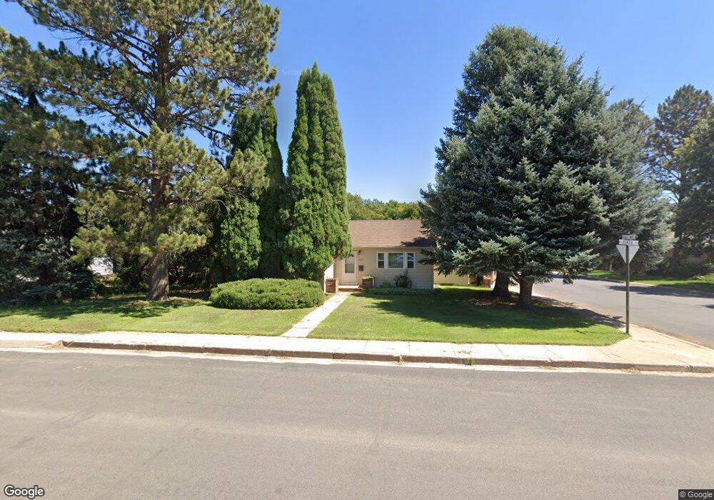
This home is located at 521 S Date St, Yuma, CO 80759 and is currently estimated at $325,599, approximately $161 per square foot. 521 S Date St is a home located in Yuma County with nearby schools including Morris Elementary School, Yuma Middle School, and Yuma High School.
Ownership History
Date
Name
Owned For
Owner Type
Purchase Details
Closed on
May 30, 2024
Sold by
Glenn Family Trust
Bought by
Ray Glenn Michael
Current Estimated Value
Purchase Details
Closed on
Jan 23, 2024
Sold by
Glenn Arlene A
Bought by
Glenn Family Trust
Purchase Details
Closed on
Sep 19, 2008
Sold by
Glenn Arlene A and Trautman Joan C
Bought by
Glenn Arlene A and Trautman Joan C
Create a Home Valuation Report for This Property
The Home Valuation Report is an in-depth analysis detailing your home's value as well as a comparison with similar homes in the area
Home Values in the Area
Average Home Value in this Area
Purchase History
| Date | Buyer | Sale Price | Title Company |
|---|---|---|---|
| Ray Glenn Michael | -- | None Listed On Document | |
| Glenn Family Trust | -- | None Listed On Document | |
| Glenn Arlene A | -- | None Available |
Source: Public Records
Tax History
| Year | Tax Paid | Tax Assessment Tax Assessment Total Assessment is a certain percentage of the fair market value that is determined by local assessors to be the total taxable value of land and additions on the property. | Land | Improvement |
|---|---|---|---|---|
| 2024 | $1,181 | $11,550 | $0 | $0 |
| 2023 | $1,181 | $18,097 | $955 | $17,142 |
| 2022 | $1,165 | $14,029 | $955 | $13,074 |
| 2021 | $1,322 | $14,029 | $955 | $13,074 |
| 2020 | $1,165 | $12,314 | $955 | $11,359 |
| 2019 | $1,146 | $12,314 | $955 | $11,359 |
| 2018 | $1,028 | $10,380 | $0 | $0 |
| 2017 | $1,032 | $10,380 | $0 | $0 |
| 2016 | $1,046 | $10,620 | $0 | $0 |
| 2015 | $955 | $10,620 | $0 | $0 |
| 2014 | $955 | $9,630 | $0 | $0 |
| 2013 | $955 | $9,630 | $0 | $0 |
Source: Public Records
Map
Nearby Homes
- 217 S Ash St
- 411 S Ivy St
- 919 S Main St
- 818 S Buffalo St
- 622 S Columbus St
- 309 N Birch St Unit Lot 4
- 309 N Birch St
- 1402 Cedar Cir Unit 6
- 401 E Benson Ave
- TBD Indian Hills Unit 1-10, 14a,14b, 15-38
- 38125 County Road G
- 35838 County Road G
- 47566 County Rd E
- 28500 County Road D
- 3208 County Road 28
- 00 County Rd E
- 50512 County Road D
- 317 N Weld St
- TBD Main Unit New Blk 2, Lot 12
- 305 E 2nd Ave