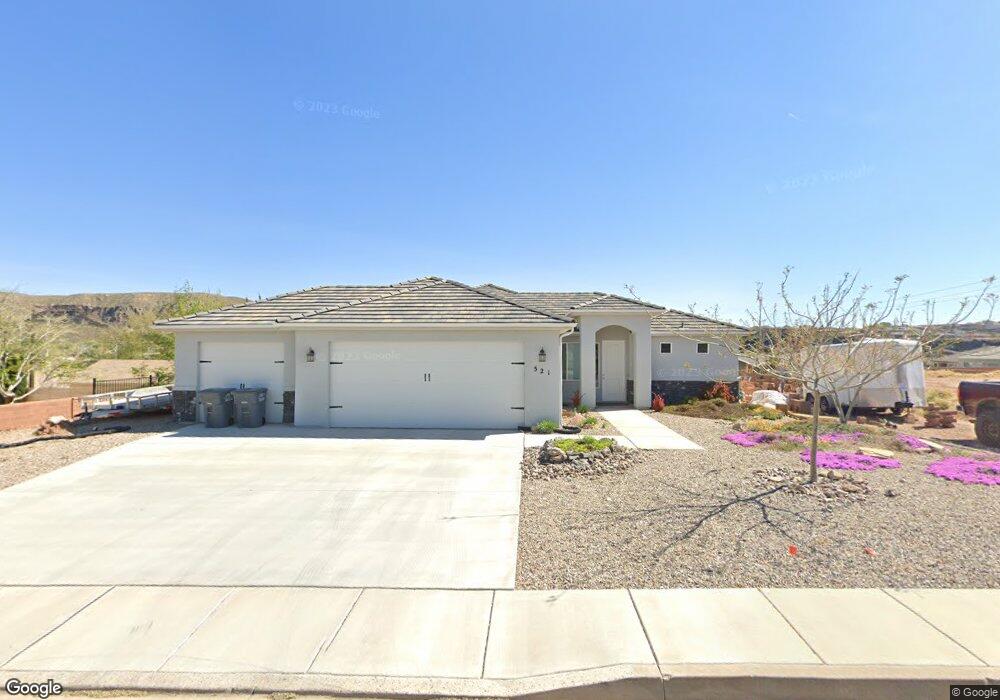
521 W 100 S La Verkin, UT 84745
Estimated Value: $514,000 - $571,759
4
Beds
2
Baths
1,689
Sq Ft
$328/Sq Ft
Est. Value
About This Home
This home is located at 521 W 100 S, La Verkin, UT 84745 and is currently estimated at $553,440, approximately $327 per square foot. 521 W 100 S is a home located in Washington County with nearby schools including La Verkin Elementary School, Hurricane Middle School, and Hurricane High School.
Ownership History
Date
Name
Owned For
Owner Type
Purchase Details
Closed on
Nov 30, 2020
Sold by
Strahie Yvonne and Young Michael R
Bought by
Valdez Timothy Euonene and Valdez Debra Lynn
Current Estimated Value
Purchase Details
Closed on
Jan 27, 2018
Sold by
Gray Tamara Ringwood
Bought by
Young Michael R and Starahle Yvonne
Purchase Details
Closed on
Nov 10, 2008
Sold by
Far West Bank
Bought by
Ringwood Richard W and Tavros Trust
Create a Home Valuation Report for This Property
The Home Valuation Report is an in-depth analysis detailing your home's value as well as a comparison with similar homes in the area
Home Values in the Area
Average Home Value in this Area
Purchase History
| Date | Buyer | Sale Price | Title Company |
|---|---|---|---|
| Valdez Timothy Euonene | -- | Terra Title Company | |
| Young Michael R | -- | Backman Title St George | |
| Ringwood Richard W | -- | Southern Utah Title |
Source: Public Records
Tax History Compared to Growth
Tax History
| Year | Tax Paid | Tax Assessment Tax Assessment Total Assessment is a certain percentage of the fair market value that is determined by local assessors to be the total taxable value of land and additions on the property. | Land | Improvement |
|---|---|---|---|---|
| 2025 | $4,056 | $541,600 | $155,000 | $386,600 |
| 2023 | $3,888 | $515,400 | $140,000 | $375,400 |
| 2022 | $3,827 | $477,600 | $95,000 | $382,600 |
| 2021 | $3,439 | $347,500 | $55,000 | $292,500 |
| 2020 | $1,838 | $315,800 | $50,000 | $265,800 |
| 2019 | $1,793 | $295,300 | $50,000 | $245,300 |
| 2018 | $534 | $45,000 | $0 | $0 |
| 2017 | $493 | $40,000 | $0 | $0 |
| 2016 | $514 | $40,000 | $0 | $0 |
| 2015 | $535 | $40,000 | $0 | $0 |
| 2014 | $501 | $37,000 | $0 | $0 |
Source: Public Records
Map
Nearby Homes