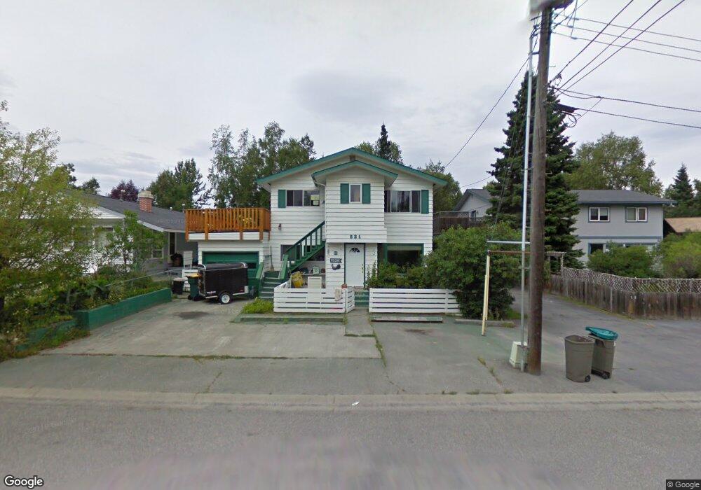
521 W 20th Ave Anchorage, AK 99503
North Star NeighborhoodEstimated Value: $287,000 - $515,000
5
Beds
2
Baths
2,336
Sq Ft
$182/Sq Ft
Est. Value
About This Home
This home is located at 521 W 20th Ave, Anchorage, AK 99503 and is currently estimated at $424,617, approximately $181 per square foot. 521 W 20th Ave is a home located in Anchorage Municipality with nearby schools including North Star Elementary School, Central Middle School of Science, and West High School.
Ownership History
Date
Name
Owned For
Owner Type
Purchase Details
Closed on
Jan 14, 2004
Sold by
Marie Donna
Bought by
Hurd Kelly C and Hondel Michael J
Current Estimated Value
Home Financials for this Owner
Home Financials are based on the most recent Mortgage that was taken out on this home.
Original Mortgage
$209,600
Outstanding Balance
$98,073
Interest Rate
6.02%
Mortgage Type
Purchase Money Mortgage
Estimated Equity
$326,544
Create a Home Valuation Report for This Property
The Home Valuation Report is an in-depth analysis detailing your home's value as well as a comparison with similar homes in the area
Home Values in the Area
Average Home Value in this Area
Purchase History
| Date | Buyer | Sale Price | Title Company |
|---|---|---|---|
| Hurd Kelly C | -- | Alyeska Title Guaranty Agenc |
Source: Public Records
Mortgage History
| Date | Status | Borrower | Loan Amount |
|---|---|---|---|
| Open | Hurd Kelly C | $209,600 | |
| Closed | Hurd Kelly C | $39,300 |
Source: Public Records
Tax History Compared to Growth
Tax History
| Year | Tax Paid | Tax Assessment Tax Assessment Total Assessment is a certain percentage of the fair market value that is determined by local assessors to be the total taxable value of land and additions on the property. | Land | Improvement |
|---|---|---|---|---|
| 2025 | $5,308 | $424,700 | $121,600 | $303,100 |
| 2024 | $5,308 | $403,800 | $121,600 | $282,200 |
| 2023 | $6,477 | $380,300 | $121,600 | $258,700 |
| 2022 | $5,535 | $378,700 | $121,600 | $257,100 |
| 2021 | $6,509 | $361,200 | $121,600 | $239,600 |
| 2020 | $5,374 | $366,400 | $121,600 | $244,800 |
| 2019 | $5,263 | $371,700 | $121,600 | $250,100 |
| 2018 | $5,360 | $376,800 | $124,400 | $252,400 |
| 2017 | $5,752 | $387,300 | $118,100 | $269,200 |
| 2016 | $4,423 | $392,500 | $118,100 | $274,400 |
| 2015 | $4,423 | $357,600 | $107,700 | $249,900 |
| 2014 | $4,423 | $344,700 | $102,600 | $242,100 |
Source: Public Records
Map
Nearby Homes
- 2140 Dawson St
- 827 W 20th Ave
- 710 W 16th Ave
- 207 W 22nd Ave Unit 304
- 1024 Potlatch Cir Unit 23
- 201 W 24th Ave
- 1001 W Fireweed Ln
- 2205 Barrow St
- 123 E 24th Ave Unit 5
- 100 W 15th Ave Unit A
- 1430 Bridgeway St Unit 3
- 1430 Bridgeway St Unit 9
- 1016 W 25th Ave
- 2607 Arctic Blvd
- 1310 G St
- 1113 W Fireweed Ln Unit 505
- 1113 W Fireweed Ln Unit 204
- 1945 Spenard Rd
- 409 W Northern Lights Blvd
- 000 Dawson St
- 525 W 20th Ave
- 515 W 20th Ave
- 539 W 20th Ave
- 501 W 20th Ave
- 541 W 20th Ave
- 530 W 19th Ave
- 524 W 19th Ave
- 2001 Borealis Dr
- 536 W 19th Ave
- 518 W 19th Ave
- 532 W 19th Ave
- L8 Borealis Dr
- 504 W 20th Ave
- 542 W 19th Ave
- 512 W 19th Ave
- 2018 Borealis Dr
- 546 W 19th Ave
- 548 W 19th Ave
- 500 W 19th Ave
- 601 W 20th Ave