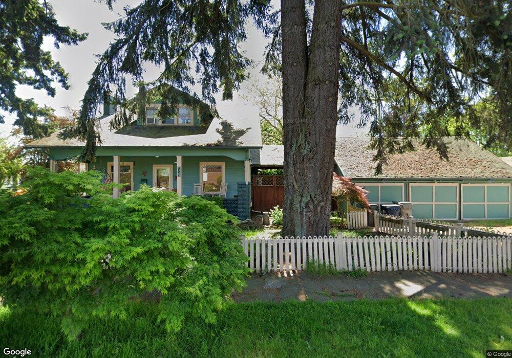
521 W 7th Ave Junction City, OR 97448
Estimated Value: $468,000 - $493,450
5
Beds
3
Baths
2,479
Sq Ft
$196/Sq Ft
Est. Value
About This Home
This home is located at 521 W 7th Ave, Junction City, OR 97448 and is currently estimated at $485,363, approximately $195 per square foot. 521 W 7th Ave is a home located in Lane County with nearby schools including Junction City High School.
Ownership History
Date
Name
Owned For
Owner Type
Purchase Details
Closed on
May 10, 2011
Sold by
Kruger Lonnie K
Bought by
Wilson Melaney M
Current Estimated Value
Purchase Details
Closed on
Aug 20, 2001
Sold by
Swarringim Marie
Bought by
Wilson Melaney M and Kruger Lonnie K
Home Financials for this Owner
Home Financials are based on the most recent Mortgage that was taken out on this home.
Original Mortgage
$166,250
Interest Rate
7.21%
Mortgage Type
Commercial
Purchase Details
Closed on
Sep 14, 1999
Sold by
Wong Lorraine S
Bought by
Swarringim Marie
Home Financials for this Owner
Home Financials are based on the most recent Mortgage that was taken out on this home.
Original Mortgage
$126,000
Interest Rate
8.09%
Mortgage Type
Commercial
Create a Home Valuation Report for This Property
The Home Valuation Report is an in-depth analysis detailing your home's value as well as a comparison with similar homes in the area
Home Values in the Area
Average Home Value in this Area
Purchase History
| Date | Buyer | Sale Price | Title Company |
|---|---|---|---|
| Wilson Melaney M | -- | None Available | |
| Wilson Melaney M | $175,000 | Western Pioneer Title Co | |
| Swarringim Marie | $140,000 | Western Pioneer Title Co |
Source: Public Records
Mortgage History
| Date | Status | Borrower | Loan Amount |
|---|---|---|---|
| Previous Owner | Wilson Melaney M | $166,250 | |
| Previous Owner | Swarringim Marie | $126,000 |
Source: Public Records
Tax History Compared to Growth
Tax History
| Year | Tax Paid | Tax Assessment Tax Assessment Total Assessment is a certain percentage of the fair market value that is determined by local assessors to be the total taxable value of land and additions on the property. | Land | Improvement |
|---|---|---|---|---|
| 2024 | $4,206 | $250,512 | -- | -- |
| 2023 | $4,206 | $243,216 | $0 | $0 |
| 2022 | $3,923 | $236,133 | $0 | $0 |
| 2021 | $3,845 | $229,256 | $0 | $0 |
| 2020 | $3,722 | $222,579 | $0 | $0 |
| 2019 | $3,591 | $216,097 | $0 | $0 |
| 2018 | $3,488 | $203,692 | $0 | $0 |
| 2017 | $3,365 | $203,692 | $0 | $0 |
| 2016 | $3,264 | $197,759 | $0 | $0 |
| 2015 | $2,892 | $191,999 | $0 | $0 |
| 2014 | $2,904 | $186,407 | $0 | $0 |
Source: Public Records
Map
Nearby Homes
- 617 Juniper St
- 351 Juniper St
- 930 Holly St
- 0 Holly St
- 805 Deal St
- 954 Elm St
- 1262 Kalmia St
- 1225 W 10th Ave Unit 26
- 1225 W 10th Ave Unit 28
- 1225 W 10th Ave Unit 50
- 1225 W 10th Ave Unit 53
- 1021 Deal St
- 1085 W 1st Ave Unit 8
- 1377 Juniper St
- 93982 Prairie (Off Street) Rd
- 346 E 10th Place
- 810 Birch St
- 850 Spruce St
- 1011 Rose St
- 1480 Ivy St