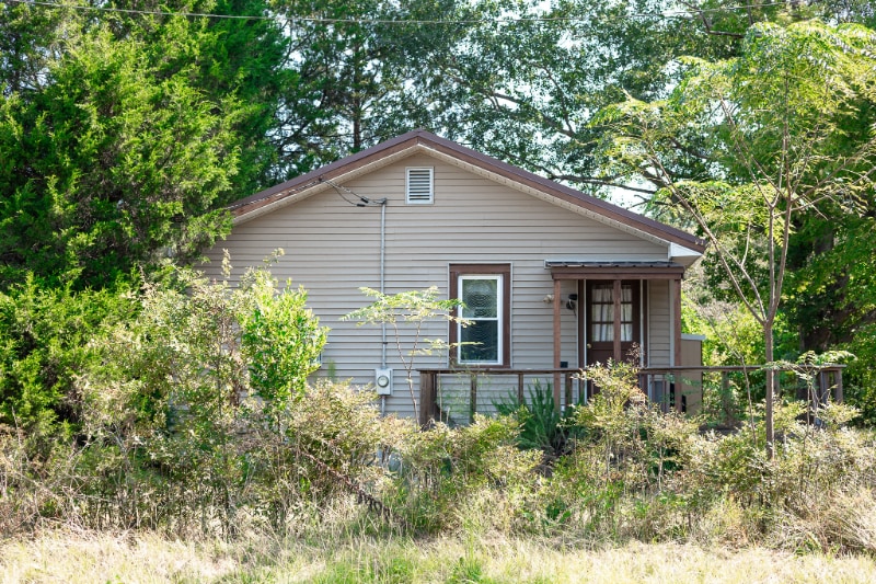
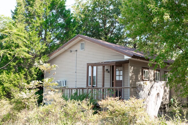
521 W Agency St Roberta, GA 31078
Estimated Value: $52,693 - $83,000
--
Bed
1
Bath
720
Sq Ft
$98/Sq Ft
Est. Value
About This Home
This home is located at 521 W Agency St, Roberta, GA 31078 and is currently estimated at $70,673, approximately $98 per square foot. 521 W Agency St is a home located in Crawford County with nearby schools including Crawford County Elementary School, Crawford County Middle School, and Crawford County High School.
Ownership History
Date
Name
Owned For
Owner Type
Purchase Details
Closed on
Apr 4, 2018
Sold by
Norton Lynne M
Bought by
Kight-Crawley Kevin
Current Estimated Value
Home Financials for this Owner
Home Financials are based on the most recent Mortgage that was taken out on this home.
Original Mortgage
$26,468
Interest Rate
4.46%
Mortgage Type
Purchase Money Mortgage
Purchase Details
Closed on
Feb 15, 2007
Sold by
Childres Juanita
Bought by
Norton Lynne M
Home Financials for this Owner
Home Financials are based on the most recent Mortgage that was taken out on this home.
Original Mortgage
$21,939
Interest Rate
6.16%
Mortgage Type
New Conventional
Create a Home Valuation Report for This Property
The Home Valuation Report is an in-depth analysis detailing your home's value as well as a comparison with similar homes in the area
Home Values in the Area
Average Home Value in this Area
Purchase History
Date | Buyer | Sale Price | Title Company |
---|---|---|---|
Kight-Crawley Kevin | $26,468 | -- | |
Norton Lynne M | $21,500 | -- |
Source: Public Records
Mortgage History
Date | Status | Borrower | Loan Amount |
---|---|---|---|
Closed | Kight-Crawley Kevin | $26,468 | |
Previous Owner | Norton Lynne M | $21,939 |
Source: Public Records
Tax History Compared to Growth
Tax History
Year | Tax Paid | Tax Assessment Tax Assessment Total Assessment is a certain percentage of the fair market value that is determined by local assessors to be the total taxable value of land and additions on the property. | Land | Improvement |
---|---|---|---|---|
2024 | $618 | $15,476 | $1,920 | $13,556 |
2023 | $618 | $15,476 | $1,920 | $13,556 |
2022 | $386 | $12,436 | $1,920 | $10,516 |
2021 | $354 | $10,716 | $1,920 | $8,796 |
2020 | $354 | $10,716 | $1,920 | $8,796 |
2019 | $336 | $10,716 | $1,920 | $8,796 |
2018 | $277 | $8,716 | $1,920 | $6,796 |
2017 | $277 | $8,716 | $1,920 | $6,796 |
2016 | $277 | $8,716 | $1,920 | $6,796 |
Source: Public Records
Map
Nearby Homes
- 127 W Crusselle St
- 0 Us Hwy 80 W Unit 223132
- 0 U S 80 Unit 23884473
- 034 U S 80
- 8 ACRES U S 80 Unit LOT 2
- 9.07 ACRES U S 80 Unit LOT 1
- 1569 Georgia 128
- 0 U S 80
- 179 Georgia 42
- 179 Ga Highway 42 S
- . S U Highway 80 E
- 319 Pope Rd
- 2775 Hortman Mill Rd
- 837 Pope Rd
- 209 Horne Rd
- 0 Cactus Hill Rd
- 0 Dixon Rd Unit 7610200
- 0 Evans Mill Cir Unit 10562397
- 1990 Zenith Mill Rd
- 12.1 ACRES Jackson Rd
- 545 W Agency St
- 50 Seagler Rd
- 475 W Agency St
- 470 W Agency St
- 90 Seagler Rd
- 451 W Agency St
- 450 W Agency St
- 34 Myrtle Dr
- 122 Seagler Rd
- 403 W Agency St
- 621 Ga Highway 128
- 66 Myrtle Dr
- 140 Seagler Rd
- 67 Myrtle Dr
- 285 Brandy Ln
- 385 W Agency St
- 154 Seagler Rd
- 82 Myrtle Dr
- 85 Myrtle Dr
- 150 Myrtle Dr Unit LOT 12