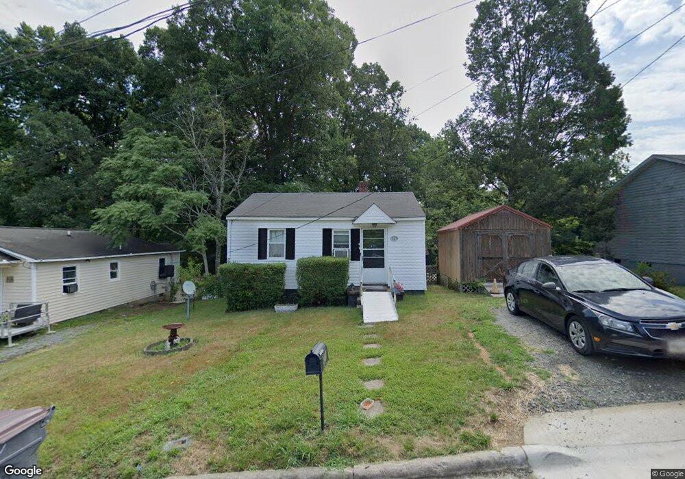
521 Wray St Reidsville, NC 27320
Estimated Value: $80,000 - $94,578
--
Bed
--
Bath
768
Sq Ft
$113/Sq Ft
Est. Value
About This Home
This home is located at 521 Wray St, Reidsville, NC 27320 and is currently estimated at $86,895, approximately $113 per square foot. 521 Wray St is a home located in Rockingham County with nearby schools including Moss Street Elementary, Reidsville High School, and Reidsville Middle School.
Ownership History
Date
Name
Owned For
Owner Type
Purchase Details
Closed on
Aug 31, 2015
Sold by
Warren Terry R and Warren Rachel M
Bought by
Mansfield Melvin G and Mansfield Mary E
Current Estimated Value
Purchase Details
Closed on
Mar 7, 2008
Sold by
Keller Richard P
Bought by
Warren Terry W and Warren Rachel M
Purchase Details
Closed on
Feb 14, 2008
Sold by
Deutsche Bank National Trust Company
Bought by
Keller Richard P
Purchase Details
Closed on
Aug 28, 2007
Sold by
Terrell Trent Michael and Terrell Kimberly D
Bought by
Deutsche Bank National Trust Co and Long Beach Mortgage Loan Trust 2005-Wl1
Purchase Details
Closed on
Apr 13, 2005
Sold by
Graves Jerry L and Graves Cleeste B
Bought by
Terrell Trent Michael
Home Financials for this Owner
Home Financials are based on the most recent Mortgage that was taken out on this home.
Original Mortgage
$40,500
Interest Rate
9.5%
Mortgage Type
Adjustable Rate Mortgage/ARM
Create a Home Valuation Report for This Property
The Home Valuation Report is an in-depth analysis detailing your home's value as well as a comparison with similar homes in the area
Home Values in the Area
Average Home Value in this Area
Purchase History
| Date | Buyer | Sale Price | Title Company |
|---|---|---|---|
| Mansfield Melvin G | $15,000 | Attorney | |
| Warren Terry W | -- | None Available | |
| Keller Richard P | $23,000 | None Available | |
| Deutsche Bank National Trust Co | $12,000 | None Available | |
| Terrell Trent Michael | $45,000 | None Available |
Source: Public Records
Mortgage History
| Date | Status | Borrower | Loan Amount |
|---|---|---|---|
| Previous Owner | Terrell Trent Michael | $40,500 |
Source: Public Records
Tax History Compared to Growth
Tax History
| Year | Tax Paid | Tax Assessment Tax Assessment Total Assessment is a certain percentage of the fair market value that is determined by local assessors to be the total taxable value of land and additions on the property. | Land | Improvement |
|---|---|---|---|---|
| 2025 | $767 | $61,869 | $2,328 | $59,541 |
| 2024 | $767 | $61,869 | $2,328 | $59,541 |
| 2023 | $462 | $32,228 | $2,134 | $30,094 |
| 2022 | $462 | $32,228 | $2,134 | $30,094 |
| 2021 | $462 | $32,228 | $2,134 | $30,094 |
| 2020 | $462 | $32,228 | $2,134 | $30,094 |
| 2019 | $462 | $32,228 | $2,134 | $30,094 |
| 2018 | $391 | $27,233 | $5,022 | $22,211 |
| 2017 | $391 | $27,233 | $5,022 | $22,211 |
| 2015 | $395 | $27,233 | $5,022 | $22,211 |
| 2014 | -- | $27,233 | $5,022 | $22,211 |
Source: Public Records
Map
Nearby Homes
- 0 Washington Ave Unit 1194758
- 329 N Washington Ave
- 331 N Washington Ave
- 319 N Washington Ave
- 323 Graves St
- 816 Moore St
- 805 Moore St
- 39 Circle Dr
- 808 Sunset St
- 820 Moore St
- 0 Davis
- 819 Moore St
- 501 N Washington Ave
- 5 Circle Dr
- 30 Circle Dr
- 508 N Washington Ave
- 210 N Franklin St
- 803 Fulton St
- 309 Leary Cir Unit 311
- 22 Circle Dr