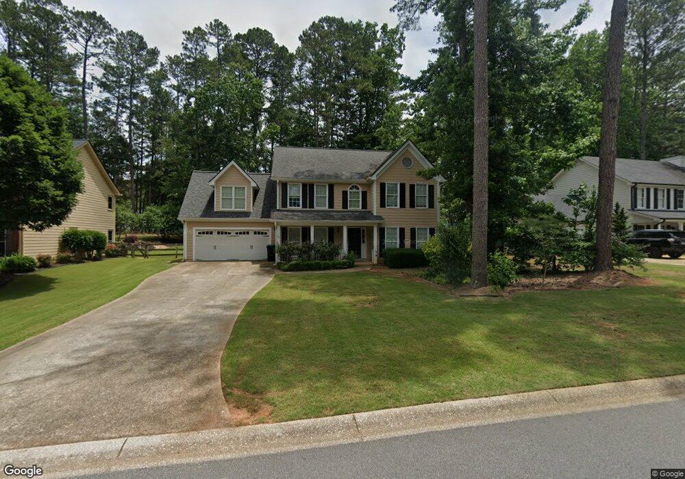
5210 Michaels Way Unit 2 Woodstock, GA 30188
Estimated Value: $458,000 - $481,638
4
Beds
3
Baths
2,376
Sq Ft
$198/Sq Ft
Est. Value
About This Home
This home is located at 5210 Michaels Way Unit 2, Woodstock, GA 30188 and is currently estimated at $469,819, approximately $197 per square foot. 5210 Michaels Way Unit 2 is a home located in Cherokee County with nearby schools including Arnold Mill Elementary School, Mill Creek Middle School, and River Ridge High School.
Ownership History
Date
Name
Owned For
Owner Type
Purchase Details
Closed on
Mar 22, 1996
Sold by
Villa Anne
Bought by
Scott James Jaqueline
Current Estimated Value
Create a Home Valuation Report for This Property
The Home Valuation Report is an in-depth analysis detailing your home's value as well as a comparison with similar homes in the area
Home Values in the Area
Average Home Value in this Area
Purchase History
| Date | Buyer | Sale Price | Title Company |
|---|---|---|---|
| Scott James Jaqueline | $145,500 | -- |
Source: Public Records
Mortgage History
| Date | Status | Borrower | Loan Amount |
|---|---|---|---|
| Closed | Scott James Jaqueline | $0 |
Source: Public Records
Tax History Compared to Growth
Tax History
| Year | Tax Paid | Tax Assessment Tax Assessment Total Assessment is a certain percentage of the fair market value that is determined by local assessors to be the total taxable value of land and additions on the property. | Land | Improvement |
|---|---|---|---|---|
| 2025 | $4,353 | $165,776 | $34,800 | $130,976 |
| 2024 | $4,396 | $169,176 | $34,800 | $134,376 |
| 2023 | $3,980 | $153,148 | $31,600 | $121,548 |
| 2022 | $3,605 | $137,160 | $28,800 | $108,360 |
| 2021 | $3,256 | $114,692 | $24,000 | $90,692 |
| 2020 | $2,873 | $101,104 | $17,600 | $83,504 |
| 2019 | $2,709 | $95,320 | $17,600 | $77,720 |
| 2018 | $2,469 | $86,360 | $17,600 | $68,760 |
| 2017 | $2,440 | $211,700 | $17,600 | $67,080 |
| 2016 | $2,327 | $199,800 | $16,800 | $63,120 |
| 2015 | $2,105 | $179,000 | $12,240 | $59,360 |
| 2014 | $1,977 | $167,800 | $12,240 | $54,880 |
Source: Public Records
Map
Nearby Homes
- 5212 Michaels Way
- 5208 Michaels Way
- 0 Michaels Way Unit 3271194
- 5214 Michaels Way Unit 2
- 5206 Michaels Way
- 1631 Willow Way
- 1633 Willow Way
- 1629 Willow Way
- 5205 Michaels Way
- 5207 Michaels Way
- 1635 Willow Way
- 5216 Michaels Way
- 5209 Michaels Way Unit II
- 1627 Willow Way
- 5204 Michaels Way Unit 1
- 5203 Michaels Way Unit II
- 5211 Michaels Way Unit 2
- 1625 Willow Way
- 5124 Shotwell St
- 5218 Michaels Way Unit 2