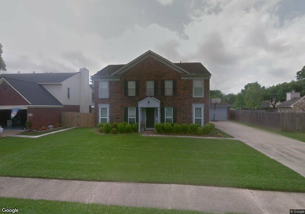
5210 Spring Circle Dr Pearland, TX 77584
Estimated Value: $308,752 - $350,000
Studio
3
Baths
2,065
Sq Ft
$159/Sq Ft
Est. Value
About This Home
This home is located at 5210 Spring Circle Dr, Pearland, TX 77584 and is currently estimated at $328,938, approximately $159 per square foot. 5210 Spring Circle Dr is a home located in Brazoria County with nearby schools including Magnolia Elementary School, Pearland Junior High School South, and Sam Jamison Middle School.
Ownership History
Date
Name
Owned For
Owner Type
Purchase Details
Closed on
Sep 29, 2000
Sold by
Scherrer Robert and Scherrer Bari Lynn
Bought by
Sullivan John P and Sullivan Kimberly C
Current Estimated Value
Home Financials for this Owner
Home Financials are based on the most recent Mortgage that was taken out on this home.
Original Mortgage
$98,000
Outstanding Balance
$35,918
Interest Rate
7.99%
Estimated Equity
$293,020
Purchase Details
Closed on
Aug 27, 1997
Sold by
Goodman Malcolm A and Lin Chen Jung
Bought by
Scherrer Robert and Scherrer Bari L
Home Financials for this Owner
Home Financials are based on the most recent Mortgage that was taken out on this home.
Original Mortgage
$32,000
Interest Rate
7.43%
Mortgage Type
Seller Take Back
Create a Home Valuation Report for This Property
The Home Valuation Report is an in-depth analysis detailing your home's value as well as a comparison with similar homes in the area
Purchase History
| Date | Buyer | Sale Price | Title Company |
|---|---|---|---|
| Sullivan John P | -- | American Title Co | |
| Scherrer Robert | -- | -- |
Source: Public Records
Mortgage History
| Date | Status | Borrower | Loan Amount |
|---|---|---|---|
| Open | Sullivan John P | $98,000 | |
| Previous Owner | Scherrer Robert | $32,000 | |
| Closed | Sullivan John P | $12,200 |
Source: Public Records
Tax History
| Year | Tax Paid | Tax Assessment Tax Assessment Total Assessment is a certain percentage of the fair market value that is determined by local assessors to be the total taxable value of land and additions on the property. | Land | Improvement |
|---|---|---|---|---|
| 2025 | $4,177 | $279,990 | $27,570 | $263,570 |
| 2023 | $4,177 | $231,396 | $27,570 | $259,120 |
| 2022 | $5,060 | $210,360 | $27,570 | $182,790 |
| 2021 | $5,259 | $204,130 | $25,450 | $178,680 |
| 2020 | $5,124 | $189,900 | $21,210 | $168,690 |
| 2019 | $4,756 | $176,240 | $21,210 | $155,030 |
| 2018 | $4,675 | $174,000 | $21,210 | $152,790 |
| 2017 | $4,455 | $165,000 | $21,210 | $143,790 |
| 2016 | $4,370 | $173,130 | $21,210 | $151,920 |
| 2014 | $3,452 | $139,600 | $21,210 | $118,390 |
Source: Public Records
Map
Nearby Homes
- 3911 Spring Circle Dr W
- 4010 Spring Branch Dr W
- 4110 Cleburne Dr
- 3730 Aubrell Rd
- 4113 Merlet Dr
- 3914 Ivywood Dr
- 3505 Parkside Dr
- 3834 Aubrell Rd
- 5403 Palo Duro Dr
- 4013 Ivywood Dr
- 0 S Pearland Unit 40563357
- 5905 Willow Dr
- 16622 Mclean Rd
- 4616 Chaperel Dr
- 3902 Basil Ct
- 4012 Cedarwood Dr
- 16719 Mclean Rd
- 0 Harkey Rd Unit 35033180
- 6018 Becky Ln
- 4527 Fox Run St
- 5208 Spring Circle Dr
- 5212 Spring Circle Dr
- 3917 Spring Crest Ct
- 3919 Spring Crest Ct
- 5206 Spring Circle Dr
- 3915 Spring Crest Ct
- 3901 Spring Meadow Dr
- 5211 Spring Circle Dr
- 3903 Spring Meadow Dr
- 5213 Spring Circle Dr
- 5209 Spring Circle Dr
- 3921 Spring Crest Ct
- 3913 Spring Crest Ct
- 3905 Spring Meadow Dr
- 5204 Spring Circle Dr
- 5207 Spring Circle Dr
- 5217 Spring Circle Dr
- 3907 Spring Meadow Dr
- 3923 Springcrest Ct
- 3903 Spring Crest Ct
Your Personal Tour Guide
Ask me questions while you tour the home.