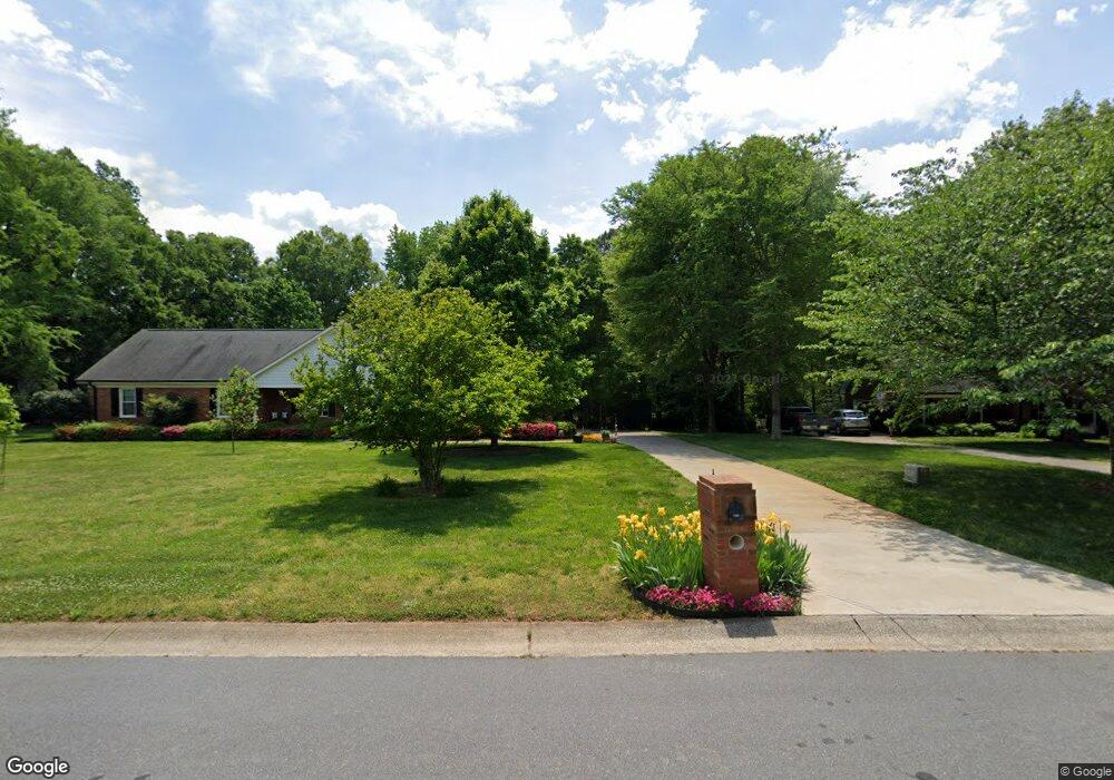
5210 Tompkins Rd Mint Hill, NC 28227
Estimated Value: $378,000 - $559,000
--
Bed
--
Bath
--
Sq Ft
0.38
Acres
About This Home
This home is located at 5210 Tompkins Rd, Mint Hill, NC 28227 and is currently estimated at $486,722. 5210 Tompkins Rd is a home with nearby schools including Bain Elementary, Mint Hill Middle School, and Independence High.
Ownership History
Date
Name
Owned For
Owner Type
Purchase Details
Closed on
May 21, 2020
Sold by
Helms Jack D
Bought by
Bennett Michael Houston and Bennett Kimberly Sexton
Current Estimated Value
Home Financials for this Owner
Home Financials are based on the most recent Mortgage that was taken out on this home.
Original Mortgage
$319,113
Outstanding Balance
$282,778
Interest Rate
3.3%
Mortgage Type
FHA
Estimated Equity
$203,944
Purchase Details
Closed on
Aug 28, 2001
Sold by
Carolina Water Service Inc Of N Carolina
Bought by
Pourlos Chris J and Pourlos Athena W
Create a Home Valuation Report for This Property
The Home Valuation Report is an in-depth analysis detailing your home's value as well as a comparison with similar homes in the area
Home Values in the Area
Average Home Value in this Area
Purchase History
| Date | Buyer | Sale Price | Title Company |
|---|---|---|---|
| Bennett Michael Houston | $325,000 | Executive Title Llc | |
| Pourlos Chris J | $8,500 | -- | |
| Miller Mark L | $6,000 | -- | |
| Helms Jack D | $3,000 | -- |
Source: Public Records
Mortgage History
| Date | Status | Borrower | Loan Amount |
|---|---|---|---|
| Open | Bennett Michael Houston | $319,113 |
Source: Public Records
Tax History Compared to Growth
Tax History
| Year | Tax Paid | Tax Assessment Tax Assessment Total Assessment is a certain percentage of the fair market value that is determined by local assessors to be the total taxable value of land and additions on the property. | Land | Improvement |
|---|---|---|---|---|
| 2025 | $230 | $32,500 | $32,500 | -- |
| 2024 | $230 | $32,500 | $32,500 | -- |
| 2023 | $87 | $32,500 | $32,500 | $0 |
| 2022 | $87 | $10,000 | $10,000 | $0 |
| 2021 | $87 | $10,000 | $10,000 | $0 |
| 2020 | $87 | $10,000 | $10,000 | $0 |
| 2019 | $87 | $10,000 | $10,000 | $0 |
| 2018 | $241 | $22,000 | $22,000 | $0 |
| 2017 | $239 | $22,000 | $22,000 | $0 |
| 2016 | $239 | $22,000 | $22,000 | $0 |
| 2015 | $239 | $22,000 | $22,000 | $0 |
| 2014 | -- | $27,500 | $27,500 | $0 |
Source: Public Records
Map
Nearby Homes
- 9450 Surface Hill Rd
- 18221 Middle Springs Ln
- 18225 Middle Springs Ln
- 18204 Middle Springs Ln
- 9526 Goldsmith Ln
- 8524 Anette Ave
- 9325 Truelight Church Rd
- 8900 Hollybrook Ln
- 8810 Hollybrook Ln
- 8705 Mullis Forest Ct
- 9901 Candlehill Dr
- 9637 Haying Place
- 9140 Blair Rd
- 9601 Twin Falls Ct
- 8416 Olde Stonegate Ln
- 8409 Olde Stonegate Ln
- 8320 Blair Rd
- 9662 Liberty Hill Dr
- 9650 Liberty Hill Dr
- 9721 Julliard Dr
- 9224 Edwards Place
- 9228 Edwards Place
- 9216 Edwards Place
- 10126 Edwards Place
- 9300 Edwards Place
- 9212 Edwards Place
- 9223 Edwards Place
- 9301 Edwards Place
- 9211 Edwards Place
- 9306 Edwards Place
- 9209 Edwards Place
- 9313 Edwards Place
- 10726 Woodhollow Rd
- 9318 Edwards Place
- 9203 Edwards Place
- 9200 Edwards Place
- 10714 Woodhollow Rd
- 10700 Woodhollow Rd
- 9400 Edwards Place
- 10636 Woodhollow Rd