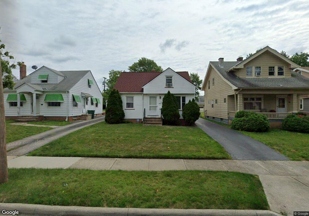
5211 Cato St Maple Heights, OH 44137
Estimated Value: $114,119 - $143,000
3
Beds
1
Bath
1,218
Sq Ft
$101/Sq Ft
Est. Value
About This Home
This home is located at 5211 Cato St, Maple Heights, OH 44137 and is currently estimated at $123,530, approximately $101 per square foot. 5211 Cato St is a home located in Cuyahoga County with nearby schools including Abraham Lincoln Elementary School, Rockside/ J.F. Kennedy School, and Barack Obama School.
Ownership History
Date
Name
Owned For
Owner Type
Purchase Details
Closed on
May 18, 2022
Sold by
Jeffries George E
Bought by
Caver Darlene
Current Estimated Value
Purchase Details
Closed on
Jul 23, 2003
Sold by
Krol Mary E
Bought by
Jefferies George E
Home Financials for this Owner
Home Financials are based on the most recent Mortgage that was taken out on this home.
Original Mortgage
$71,400
Interest Rate
5.3%
Mortgage Type
Purchase Money Mortgage
Purchase Details
Closed on
Apr 13, 1988
Sold by
Krol Raymond R and Krol Mary E
Bought by
Krol Mary E
Purchase Details
Closed on
Jan 1, 1975
Bought by
Krol Raymond R and Krol Mary E
Create a Home Valuation Report for This Property
The Home Valuation Report is an in-depth analysis detailing your home's value as well as a comparison with similar homes in the area
Home Values in the Area
Average Home Value in this Area
Purchase History
| Date | Buyer | Sale Price | Title Company |
|---|---|---|---|
| Caver Darlene | $60,700 | None Listed On Document | |
| Jefferies George E | $84,000 | Multiple | |
| Krol Mary E | -- | -- | |
| Krol Raymond R | -- | -- |
Source: Public Records
Mortgage History
| Date | Status | Borrower | Loan Amount |
|---|---|---|---|
| Previous Owner | Jefferies George E | $71,400 |
Source: Public Records
Tax History Compared to Growth
Tax History
| Year | Tax Paid | Tax Assessment Tax Assessment Total Assessment is a certain percentage of the fair market value that is determined by local assessors to be the total taxable value of land and additions on the property. | Land | Improvement |
|---|---|---|---|---|
| 2024 | $3,325 | $37,030 | $7,280 | $29,750 |
| 2023 | $2,172 | $21,250 | $4,380 | $16,870 |
| 2022 | $1,377 | $21,245 | $4,375 | $16,870 |
| 2021 | $1,465 | $21,250 | $4,380 | $16,870 |
| 2020 | $1,034 | $16,100 | $3,330 | $12,780 |
| 2019 | $1,023 | $46,000 | $9,500 | $36,500 |
| 2018 | $925 | $16,100 | $3,330 | $12,780 |
| 2017 | $906 | $14,950 | $3,080 | $11,870 |
| 2016 | $873 | $14,950 | $3,080 | $11,870 |
| 2015 | $834 | $14,950 | $3,080 | $11,870 |
| 2014 | $947 | $16,420 | $3,400 | $13,020 |
Source: Public Records
Map
Nearby Homes
- 5199 Arch St
- 5239 Arch St
- 5231 Philip Ave
- 5257 Philip Ave
- 5234 Erwin St
- 5110 Philip Ave
- 5212 Catherine St
- 5185 Clement Ave
- 5082 Philip Ave
- 5061 Philip Ave
- 17916 North Blvd
- 5208 Clement Ave
- 17912 North Blvd
- 5031 Cato St
- 17806 Maple Heights Blvd
- 5320 Clement Ave
- 17204 Maple Heights Blvd
- 5265 Bellview St
- 5425 Grasmere Ave
- 18909 Maple Heights Blvd