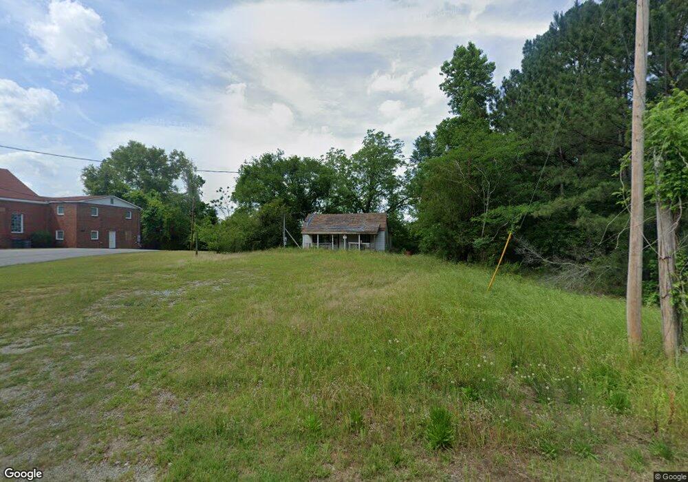
5211 Old Gordon Rd Dry Branch, GA 31020
Estimated Value: $53,785 - $181,000
--
Bed
1
Bath
1,008
Sq Ft
$126/Sq Ft
Est. Value
About This Home
This home is located at 5211 Old Gordon Rd, Dry Branch, GA 31020 and is currently estimated at $127,446, approximately $126 per square foot. 5211 Old Gordon Rd is a home located in Twiggs County with nearby schools including Jeffersonville Elementary School, Twiggs Middle School, and Twiggs County High School.
Ownership History
Date
Name
Owned For
Owner Type
Purchase Details
Closed on
Jul 15, 2005
Sold by
Colvin Robert G
Bought by
Ryles Brandy
Current Estimated Value
Purchase Details
Closed on
Mar 15, 2005
Sold by
Shipes Kaye C
Bought by
Colvin Robert G
Home Financials for this Owner
Home Financials are based on the most recent Mortgage that was taken out on this home.
Original Mortgage
$25,000
Interest Rate
5.54%
Mortgage Type
New Conventional
Purchase Details
Closed on
Aug 26, 1996
Sold by
Wimberly Delmas E
Bought by
Shipes Kaye C
Purchase Details
Closed on
Feb 3, 1993
Bought by
Wimberly Delmas E
Create a Home Valuation Report for This Property
The Home Valuation Report is an in-depth analysis detailing your home's value as well as a comparison with similar homes in the area
Home Values in the Area
Average Home Value in this Area
Purchase History
| Date | Buyer | Sale Price | Title Company |
|---|---|---|---|
| Ryles Brandy | $29,800 | -- | |
| Colvin Robert G | $25,000 | -- | |
| Shipes Kaye C | $50,000 | -- | |
| Wimberly Delmas E | $3,800 | -- |
Source: Public Records
Mortgage History
| Date | Status | Borrower | Loan Amount |
|---|---|---|---|
| Previous Owner | Colvin Robert G | $25,000 |
Source: Public Records
Tax History Compared to Growth
Tax History
| Year | Tax Paid | Tax Assessment Tax Assessment Total Assessment is a certain percentage of the fair market value that is determined by local assessors to be the total taxable value of land and additions on the property. | Land | Improvement |
|---|---|---|---|---|
| 2024 | $214 | $11,982 | $776 | $11,206 |
| 2023 | $215 | $11,982 | $776 | $11,206 |
| 2022 | $434 | $11,982 | $776 | $11,206 |
| 2021 | $434 | $11,982 | $776 | $11,206 |
| 2020 | $434 | $11,982 | $776 | $11,206 |
| 2019 | $434 | $11,982 | $776 | $11,206 |
| 2018 | $398 | $11,982 | $776 | $11,206 |
| 2017 | $398 | $11,982 | $776 | $11,206 |
| 2016 | $0 | $11,206 | $0 | $11,206 |
| 2015 | -- | $11,982 | $776 | $11,206 |
| 2014 | -- | $11,982 | $776 | $11,206 |
| 2013 | -- | $13,726 | $775 | $12,950 |
Source: Public Records
Map
Nearby Homes
- 4912 Old Gordon Rd
- 6678 Davis Rd
- 290 Forestwood Dr
- Hwy 129
- 1659 Henderson Rd
- 5757 Jeffersonville Rd
- 451 Possum Hollow Rd
- 0 Old Gordon Rd
- 0 Knollwood Rd Unit LotWP004
- 0 Knollwood Rd Unit 10495049
- 32 Knollwood Rd
- 4400 Davis Rd
- 0 Old Gordon Rd Unit 179400
- 0 Old Gordon Rd Unit 252673
- 5503 Jeffersonville Rd
- 134 Bowers Dr
- 0 Parker Rd Unit 10461595
- 000 Parker Rd
- 3741 Franklinton Rd
- 5201 Old Gordon Rd
- 5263 Old Gordon Rd
- 5255 Old Gordon Rd
- 5034 Old Gordon Rd
- 4970 Old Gordon Rd
- 4968 Old Gordon Rd
- 91 Ridge Rd
- 112 Ridge Rd
- 14 Ridge Rd
- 4808 Old Gordon Rd
- 236 Ridge Rd
- 298 Ridge Rd
- 4806 Old Gordon Rd
- 5679 Old Gordon Rd
- 4718 Old Gordon Rd
- 4718 Old Gordon Rd
- 149 Georgia Kaolin Rd
- 5729 Old Gordon Rd
- 84 Charles Dr
- 163 Charles Dr