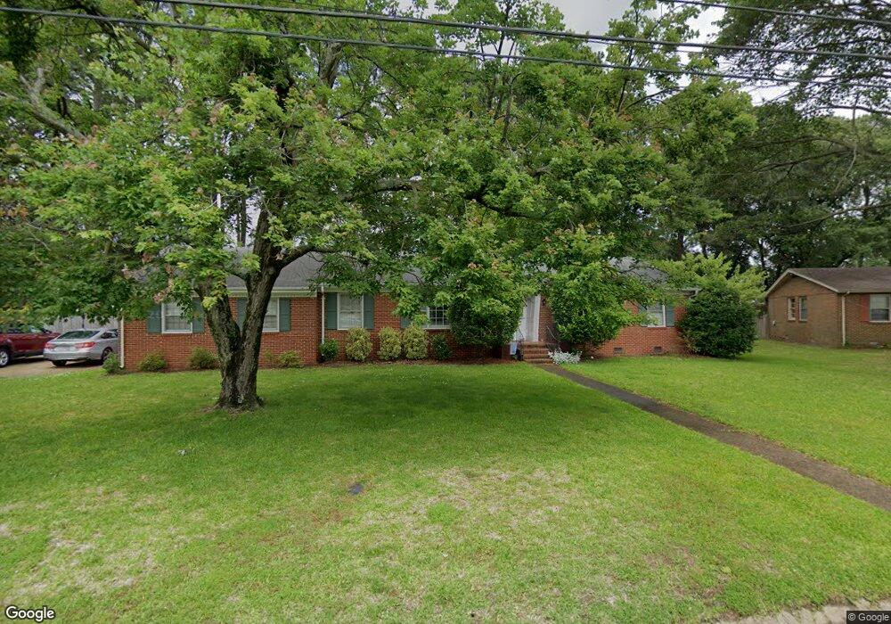
5212 Bingham Dr Portsmouth, VA 23703
Churchland NeighborhoodEstimated Value: $340,942 - $347,000
3
Beds
2
Baths
1,574
Sq Ft
$218/Sq Ft
Est. Value
About This Home
This home is located at 5212 Bingham Dr, Portsmouth, VA 23703 and is currently estimated at $343,736, approximately $218 per square foot. 5212 Bingham Dr is a home located in Portsmouth City with nearby schools including Churchland Elementary School, Churchland Academy Elementary School, and Churchland Middle School.
Ownership History
Date
Name
Owned For
Owner Type
Purchase Details
Closed on
Jun 17, 2013
Sold by
Shelhorse Stanley C
Bought by
Emons Nicholas M
Current Estimated Value
Home Financials for this Owner
Home Financials are based on the most recent Mortgage that was taken out on this home.
Original Mortgage
$194,342
Outstanding Balance
$139,369
Interest Rate
3.75%
Mortgage Type
FHA
Estimated Equity
$204,367
Purchase Details
Closed on
Aug 9, 2002
Sold by
Vincent Ada A
Bought by
Shelhouse Stanley C
Create a Home Valuation Report for This Property
The Home Valuation Report is an in-depth analysis detailing your home's value as well as a comparison with similar homes in the area
Home Values in the Area
Average Home Value in this Area
Purchase History
| Date | Buyer | Sale Price | Title Company |
|---|---|---|---|
| Emons Nicholas M | $198,000 | -- | |
| Shelhouse Stanley C | $139,000 | -- |
Source: Public Records
Mortgage History
| Date | Status | Borrower | Loan Amount |
|---|---|---|---|
| Open | Emons Nicholas M | $194,342 |
Source: Public Records
Tax History Compared to Growth
Tax History
| Year | Tax Paid | Tax Assessment Tax Assessment Total Assessment is a certain percentage of the fair market value that is determined by local assessors to be the total taxable value of land and additions on the property. | Land | Improvement |
|---|---|---|---|---|
| 2025 | $3,698 | $288,230 | $104,400 | $183,830 |
| 2024 | $3,698 | $286,730 | $104,400 | $182,330 |
| 2023 | $3,360 | $268,800 | $104,400 | $164,400 |
| 2022 | $3,365 | $258,870 | $87,000 | $171,870 |
| 2021 | $2,715 | $208,880 | $69,890 | $138,990 |
| 2020 | $2,672 | $205,550 | $66,560 | $138,990 |
| 2019 | $2,653 | $204,060 | $66,560 | $137,500 |
| 2018 | $2,653 | $204,060 | $66,560 | $137,500 |
| 2017 | $2,653 | $204,060 | $66,560 | $137,500 |
| 2016 | $2,653 | $204,060 | $66,560 | $137,500 |
| 2015 | $2,575 | $198,080 | $66,560 | $131,520 |
| 2014 | $2,510 | $197,670 | $66,560 | $131,110 |
Source: Public Records
Map
Nearby Homes
- 4959 Briarwood Ln
- 4955 Briarwood Ln
- 3509 Spence Rd
- 10AC Cedar Ln
- 5300 Larkspur Rd
- 3315 Camellia Dr
- 3425 Cedar Ln
- 4808 Thornwood St
- 5516 Bingham Dr
- 3432 Carter Rd
- 3613 Cardinal Ln
- 3728 Cardinal Ln
- 5220 Clover Hill Dr
- 3405 Canterbury Dr
- 4705 Templar Dr
- 3604 Lilac Dr
- 5304 High St W
- 3408 Wakefield Dr
- 5302 High St W
- 4313 Templar Dr
- 5216 Bingham Dr
- 5107 Peake Ln
- 5208 Bingham Dr
- 5109 Peake Ln
- 5205 Bingham Dr
- 5213 Bingham Dr
- 5105 Peake Ln
- 5220 Bingham Dr
- 5204 Bingham Dr
- 5217 Bingham Dr
- 5113 Peake Ln
- 5101 Peake Ln
- 5201 Bingham Dr
- 5224 Bingham Dr
- 5104 Peake Ln
- 3708 Cedar Ln
- 5516 Briarwood Ln
- 5221 Bingham Dr
- 5504 Briarwood Ln
- 5520 Briarwood Ln