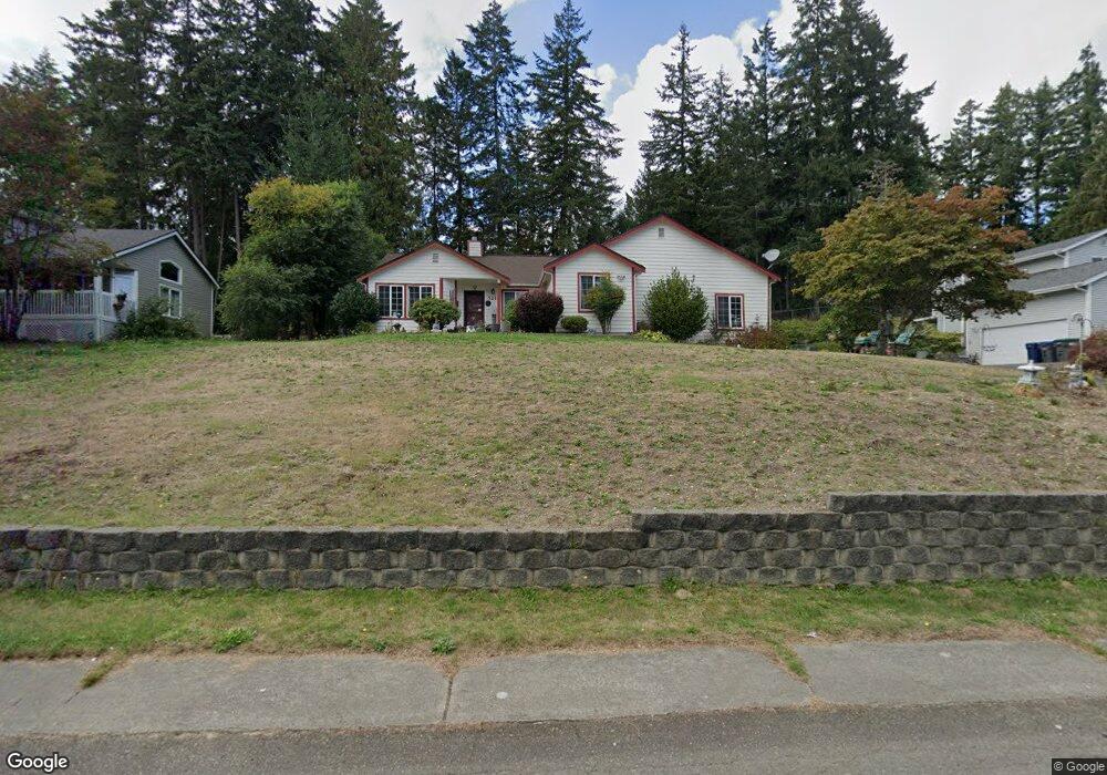
5214 Durand Place SE Port Orchard, WA 98366
East Port Orchard NeighborhoodEstimated Value: $511,000 - $538,800
3
Beds
2
Baths
1,886
Sq Ft
$278/Sq Ft
Est. Value
About This Home
This home is located at 5214 Durand Place SE, Port Orchard, WA 98366 and is currently estimated at $524,950, approximately $278 per square foot. 5214 Durand Place SE is a home located in Kitsap County with nearby schools including East Port Orchard Elementary School, Marcus Whitman Middle School, and South Kitsap High School.
Ownership History
Date
Name
Owned For
Owner Type
Purchase Details
Closed on
Aug 12, 1994
Sold by
Herington James O and Herington Shirley M
Bought by
Hayes Edward B and Hayes Edna D
Current Estimated Value
Home Financials for this Owner
Home Financials are based on the most recent Mortgage that was taken out on this home.
Original Mortgage
$153,418
Interest Rate
8.73%
Mortgage Type
Assumption
Create a Home Valuation Report for This Property
The Home Valuation Report is an in-depth analysis detailing your home's value as well as a comparison with similar homes in the area
Home Values in the Area
Average Home Value in this Area
Purchase History
| Date | Buyer | Sale Price | Title Company |
|---|---|---|---|
| Hayes Edward B | $148,950 | Charter Title Corporation |
Source: Public Records
Mortgage History
| Date | Status | Borrower | Loan Amount |
|---|---|---|---|
| Closed | Hayes Edward B | $153,418 |
Source: Public Records
Tax History Compared to Growth
Tax History
| Year | Tax Paid | Tax Assessment Tax Assessment Total Assessment is a certain percentage of the fair market value that is determined by local assessors to be the total taxable value of land and additions on the property. | Land | Improvement |
|---|---|---|---|---|
| 2026 | $4,227 | $516,510 | $83,000 | $433,510 |
| 2025 | $4,227 | $481,860 | $68,210 | $413,650 |
| 2024 | $4,100 | $481,860 | $68,210 | $413,650 |
| 2023 | $4,072 | $481,860 | $68,210 | $413,650 |
| 2022 | $3,985 | $395,010 | $63,700 | $331,310 |
| 2021 | $3,856 | $361,750 | $59,190 | $302,560 |
| 2020 | $3,791 | $345,530 | $56,370 | $289,160 |
| 2019 | $3,204 | $320,050 | $55,400 | $264,650 |
| 2018 | $3,338 | $257,690 | $55,400 | $202,290 |
| 2017 | $2,845 | $257,690 | $55,400 | $202,290 |
| 2016 | $2,761 | $228,790 | $55,400 | $173,390 |
| 2015 | $2,671 | $224,230 | $55,400 | $168,830 |
| 2014 | -- | $219,660 | $55,400 | $164,260 |
| 2013 | -- | $213,560 | $58,310 | $155,250 |
Source: Public Records
Map
Nearby Homes
- 2225 SE Kelby Cir
- 2315 SE Kelby Cir
- 2360 SE Plymouth Way
- 2198 SE Galeel Ct
- 2948 SE Alson Ct
- 3132 Harris Rd SE
- 3131 SE Berger Ln
- 1743 SE Crawford Rd
- 3922 Bethel Rd SE
- 4590 Laguna Ln SE
- 3463 Balsam Blvd SE
- 4777 Okanogan Dr SE
- 0 SE Sedgwick Rd Unit NWM2362855
- 0 SE Sedgwick Rd Unit 21804061
- 0 SE Sedgwick Rd Unit NWM2332354
- 1612 SE Sylvis Ln
- 1330 SE Casandra Loop
- 3365 SE Carmae Dr
- 2313 Lincoln Ave SE
- 0 Lincoln Ave SE
- 5220 Durand Place SE
- 5208 Durand Place SE
- 5202 Durand Place SE
- 5226 Durand Place SE
- 5215 Durand Place SE
- 5209 Durand Place SE
- 2260 SE Moritz Way
- 2325 SE Dean Ct
- 5221 Durand Place SE
- 5203 Durand Place SE
- 5227 Durand Place SE
- 2337 SE Dean Ct
- 2279 SE Kelby Cir
- 5232 Durand Place SE
- 2273 SE Kelby Cir
- 2267 SE Kelby Cir
- 2261 SE Kelby Cir
- 2349 SE Dean Ct
- 5206 Brady Place SE
- 2255 SE Kelby Cir