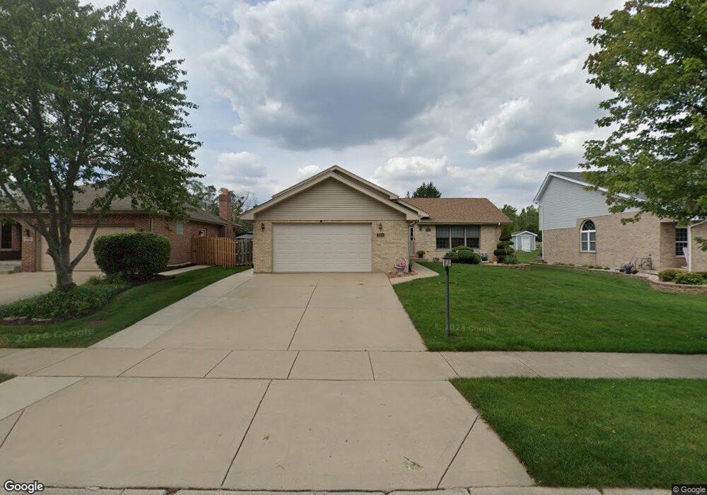
5214 Harcourt St Oak Forest, IL 60452
Estimated Value: $361,000 - $410,000
3
Beds
3
Baths
1,467
Sq Ft
$263/Sq Ft
Est. Value
About This Home
This home is located at 5214 Harcourt St, Oak Forest, IL 60452 and is currently estimated at $385,851, approximately $263 per square foot. 5214 Harcourt St is a home located in Cook County with nearby schools including Kimberly Heights Elementary School, Scarlet Oak Elementary School, and Arbor Park Middle School.
Ownership History
Date
Name
Owned For
Owner Type
Purchase Details
Closed on
Nov 6, 2003
Sold by
First Midwest Bank
Bought by
Host Guy and Host Nancy
Current Estimated Value
Home Financials for this Owner
Home Financials are based on the most recent Mortgage that was taken out on this home.
Original Mortgage
$175,000
Outstanding Balance
$78,128
Interest Rate
5.81%
Mortgage Type
Unknown
Estimated Equity
$307,723
Create a Home Valuation Report for This Property
The Home Valuation Report is an in-depth analysis detailing your home's value as well as a comparison with similar homes in the area
Home Values in the Area
Average Home Value in this Area
Purchase History
| Date | Buyer | Sale Price | Title Company |
|---|---|---|---|
| Host Guy | $264,000 | Git |
Source: Public Records
Mortgage History
| Date | Status | Borrower | Loan Amount |
|---|---|---|---|
| Open | Host Guy | $175,000 |
Source: Public Records
Tax History
| Year | Tax Paid | Tax Assessment Tax Assessment Total Assessment is a certain percentage of the fair market value that is determined by local assessors to be the total taxable value of land and additions on the property. | Land | Improvement |
|---|---|---|---|---|
| 2025 | $10,374 | $29,466 | $7,445 | $22,021 |
| 2024 | $10,374 | $29,466 | $7,445 | $22,021 |
| 2023 | $9,093 | $32,001 | $7,445 | $24,556 |
| 2022 | $9,093 | $22,942 | $6,586 | $16,356 |
| 2021 | $8,909 | $22,940 | $6,585 | $16,355 |
| 2020 | $8,689 | $22,940 | $6,585 | $16,355 |
| 2019 | $8,485 | $22,340 | $6,012 | $16,328 |
| 2018 | $8,786 | $23,455 | $6,012 | $17,443 |
| 2017 | $8,771 | $23,455 | $6,012 | $17,443 |
| 2016 | $8,611 | $21,473 | $5,153 | $16,320 |
| 2015 | $8,310 | $21,473 | $5,153 | $16,320 |
| 2014 | $8,127 | $21,473 | $5,153 | $16,320 |
| 2013 | $6,990 | $20,879 | $5,153 | $15,726 |
Source: Public Records
Map
Nearby Homes
- 5048 171st St
- 5319 Martha Ln
- 17027 Judy Ct
- 16908 Laramie Ave
- 5345 Forest Trail
- 5426 Bonnie Trail
- 5417 Christopher Dr
- 16909 W Thackeray Lot #8 St
- 16861 Thackery Ave
- 5524 Christopher Dr
- 5320 175th St
- 17140 Central Ave
- 16938 Cicero Ave
- 5166 Aldersyde Rd
- 4847 175th St
- 5970 Lake Bluff Dr Unit 59705
- 5980 Lake Bluff Dr Unit 202
- 6010 Lake Bluff Dr Unit 402
- 4657 176th Place
- 17526 Mulberry St
- 5208 Harcourt St
- 5220 Harcourt St
- 5202 Harcourt St
- 5226 Harcourt St
- 17400 Laramie Ave
- 5232 Harcourt St
- 5211 Harcourt St
- 5217 Harcourt St
- 5205 Harcourt St
- 5223 Harcourt St
- 5238 Harcourt St
- 5159 Harcourt St
- 5229 Harcourt St
- 17050 Danielle Ct
- 17056 Danielle Ct
- 5153 Harcourt St
- 5153 Harcourt St
- 17044 Danielle Ct
- 5244 Harcourt St
- 5235 Harcourt St
Your Personal Tour Guide
Ask me questions while you tour the home.