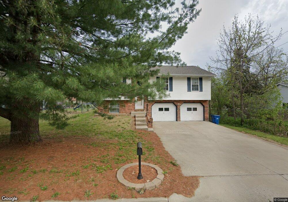
5216 Scruggs Station Rd Jefferson City, MO 65109
Estimated Value: $205,000 - $283,000
3
Beds
3
Baths
1,202
Sq Ft
$191/Sq Ft
Est. Value
About This Home
This home is located at 5216 Scruggs Station Rd, Jefferson City, MO 65109 and is currently estimated at $229,278, approximately $190 per square foot. 5216 Scruggs Station Rd is a home located in Cole County with nearby schools including Clarence Lawson Elementary School, Thomas Jefferson Middle School, and Capital City High School.
Ownership History
Date
Name
Owned For
Owner Type
Purchase Details
Closed on
Jun 2, 2017
Sold by
Michel Mark and Michel Jennifer
Bought by
Gpm Property Investments
Current Estimated Value
Home Financials for this Owner
Home Financials are based on the most recent Mortgage that was taken out on this home.
Original Mortgage
$92,650
Outstanding Balance
$59,624
Interest Rate
4.02%
Mortgage Type
New Conventional
Estimated Equity
$169,654
Purchase Details
Closed on
Mar 27, 2017
Sold by
Vecellio Andrew P and Vecellio Stacy L
Bought by
Michel Mark and Michel Jennifer
Home Financials for this Owner
Home Financials are based on the most recent Mortgage that was taken out on this home.
Original Mortgage
$98,551
Interest Rate
4.16%
Mortgage Type
New Conventional
Create a Home Valuation Report for This Property
The Home Valuation Report is an in-depth analysis detailing your home's value as well as a comparison with similar homes in the area
Home Values in the Area
Average Home Value in this Area
Purchase History
| Date | Buyer | Sale Price | Title Company |
|---|---|---|---|
| Gpm Property Investments | -- | -- | |
| Michel Mark | -- | -- |
Source: Public Records
Mortgage History
| Date | Status | Borrower | Loan Amount |
|---|---|---|---|
| Open | Gpm Property Investments | $92,650 | |
| Previous Owner | Michel Mark | $98,551 |
Source: Public Records
Tax History Compared to Growth
Tax History
| Year | Tax Paid | Tax Assessment Tax Assessment Total Assessment is a certain percentage of the fair market value that is determined by local assessors to be the total taxable value of land and additions on the property. | Land | Improvement |
|---|---|---|---|---|
| 2025 | $1,272 | $23,700 | $2,660 | $21,040 |
| 2024 | $1,272 | $21,280 | $0 | $21,280 |
| 2023 | $1,272 | $21,280 | $0 | $21,280 |
| 2022 | $1,276 | $21,280 | $0 | $21,280 |
| 2021 | $1,283 | $21,280 | $0 | $21,280 |
| 2020 | $1,301 | $23,541 | $2,660 | $20,881 |
| 2019 | $1,265 | $21,280 | $2,660 | $18,620 |
| 2018 | $1,172 | $19,418 | $2,660 | $16,758 |
| 2017 | $1,143 | $20,710 | $2,660 | $18,050 |
| 2016 | -- | $20,710 | $2,660 | $18,050 |
| 2015 | $969 | $0 | $0 | $0 |
| 2014 | $969 | $20,710 | $2,660 | $18,050 |
Source: Public Records
Map
Nearby Homes
- 5401 Collier Ln
- 5405 Collier Ln
- 1628 Westview Dr
- 5417 Collier Ln
- 1616 Westview Dr
- 5203 Starlite Ct
- 5416 S Brooks Dr
- 5305 Bagnall Dr
- 4911 Lucia Dr
- 1600 Northport Dr
- 1910 Eliana Dr
- 4817 Carly Dr
- 5318 Thornridge Dr
- 5314 Thornridge Dr
- 1333 Grandview Dr
- 5418 Thornridge Dr
- 1323 Grandview Dr
- 5506 Kenview Dr
- 1317 Grandview Dr
- 2001 Buschman Ln
- 5300 Scherr Dr
- 5302 Scherr Dr
- 5212 Scruggs Station Rd
- 5210 Scruggs Station Rd
- 5304 Scherr Dr
- 5211 Scruggs Station Rd
- 5207 Scruggs Station Rd
- 5301 Scherr Dr
- 5306 Scherr Dr
- 5302 Scruggs Station Rd
- 5304 Scruggs Station Rd
- 5306 Scruggs Station Rd
- 5308 Scruggs Station Rd
- 5219 Scruggs Station Rd
- 5204 Scruggs Station Rd
- 5303 Scherr Dr
- 5308 Scherr Dr
- 5221 Scruggs Station Rd
- 5101 S Brooks Dr
- 5307 Scherr Dr