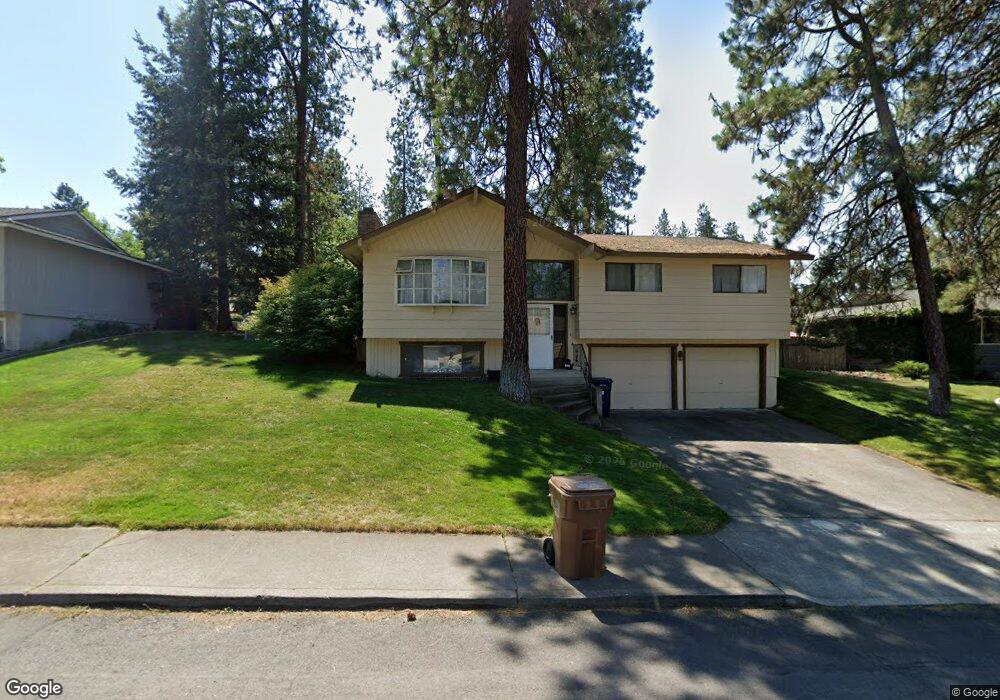
5217 W Woodside Ave Spokane, WA 99208
Northwest Spokane NeighborhoodEstimated Value: $397,000 - $439,666
4
Beds
3
Baths
1,766
Sq Ft
$235/Sq Ft
Est. Value
About This Home
This home is located at 5217 W Woodside Ave, Spokane, WA 99208 and is currently estimated at $414,917, approximately $234 per square foot. 5217 W Woodside Ave is a home located in Spokane County with nearby schools including Indian Trail Elementary School, Salk Middle School, and North Central High School.
Ownership History
Date
Name
Owned For
Owner Type
Purchase Details
Closed on
Jan 2, 2019
Sold by
Wertman Douglas D
Bought by
Wertman Tracy J
Current Estimated Value
Home Financials for this Owner
Home Financials are based on the most recent Mortgage that was taken out on this home.
Original Mortgage
$90,000
Interest Rate
4.6%
Mortgage Type
New Conventional
Create a Home Valuation Report for This Property
The Home Valuation Report is an in-depth analysis detailing your home's value as well as a comparison with similar homes in the area
Home Values in the Area
Average Home Value in this Area
Purchase History
| Date | Buyer | Sale Price | Title Company |
|---|---|---|---|
| Wertman Tracy J | -- | First American Title Ins Co |
Source: Public Records
Mortgage History
| Date | Status | Borrower | Loan Amount |
|---|---|---|---|
| Closed | Wertman Tracy J | $90,000 |
Source: Public Records
Tax History Compared to Growth
Tax History
| Year | Tax Paid | Tax Assessment Tax Assessment Total Assessment is a certain percentage of the fair market value that is determined by local assessors to be the total taxable value of land and additions on the property. | Land | Improvement |
|---|---|---|---|---|
| 2025 | $4,358 | $443,900 | $95,000 | $348,900 |
| 2024 | $4,358 | $439,300 | $95,000 | $344,300 |
| 2023 | $4,047 | $439,300 | $95,000 | $344,300 |
| 2022 | $3,201 | $413,800 | $95,000 | $318,800 |
| 2021 | $2,843 | $238,800 | $45,000 | $193,800 |
| 2020 | $2,565 | $207,500 | $33,000 | $174,500 |
| 2019 | $2,257 | $188,700 | $33,000 | $155,700 |
| 2018 | $2,403 | $172,600 | $33,000 | $139,600 |
| 2017 | $2,228 | $163,000 | $33,000 | $130,000 |
| 2016 | $2,142 | $153,300 | $30,000 | $123,300 |
| 2015 | $2,127 | $148,900 | $30,000 | $118,900 |
| 2014 | -- | $147,400 | $30,000 | $117,400 |
| 2013 | -- | $0 | $0 | $0 |
Source: Public Records
Map
Nearby Homes
- 5112 W Lyons Ave
- 6831 N Cambridge Ln
- 6605 N Conestoga St
- 6805 N Royal Ln
- 6720 N Royal Ln
- 5007 W Rosewood Ave
- 5212 W Decatur Ave
- 6110 N Windsor St
- 6624 N Greenwood Blvd
- 6211 N Forest Blvd
- 7706 N Old Fort Dr
- 4318 W Janice Ave
- 6017 N Driscoll Blvd
- 6514 N Sutherlin St
- 6304 N Greenwood Blvd
- 7231 N Drumheller St
- 7124 N Drumheller St
- 4004 W Taft Dr
- 5715 N Alameda Blvd
- 5902 N Sutherlin St
- 5305 W Woodside Ave
- 5211 W Woodside Ave
- 5218 W Lyons Ave
- 5224 W Lyons Ave
- 5212 W Lyons Ave
- 5311 W Woodside Ave
- 5205 W Woodside Ave
- 5218 W Woodside Ave
- 5306 W Woodside Ave
- 5212 W Woodside Ave
- 5206 W Lyons Ave
- 5230 W Lyons Ave
- 5312 W Woodside Ave
- 5317 W Woodside Ave
- 5206 W Woodside Ave
- 6624 N Elizabeth St
- 5309 W Conestoga Ave
- 5305 W Conestoga Ave
- 5141 W Woodside Ave
- 6623 N Catherine St